TopoQuest Logo
Do you find TopoQuest useful?
Help keep TopoQuest running and adding new maps/features by donating!
Bitcoin:  19c7KJd3qBynnjoSw5npx9KScwjBe4ifkT
Litecoin:  LXs6TkuXGGXo1vDsWCkWVdjQX94eUKd6ui
Home View Maps Find Maps Find Places Resources & Links


Cuyuna, Minnesota Topographic Map

USGS Map Title: Cuyuna, MN
USGS Map MRC: 46093E8
DRG (GeoTIFF) Download: o46093e8.tif


Neighboring USGS Topographic Map Quads:


  Cross Lake, MN  
46094F1
 

  Emily, MN  
46093F8
 

  Ross Lake, MN  
46093F7
 

  Trommald, MN  
46094E1
 

  Cuyuna, MN  
46093E8
 

  Iron Hub, MN  
46093E7
 

  Riverton, MN  
46094D1
 

  Crosby, MN  
46093D8
 

  Bay Lake, MN  
46093D7


Map MRC Location:

N47°
W94°
N47°
W93°
H8 H7 H6 H5 H4 H3 H2 H1
G8 G7 G6 G5 G4 G3 G2 G1
F8 F7 F6 F5 F4 F3 F2 F1
E8 E7 E6 E5 E4 E3 E2 E1
D8 D7 D6 D5 D4 D3 D2 D1
C8 C7 C6 C5 C4 C3 C2 C1
B8 B7 B6 B5 B4 B3 B2 B1
A8 A7 A6 A5 A4 A3 A2 A1
N46°
W94°
N46°
W93°

Cuyuna, MN USGS 1:24K Topographic Map Preview:
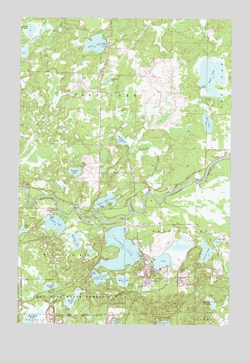
Cuyuna, MN USGS Topographic Map
Click on map above to begin viewing in our Map Viewer.

This topographic map contains these locations and features:
Feature Name Type Latitude Longitude GNIS ID View Map
Bullhead LakeLakeN46.5999°W93.9484°640637View Map
Carlson LakeLakeN46.5299°W93.8889°640908View Map
City of CuyunaCivilN46.5117°W93.9257°2393702View Map
Clinker LakeLakeN46.5191°W93.9521°641337View Map
CuyunaPopulated PlaceN46.5169°W93.9230°642570View Map
Cuyuna (historical)LocaleN46.5139°W93.9228°2071702View Map
Cuyuna Fire DepartmentBuildingN46.5166°W93.9235°2666219View Map
Cuyuna Lookout TowerTowerN46.5089°W93.9378°659814View Map
Cuyuna Police DepartmentBuildingN46.5180°W93.9236°2758680View Map
Cuyuna Post Office (historical)Post OfficeN46.5169°W93.9228°2071701View Map
Deadmans CreekStreamN46.5541°W93.9230°642683View Map
Deadmans LakeLakeN46.5753°W93.9400°642684View Map
Dean LakeLakeN46.6016°W93.8867°642689View Map
Deer LakeLakeN46.5827°W93.8888°642723View Map
Hunter LakeLakeN46.5383°W93.9978°645295View Map
Indian Jack LakeLakeN46.5503°W93.9485°645406View Map
Island LakeLakeN46.5414°W93.9783°645480View Map
KTCF-FM (Crosby)TowerN46.5347°W93.8783°663029View Map
Lake CuyunaLakeN46.5181°W93.9383°648304View Map
Lost Long LakeLakeN46.5094°W93.8857°647211View Map
Milford LakeLakeN46.5342°W93.9667°647842View Map
Perry LakeLakeN46.6143°W93.9560°649303View Map
Perry Lake CreekStreamN46.6202°W93.9850°649304View Map
Rabbit LakeLakeN46.5304°W93.9240°649780View Map
Rassett LakeLakeN46.5152°W93.9808°649833View Map
Rice Bed LakeLakeN46.6197°W93.9942°649964View Map
Stanley LakeLakeN46.5622°W93.9671°652545View Map
Township of Perry LakeCivilN46.5902°W93.9527°665288View Map
Turner LakeLakeN46.5095°W93.9684°653366View Map
WolfordPopulated PlaceN46.5455°W93.9791°654326View Map
Wolford Post Office (historical)Post OfficeN46.5456°W93.9789°2071654View Map
Yawkey MineMineN46.5014°W93.9430°654412View Map

Note: Coordinates in the location and feature list above are referenced to NAD83 datum.


Copyright (C) 2008-2024 Ryan Niemi / Sunset Dynamics ... All Rights Reserved