TopoQuest Logo
Do you find TopoQuest useful?
Help keep TopoQuest running and adding new maps/features by donating!
Bitcoin:  19c7KJd3qBynnjoSw5npx9KScwjBe4ifkT
Litecoin:  LXs6TkuXGGXo1vDsWCkWVdjQX94eUKd6ui
Home View Maps Find Maps Find Places Resources & Links


De Valls Bluff NE, Arkansas Topographic Map

USGS Map Title: De Valls Bluff NE, AR
USGS Map MRC: 34091H3
DRG (GeoTIFF) Download: o34091h3.tif


Neighboring USGS Topographic Map Quads:


  Gregory SW, AR  
35091A4
 

  Cotton Plant, AR  
35091A3
 

  Hunter West, AR  
35091A2
 

  Des Arc East, AR  
34091H4
 

  De Valls Bluff NE, AR  
34091H3
 

  Brinkley, AR  
34091H2
 

  De Valls Bluff, AR  
34091G4
 

  De Valls Bluff SE, AR  
34091G3
 

  Keevil, AR  
34091G2


Map MRC Location:

N35°
W92°
N35°
W91°
H8 H7 H6 H5 H4 H3 H2 H1
G8 G7 G6 G5 G4 G3 G2 G1
F8 F7 F6 F5 F4 F3 F2 F1
E8 E7 E6 E5 E4 E3 E2 E1
D8 D7 D6 D5 D4 D3 D2 D1
C8 C7 C6 C5 C4 C3 C2 C1
B8 B7 B6 B5 B4 B3 B2 B1
A8 A7 A6 A5 A4 A3 A2 A1
N34°
W92°
N34°
W91°

De Valls Bluff NE, AR USGS 1:24K Topographic Map Preview:
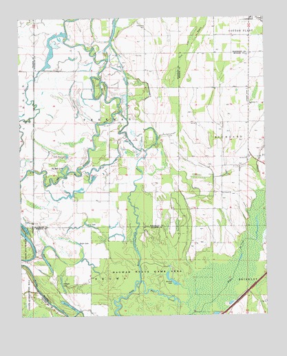
De Valls Bluff NE, AR USGS Topographic Map
Click on map above to begin viewing in our Map Viewer.

This topographic map contains these locations and features:
Feature Name Type Latitude Longitude GNIS ID View Map
Ash Grove CemeteryCemeteryN34.9399°W91.2592°61121View Map
Ash Grove ChurchChurchN34.9412°W91.2590°45947View Map
Barnes LakeLakeN34.8796°W91.3509°74637View Map
Benson Slash CreekStreamN34.9293°W91.2504°46391View Map
Big Buck LakeLakeN34.9378°W91.3522°74660View Map
Bull LakeLakeN34.8968°W91.3610°74719View Map
Dagmar State Wildlife Management AreaParkN34.8912°W91.3123°76740View Map
Ditch Number 1CanalN34.9762°W91.3210°82014View Map
Gum Flat BayouStreamN34.9443°W91.3112°77088View Map
Halls LakeLakeN34.9125°W91.3733°74876View Map
Hammond LakeLakeN34.9903°W91.3278°74879View Map
Heifer LakeLakeN34.9055°W91.3456°74887View Map
Hickson LakeLakeN34.8889°W91.2969°74890View Map
Little Buck LakeLakeN34.9422°W91.3510°74950View Map
Long LakeLakeN34.9129°W91.3394°74991View Map
Mount Pleasant ChurchChurchN34.9637°W91.2576°52404View Map
Mount Pleasant School (historical)SchoolN34.9634°W91.2568°61123View Map
Mud SloughGutN34.8837°W91.3040°52523View Map
New Home Church (historical)ChurchN34.9556°W91.2587°61124View Map
Olive Branch ChurchChurchN34.9268°W91.2726°53041View Map
Robe BayouGutN34.9151°W91.3160°54066View Map
Straight LakeLakeN34.8870°W91.3538°75147View Map
Township of FreemanCivilN34.9768°W91.3262°69863View Map
Trice CemeteryCemeteryN34.9845°W91.3154°55647View Map
Trices ChapelChurchN34.9965°W91.3112°78576View Map

Note: Coordinates in the location and feature list above are referenced to NAD83 datum.


Copyright (C) 2008-2024 Ryan Niemi / Sunset Dynamics ... All Rights Reserved