TopoQuest Logo
Do you find TopoQuest useful?
Help keep TopoQuest running and adding new maps/features by donating!
Bitcoin:  19c7KJd3qBynnjoSw5npx9KScwjBe4ifkT
Litecoin:  LXs6TkuXGGXo1vDsWCkWVdjQX94eUKd6ui
Home View Maps Find Maps Find Places Resources & Links


Dearborn, Missouri Topographic Map

USGS Map Title: Dearborn, MO
USGS Map MRC: 39094E7
DRG (GeoTIFF) Download: o39094e7.tif


Neighboring USGS Topographic Map Quads:


  Halls, MO  
39094F8
 

  Saint Joseph South, MO  
39094F7
 

  Agency, MO  
39094F6
 

  De Kalb, MO  
39094E8
 

  Dearborn, MO  
39094E7
 

  Edgerton, MO  
39094E6
 

  Weston, MO  
39094D8
 

  Tracy, MO  
39094D7
 

  Camden Point, MO  
39094D6


Map MRC Location:

N40°
W95°
N40°
W94°
H8 H7 H6 H5 H4 H3 H2 H1
G8 G7 G6 G5 G4 G3 G2 G1
F8 F7 F6 F5 F4 F3 F2 F1
E8 E7 E6 E5 E4 E3 E2 E1
D8 D7 D6 D5 D4 D3 D2 D1
C8 C7 C6 C5 C4 C3 C2 C1
B8 B7 B6 B5 B4 B3 B2 B1
A8 A7 A6 A5 A4 A3 A2 A1
N39°
W95°
N39°
W94°

Dearborn, MO USGS 1:24K Topographic Map Preview:
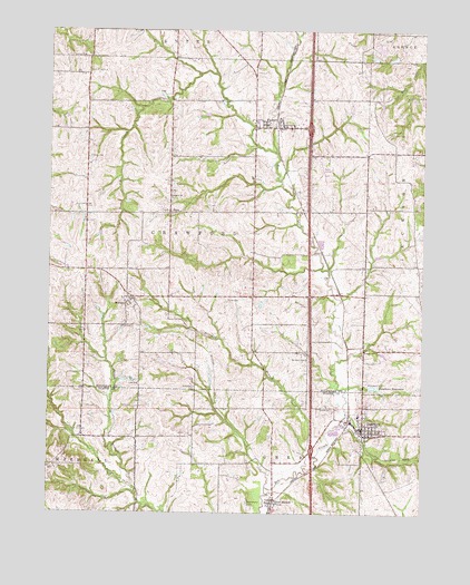
Dearborn, MO USGS Topographic Map
Click on map above to begin viewing in our Map Viewer.

This topographic map contains these locations and features:
Feature Name Type Latitude Longitude GNIS ID View Map
Antioch CemeteryCemeteryN39.6178°W94.8633°713318View Map
Bleazard BranchStreamN39.5117°W94.7891°714362View Map
Campbells (historical)LocaleN39.5556°W94.7772°746529View Map
City of DearbornCivilN39.5246°W94.7741°2394478View Map
Clarence Jones DamDamN39.6183°W94.7669°760629View Map
Clarence Jones East DamDamN39.6183°W94.7602°761937View Map
Clarence Jones East LakeReservoirN39.6178°W94.7605°761938View Map
Collier CemeteryCemeteryN39.5114°W94.8730°716124View Map
Cox SchoolSchoolN39.5503°W94.8097°746527View Map
DearbornPopulated PlaceN39.5219°W94.7700°716775View Map
Dearborn Area Fire Protection DistrictBuildingN39.5230°W94.7734°2621089View Map
Dearborn Post OfficePost OfficeN39.5217°W94.7704°2782586View Map
Dearborn ReservoirReservoirN39.5327°W94.7662°758273View Map
Dearborn Reservoir DamDamN39.5330°W94.7680°760877View Map
Farris StripAirportN39.5904°W94.7847°758677View Map
FaucettPopulated PlaceN39.6000°W94.7975°717865View Map
Faucett CemeteryCemeteryN39.5995°W94.7944°2681358View Map
Faucett Post OfficePost OfficeN39.5995°W94.7979°2779500View Map
Hackett CemeteryCemeteryN39.5272°W94.7850°718957View Map
HalleckPopulated PlaceN39.5781°W94.8208°759713View Map
Halleck ChurchChurchN39.5814°W94.8344°719012View Map
Jeffers Lake DamDamN39.5350°W94.8269°762445View Map
Jones DamDamN39.6067°W94.7636°761047View Map
Jones LakeReservoirN39.6055°W94.7644°761048View Map
Jordan School (historical)SchoolN39.5197°W94.8461°746528View Map
Judy CemeteryCemeteryN39.5333°W94.8447°720450View Map
Lone StarPopulated PlaceN39.5781°W94.7902°739511View Map
New MarketPopulated PlaceN39.5025°W94.7994°740007View Map
New Market CemeteryCemeteryN39.5025°W94.8080°723285View Map
North Platte High SchoolSchoolN39.5251°W94.7712°2545153View Map
North Platte Junior High SchoolSchoolN39.5251°W94.7712°2545262View Map
Platte Valley Educational CooperativeSchoolN39.5253°W94.7710°2545191View Map
Richardson CemeteryCemeteryN39.5325°W94.8261°725261View Map
South Central Buchanan County Fire Protection District Station 2BuildingN39.6011°W94.8065°2621230View Map
Stafford (historical)LocaleN39.5431°W94.7752°746530View Map
TaosPopulated PlaceN39.5775°W94.8350°730227View Map
Township of CrawfordCivilN39.5748°W94.8253°766339View Map
Trickey LakeReservoirN39.6031°W94.8228°762449View Map
Trickey Lake DamDamN39.6033°W94.8219°762448View Map
Turner CemeteryCemeteryN39.5550°W94.8158°727899View Map
Union CemeteryCemeteryN39.5919°W94.8616°727968View Map
Union School (historical)SchoolN39.5914°W94.8625°746526View Map
WallacePopulated PlaceN39.5553°W94.8469°728275View Map
Williams CemeteryCemeteryN39.5397°W94.7891°728890View Map
Willis CemeteryCemeteryN39.5483°W94.8472°728914View Map
Yates CemeteryCemeteryN39.5983°W94.7608°729192View Map

Note: Coordinates in the location and feature list above are referenced to NAD83 datum.


Copyright (C) 2008-2024 Ryan Niemi / Sunset Dynamics ... All Rights Reserved