TopoQuest Logo
Do you find TopoQuest useful?
Help keep TopoQuest running and adding new maps/features by donating!
Bitcoin:  19c7KJd3qBynnjoSw5npx9KScwjBe4ifkT
Litecoin:  LXs6TkuXGGXo1vDsWCkWVdjQX94eUKd6ui
Home View Maps Find Maps Find Places Resources & Links


Dolores Peak, Colorado Topographic Map

USGS Map Title: Dolores Peak, CO
USGS Map MRC: 37108G1
DRG (GeoTIFF) Download: o37108g1.tif


Neighboring USGS Topographic Map Quads:


  Beaver Park, CO  
37108H2
 

  Little Cone, CO  
37108H1
 

  Gray Head, CO  
37107H8
 

  Groundhog Mountain, CO  
37108G2
 

  Dolores Peak, CO  
37108G1
 

  Mount Wilson, CO  
37107G8
 

  Clyde Lake, CO  
37108F2
 

  Rico, CO  
37108F1
 

  Hermosa Peak, CO  
37107F8


Map MRC Location:

N38°
W109°
N38°
W108°
H8 H7 H6 H5 H4 H3 H2 H1
G8 G7 G6 G5 G4 G3 G2 G1
F8 F7 F6 F5 F4 F3 F2 F1
E8 E7 E6 E5 E4 E3 E2 E1
D8 D7 D6 D5 D4 D3 D2 D1
C8 C7 C6 C5 C4 C3 C2 C1
B8 B7 B6 B5 B4 B3 B2 B1
A8 A7 A6 A5 A4 A3 A2 A1
N37°
W109°
N37°
W108°

Dolores Peak, CO USGS 1:24K Topographic Map Preview:
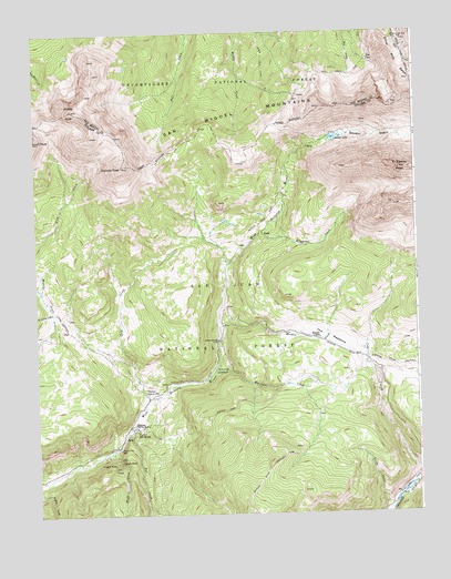
Dolores Peak, CO USGS Topographic Map
Click on map above to begin viewing in our Map Viewer.

This topographic map contains these locations and features:
Feature Name Type Latitude Longitude GNIS ID View Map
Burro BridgeBridgeN37.7953°W108.0659°176579View Map
Burro Bridge CampgroundLocaleN37.7872°W108.0645°176592View Map
Calico TrailheadLocaleN37.7825°W108.0278°197610View Map
Cold CreekStreamN37.7792°W108.0892°176591View Map
Cold ReservoirReservoirN37.7869°W108.0894°197622View Map
Como MineMineN37.7605°W108.1059°1734224View Map
Corkscrew MineMineN37.7605°W108.1059°1734225View Map
Divide ReservoirReservoirN37.7704°W108.1241°197608View Map
Dolores PeakSummitN37.8403°W108.0965°176573View Map
DuntonPopulated PlaceN37.7728°W108.0940°176594View Map
Dunton Guard StationLocaleN37.7814°W108.0892°176593View Map
Dunton Hot SpringSpringN37.7716°W108.0928°176595View Map
Dunton Post Office (historical)Post OfficeN37.7728°W108.0940°2026874View Map
Eagle CreekStreamN37.7667°W108.1009°176580View Map
Eagle FallsFallsN37.7637°W108.0977°176597View Map
East Fork Fall CreekStreamN37.7519°W108.0892°176584View Map
El Diente PeakSummitN37.8394°W108.0053°176576View Map
Emma MineMineN37.7669°W108.0984°176596View Map
Fall CreekStreamN37.7711°W108.0959°176581View Map
Free Coinage MineMineN37.7603°W108.0945°1734226View Map
Geyser SpringMineN37.7517°W108.1206°1735246View Map
Geyser Spring TrailTrailN37.7583°W108.1201°169413View Map
Ground Hog Stock DrivewayTrailN37.7978°W108.1134°202408View Map
Groundhog Stock DrivewayTrailN37.8055°W108.0912°169411View Map
Jeep MineMineN37.7694°W108.0942°1734227View Map
Kilpacker CreekStreamN37.8233°W108.0512°176590View Map
Kilpacker TrailTrailN37.8125°W108.0509°197612View Map
Lizard Head WildernessReserveN37.8418°W108.0152°197187View Map
Meadow CreekStreamN37.7983°W108.0656°176585View Map
Middle PeakSummitN37.8555°W108.1123°202405View Map
Morgan CampLocaleN37.7958°W108.0323°176586View Map
Morrison CreekStreamN37.7872°W108.0665°176588View Map
Mount Pleasant MineMineN37.7714°W108.0898°1734229View Map
Navajo BasinBasinN37.8567°W108.0037°202407View Map
Navajo LakeReservoirN37.8475°W108.0271°176599View Map
Navajo Lake TrailTrailN37.8269°W108.0487°176574View Map
Navajo Lake TrailheadLocaleN37.8033°W108.0640°197611View Map
Poor Boy MineMineN37.7583°W108.1084°1734230View Map
San Miguel MountainsRangeN37.8567°W108.0034°202406View Map
Silver Pick BasinBasinN37.8675°W108.0040°202392View Map
Silver Pick MillLocaleN37.8736°W108.0051°176575View Map
Smuggler MineMineN37.7633°W108.1006°176598View Map
Sulfur King MineMineN37.7567°W108.1117°1734231View Map
Sulphur Queen Group MineMineN37.7567°W108.1117°1734232View Map
The MeadowsFlatN37.7955°W108.0287°176589View Map
Tom Akin ReservoirReservoirN37.8069°W108.0770°197609View Map
Truby CreekStreamN37.7519°W108.0090°176577View Map
West Fork Fall CreekStreamN37.7519°W108.0892°176583View Map
Winter TrailTrailN37.7786°W108.0595°176582View Map
Wood Lake TrailTrailN37.8672°W108.0501°202394View Map
Woods Lake TrailTrailN37.8686°W108.0495°169383View Map

Note: Coordinates in the location and feature list above are referenced to NAD83 datum.


Copyright (C) 2008-2024 Ryan Niemi / Sunset Dynamics ... All Rights Reserved