TopoQuest Logo
Do you find TopoQuest useful?
Help keep TopoQuest running and adding new maps/features by donating!
Bitcoin:  19c7KJd3qBynnjoSw5npx9KScwjBe4ifkT
Litecoin:  LXs6TkuXGGXo1vDsWCkWVdjQX94eUKd6ui
Home View Maps Find Maps Find Places Resources & Links


Dwight, Nebraska Topographic Map

USGS Map Title: Dwight, NE
USGS Map MRC: 41097A1
DRG (GeoTIFF) Download: o41097a1.tif


Neighboring USGS Topographic Map Quads:


  Garrison, NE  
41097B2
 

  Brainard, NE  
41097B1
 

  Loma, NE  
41096B8
 

  Ulysses, NE  
41097A2
 

  Dwight, NE  
41097A1
 

  Valparaiso SW, NE  
41096A8
 

  Staplehurst, NE  
40097H2
 

  Seward, NE  
40097H1
 

  Garland, NE  
40096H8


Map MRC Location:

N42°
W98°
N42°
W97°
H8 H7 H6 H5 H4 H3 H2 H1
G8 G7 G6 G5 G4 G3 G2 G1
F8 F7 F6 F5 F4 F3 F2 F1
E8 E7 E6 E5 E4 E3 E2 E1
D8 D7 D6 D5 D4 D3 D2 D1
C8 C7 C6 C5 C4 C3 C2 C1
B8 B7 B6 B5 B4 B3 B2 B1
A8 A7 A6 A5 A4 A3 A2 A1
N41°
W98°
N41°
W97°

Dwight, NE USGS 1:24K Topographic Map Preview:
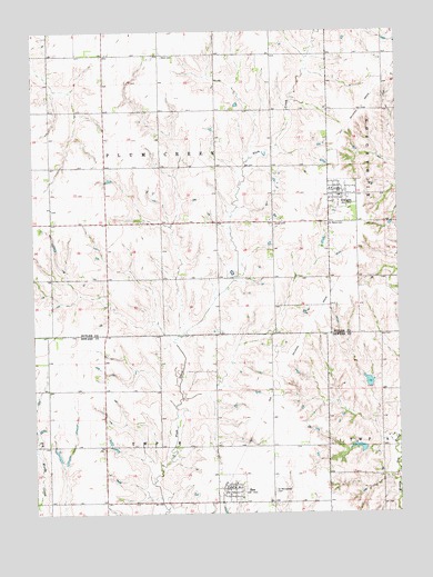
Dwight, NE USGS Topographic Map
Click on map above to begin viewing in our Map Viewer.

This topographic map contains these locations and features:
Feature Name Type Latitude Longitude GNIS ID View Map
Assumption ChurchChurchN41.0836°W97.0200°1881445View Map
BeePopulated PlaceN41.0064°W97.0573°827274View Map
Bee (historical)LocaleN41.0070°W97.0600°1881926View Map
Bee Post OfficePost OfficeN41.0063°W97.0591°1881924View Map
Bee Public SchoolSchoolN41.0078°W97.0564°1881928View Map
Bee Volunteer Fire DepartmentBuildingN41.0067°W97.0580°1881925View Map
Blue Valley Cooperative ElevatorLocaleN41.0064°W97.0573°1881923View Map
Detention Dam 82-BDamN41.0167°W97.0120°1766895View Map
Detention Dam 86-ADamN41.0333°W97.0103°1766909View Map
Detention Dam 87-ADamN41.0233°W97.0103°1766921View Map
DwightPopulated PlaceN41.0836°W97.0200°828907View Map
Dwight (historical)LocaleN41.0833°W97.0184°1881440View Map
Dwight Community LibraryBuildingN41.0836°W97.0200°1881442View Map
Dwight Elementary SchoolSchoolN41.0836°W97.0200°1881444View Map
Dwight Post OfficePost OfficeN41.0830°W97.0204°1881446View Map
Dwight Volunteer Fire DepartmentBuildingN41.0834°W97.0186°1881443View Map
Election Precinct BCivilN41.0029°W97.0820°1929203View Map
Oak Middle Reservoir 87-AReservoirN41.0233°W97.0103°1766922View Map
Oak-Middle Reservoir 82-BReservoirN41.0172°W97.0146°1766896View Map
Oak-Middle Reservoir 86-AReservoirN41.0338°W97.0105°1766910View Map
Pekarek DamDamN41.0968°W97.1083°1769894View Map
Pekarek ReservoirLakeN41.0942°W97.1067°1769895View Map
Pruss DamDamN41.0333°W97.0220°1766933View Map
Pruss ReservoirReservoirN41.0327°W97.0219°1766934View Map
Saint Marys CemeteryCemeteryN41.0747°W97.0245°832990View Map
Saint Wenceslaus Catholic ChurchChurchN41.0067°W97.0561°1881927View Map
Saint Wenceslaus CemeteryCemeteryN41.0058°W97.0434°833113View Map
Skolnik DamDamN41.0343°W97.0930°1767273View Map
Skolnik Dams DamDamN41.0133°W97.1158°1766915View Map
Skolnik ReservoirReservoirN41.0347°W97.0949°1767274View Map
Skolnik ReservoirLakeN41.0136°W97.1160°1766916View Map
Stastny DamDamN41.0659°W97.1011°1769820View Map
Stastny ReservoirLakeN41.0670°W97.1020°1769821View Map
Township BCivilN41.0014°W97.0809°1881763View Map
Township of Plum CreekCivilN41.0899°W97.0811°838193View Map
Union CemeteryCemeteryN41.0756°W97.0422°834265View Map
United Methodist ChurchChurchN41.0836°W97.0200°1881441View Map
Vandenberg DamDamN41.0899°W97.1161°1767289View Map
Vandenberg ReservoirReservoirN41.0887°W97.1167°1767290View Map
Village of BeeCivilN41.0064°W97.0583°2398065View Map
Village of DwightCivilN41.0827°W97.0191°2398765View Map
Ware CemeteryCemeteryN41.1186°W97.0806°834477View Map

Note: Coordinates in the location and feature list above are referenced to NAD83 datum.


Copyright (C) 2008-2024 Ryan Niemi / Sunset Dynamics ... All Rights Reserved