TopoQuest Logo
Do you find TopoQuest useful?
Help keep TopoQuest running and adding new maps/features by donating!
Bitcoin:  19c7KJd3qBynnjoSw5npx9KScwjBe4ifkT
Litecoin:  LXs6TkuXGGXo1vDsWCkWVdjQX94eUKd6ui
Home View Maps Find Maps Find Places Resources & Links


Brainard, Nebraska Topographic Map

USGS Map Title: Brainard, NE
USGS Map MRC: 41097B1
DRG (GeoTIFF) Download: o41097b1.tif


Neighboring USGS Topographic Map Quads:


  David City West, NE  
41097C2
 

  David City East, NE  
41097C1
 

  Bruno, NE  
41096C8
 

  Garrison, NE  
41097B2
 

  Brainard, NE  
41097B1
 

  Loma, NE  
41096B8
 

  Ulysses, NE  
41097A2
 

  Dwight, NE  
41097A1
 

  Valparaiso SW, NE  
41096A8


Map MRC Location:

N42°
W98°
N42°
W97°
H8 H7 H6 H5 H4 H3 H2 H1
G8 G7 G6 G5 G4 G3 G2 G1
F8 F7 F6 F5 F4 F3 F2 F1
E8 E7 E6 E5 E4 E3 E2 E1
D8 D7 D6 D5 D4 D3 D2 D1
C8 C7 C6 C5 C4 C3 C2 C1
B8 B7 B6 B5 B4 B3 B2 B1
A8 A7 A6 A5 A4 A3 A2 A1
N41°
W98°
N41°
W97°

Brainard, NE USGS 1:24K Topographic Map Preview:
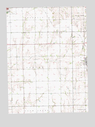
Brainard, NE USGS Topographic Map
Click on map above to begin viewing in our Map Viewer.

This topographic map contains these locations and features:
Feature Name Type Latitude Longitude GNIS ID View Map
BrainardPopulated PlaceN41.1839°W97.0039°827616View Map
Brainard Post OfficePost OfficeN41.1834°W97.0023°1881454View Map
Brainard Volunteer Fire DepartmentBuildingN41.1846°W97.0014°1881453View Map
Butler County ClinicHospitalN41.2472°W97.1225°1881392View Map
Butler County Health Care CenterHospitalN41.2464°W97.1226°1881393View Map
Butler County Health Care Center Ambulance ServiceBuildingN41.2466°W97.1227°2553731View Map
David City Golf ClubLocaleN41.2417°W97.1192°1881385View Map
David PlaceHospitalN41.2483°W97.1211°1881394View Map
East Butler High SchoolSchoolN41.1817°W97.0023°1881458View Map
Grandview SchoolSchoolN41.2497°W97.0611°829636View Map
Holy Trinity Catholic ChurchChurchN41.1883°W97.0031°1881457View Map
Saint Francis ChurchChurchN41.1883°W97.0814°832861View Map
Saint Marys CemeteryCemeteryN41.2431°W97.1181°832992View Map
School Number 60SchoolN41.2206°W97.0992°836931View Map
Speedway SchoolSchoolN41.1558°W97.1006°833646View Map
Stava AirportAirportN41.1670°W97.0313°837502View Map
Township of CenterCivilN41.1769°W97.0809°837907View Map
United Methodist ChurchChurchN41.1867°W97.0025°1881456View Map
Vandenberg DamDamN41.1333°W97.0053°1769822View Map
Vandenberg ReservoirReservoirN41.1320°W97.0027°1769823View Map
Vandenburg DamDamN41.1770°W97.0684°1767496View Map
Vandenburg ReservoirLakeN41.1759°W97.0691°1767497View Map
Village of BrainardCivilN41.1819°W97.0022°2398169View Map
Yanka (historical)LocaleN41.2250°W97.0503°1881345View Map

Note: Coordinates in the location and feature list above are referenced to NAD83 datum.


Copyright (C) 2008-2024 Ryan Niemi / Sunset Dynamics ... All Rights Reserved