TopoQuest Logo
Do you find TopoQuest useful?
Help keep TopoQuest running and adding new maps/features by donating!
Bitcoin:  19c7KJd3qBynnjoSw5npx9KScwjBe4ifkT
Litecoin:  LXs6TkuXGGXo1vDsWCkWVdjQX94eUKd6ui
Home View Maps Find Maps Find Places Resources & Links


Eagle Bend, Minnesota Topographic Map

USGS Map Title: Eagle Bend, MN
USGS Map MRC: 46095B1
DRG (GeoTIFF) Download: o46095b1.tif


Neighboring USGS Topographic Map Quads:


  Wrightstown, MN  
46095C2
 

  Bertha, MN  
46095C1
 

  Aldrich South, MN  
46094C8
 

  Eagle Bend NW, MN  
46095B2
 

  Eagle Bend, MN  
46095B1
 

  Clarissa, MN  
46094B8
 

  Rose City, MN  
46095A2
 

  Clotho, MN  
46095A1
 

  Browerville SW, MN  
46094A8


Map MRC Location:

N47°
W96°
N47°
W95°
H8 H7 H6 H5 H4 H3 H2 H1
G8 G7 G6 G5 G4 G3 G2 G1
F8 F7 F6 F5 F4 F3 F2 F1
E8 E7 E6 E5 E4 E3 E2 E1
D8 D7 D6 D5 D4 D3 D2 D1
C8 C7 C6 C5 C4 C3 C2 C1
B8 B7 B6 B5 B4 B3 B2 B1
A8 A7 A6 A5 A4 A3 A2 A1
N46°
W96°
N46°
W95°

Eagle Bend, MN USGS 1:24K Topographic Map Preview:
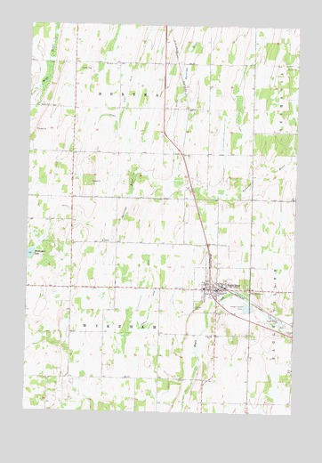
Eagle Bend, MN USGS Topographic Map
Click on map above to begin viewing in our Map Viewer.

This topographic map contains these locations and features:
Feature Name Type Latitude Longitude GNIS ID View Map
Assembly of God ChurchChurchN46.1619°W95.0361°2068905View Map
Bonar CemeteryCemeteryN46.2236°W95.1156°640359View Map
Church of the Open BibleChurchN46.1939°W95.1200°2068894View Map
City of Eagle BendCivilN46.1642°W95.0341°2394587View Map
County Ditch Number TwentysevenCanalN46.1602°W95.0664°641889View Map
Eagle BendPopulated PlaceN46.1650°W95.0392°643006View Map
Eagle Bend (historical)LocaleN46.1661°W95.0325°2068898View Map
Eagle Bend CemeteryCemeteryN46.1647°W95.0214°643007View Map
Eagle Bend City HallBuildingN46.1650°W95.0381°2068901View Map
Eagle Bend Fire DepartmentBuildingN46.1646°W95.0373°2666631View Map
Eagle Bend LibraryBuildingN46.1650°W95.0339°2068899View Map
Eagle Bend Police DepartmentBuildingN46.1646°W95.0373°2068902View Map
Eagle Bend Post OfficePost OfficeN46.1647°W95.0378°2068900View Map
Faith Lutheran ChurchChurchN46.1653°W95.0397°2068904View Map
German CemeteryCemeteryN46.1591°W95.0464°644093View Map
Hope CemeteryCemeteryN46.1655°W95.0514°645172View Map
Immanuel Lutheran ChurchChurchN46.1639°W95.0403°2068906View Map
Saint Johns CemeteryCemeteryN46.2375°W95.0847°650691View Map
Scandinavian CemeteryCemeteryN46.2377°W95.0003°651269View Map
Township of BerthaCivilN46.2371°W95.0843°663578View Map
Township of WykehamCivilN46.1499°W95.0854°666061View Map
United Methodist ChurchChurchN46.1650°W95.0400°2068903View Map

Note: Coordinates in the location and feature list above are referenced to NAD83 datum.


Copyright (C) 2008-2024 Ryan Niemi / Sunset Dynamics ... All Rights Reserved