TopoQuest Logo
Do you find TopoQuest useful?
Help keep TopoQuest running and adding new maps/features by donating!
Bitcoin:  19c7KJd3qBynnjoSw5npx9KScwjBe4ifkT
Litecoin:  LXs6TkuXGGXo1vDsWCkWVdjQX94eUKd6ui
Home View Maps Find Maps Find Places Resources & Links


Clarissa, Minnesota Topographic Map

USGS Map Title: Clarissa, MN
USGS Map MRC: 46094B8
DRG (GeoTIFF) Download: o46094b8.tif


Neighboring USGS Topographic Map Quads:


  Bertha, MN  
46095C1
 

  Aldrich South, MN  
46094C8
 

  Staples, MN  
46094C7
 

  Eagle Bend, MN  
46095B1
 

  Clarissa, MN  
46094B8
 

  Browerville NE, MN  
46094B7
 

  Clotho, MN  
46095A1
 

  Browerville SW, MN  
46094A8
 

  Browerville, MN  
46094A7


Map MRC Location:

N47°
W95°
N47°
W94°
H8 H7 H6 H5 H4 H3 H2 H1
G8 G7 G6 G5 G4 G3 G2 G1
F8 F7 F6 F5 F4 F3 F2 F1
E8 E7 E6 E5 E4 E3 E2 E1
D8 D7 D6 D5 D4 D3 D2 D1
C8 C7 C6 C5 C4 C3 C2 C1
B8 B7 B6 B5 B4 B3 B2 B1
A8 A7 A6 A5 A4 A3 A2 A1
N46°
W95°
N46°
W94°

Clarissa, MN USGS 1:24K Topographic Map Preview:
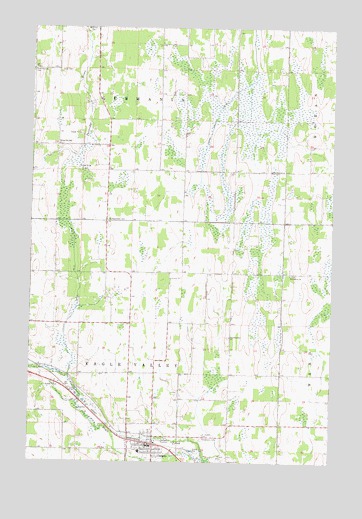
Clarissa, MN USGS Topographic Map
Click on map above to begin viewing in our Map Viewer.

This topographic map contains these locations and features:
Feature Name Type Latitude Longitude GNIS ID View Map
Bethlehem CemeteryCemeteryN46.1792°W94.8917°2068838View Map
Bethlehem ChurchChurchN46.1791°W94.8928°640057View Map
Central Todd County Nursing HomeHospitalN46.1303°W94.9483°2068915View Map
City of ClarissaCivilN46.1285°W94.9492°2393536View Map
ClarissaPopulated PlaceN46.1302°W94.9486°641242View Map
Clarissa (historical)LocaleN46.1308°W94.9514°2068913View Map
Clarissa City HallBuildingN46.1300°W94.9500°2068919View Map
Clarissa Fire DepartmentBuildingN46.1306°W94.9499°2666616View Map
Clarissa Medical CenterHospitalN46.1303°W94.9483°2068916View Map
Clarissa Police DepartmentBuildingN46.1299°W94.9504°2068918View Map
Clarissa Post OfficePost OfficeN46.1300°W94.9506°2068917View Map
County Ditch Number ThirtyoneCanalN46.1683°W94.9820°641945View Map
County Ditch Number TwentyfiveCanalN46.2261°W94.9239°641860View Map
Eagle Valley Elementary SchoolSchoolN46.1281°W94.9533°2068914View Map
Immanuel Lutheran ChurchChurchN46.1292°W94.9508°2068910View Map
Saint Joseph Catholic ChurchChurchN46.1281°W94.9494°2068908View Map
Saint Joseph CemeteryCemeteryN46.1325°W94.9289°650758View Map
Saint Matthew Lutheran ChurchChurchN46.1292°W94.9561°2068912View Map
Saint Matthews CemeteryCemeteryN46.1947°W94.9686°650898View Map
Scandinavian ChurchChurchN46.1611°W94.9172°651271View Map
School Number 2282SchoolN46.2164°W94.9892°651566View Map
School Number 2286SchoolN46.1319°W94.8750°651569View Map
School Number 2365SchoolN46.2091°W94.8961°651586View Map
Township of Eagle ValleyCivilN46.1512°W94.9588°664020View Map
Township of GermaniaCivilN46.2380°W94.9582°664261View Map
United Methodist ChurchChurchN46.1292°W94.9528°2068911View Map
Valley Our Saviors ChurchChurchN46.1269°W94.9481°2068909View Map
Woodmans CemeteryCemeteryN46.1319°W94.9289°654375View Map
Zoar CemeteryCemeteryN46.2377°W94.9889°654501View Map

Note: Coordinates in the location and feature list above are referenced to NAD83 datum.


Copyright (C) 2008-2024 Ryan Niemi / Sunset Dynamics ... All Rights Reserved