TopoQuest Logo
Do you find TopoQuest useful?
Help keep TopoQuest running and adding new maps/features by donating!
Bitcoin:  19c7KJd3qBynnjoSw5npx9KScwjBe4ifkT
Litecoin:  LXs6TkuXGGXo1vDsWCkWVdjQX94eUKd6ui
Home View Maps Find Maps Find Places Resources & Links


Ellisville, Alabama Topographic Map

USGS Map Title: Ellisville, AL
USGS Map MRC: 34085A5
DRG (GeoTIFF) Download: o34085a5.tif


Neighboring USGS Topographic Map Quads:


  Centre, AL  
34085B6
 

  Cedar Bluff, AL  
34085B5
 

  Melson, GA  
34085B4
 

  Weisner Mountain, AL  
34085A6
 

  Ellisville, AL  
34085A5
 

  Indian Mountain, AL  
34085A4
 

  Piedmont NW, AL  
33085H6
 

  Piedmont, AL  
33085H5
 

  Borden Springs, AL  
33085H4


Map MRC Location:

N35°
W86°
N35°
W85°
H8 H7 H6 H5 H4 H3 H2 H1
G8 G7 G6 G5 G4 G3 G2 G1
F8 F7 F6 F5 F4 F3 F2 F1
E8 E7 E6 E5 E4 E3 E2 E1
D8 D7 D6 D5 D4 D3 D2 D1
C8 C7 C6 C5 C4 C3 C2 C1
B8 B7 B6 B5 B4 B3 B2 B1
A8 A7 A6 A5 A4 A3 A2 A1
N34°
W86°
N34°
W85°

Ellisville, AL USGS 1:24K Topographic Map Preview:
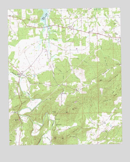
Ellisville, AL USGS Topographic Map
Click on map above to begin viewing in our Map Viewer.

This topographic map contains these locations and features:
Feature Name Type Latitude Longitude GNIS ID View Map
Big Elm BranchStreamN34.0826°W85.5200°114279View Map
Blue PondLakeN34.0329°W85.5555°114558View Map
Bob Hollow BranchStreamN34.0732°W85.5744°114635View Map
BomarPopulated PlaceN34.1087°W85.5802°156091View Map
Brown MountainSummitN34.0112°W85.5547°114996View Map
Bulse BranchStreamN34.0182°W85.5166°1730557View Map
Cantrell BranchStreamN34.1034°W85.5777°115597View Map
Casey HillSummitN34.0062°W85.5716°115683View Map
Centre-Piedmont-Cherokee County Regional AirportAirportN34.0903°W85.6137°2676312View Map
Christian Mission ChurchChurchN34.0095°W85.5350°136869View Map
Coloma (historical)Populated PlaceN34.0773°W85.6189°166065View Map
Coloma MountainRidgeN34.0368°W85.6125°116452View Map
Coloma Post Office (historical)Post OfficeN34.0773°W85.6189°169249View Map
Couches Mill (historical)LocaleN34.0215°W85.5983°136874View Map
Craig MountainSummitN34.0298°W85.5627°116808View Map
Craig Mountain Lookout TowerTowerN34.0329°W85.5519°164460View Map
Dockage MineMineN34.0134°W85.5450°1730559View Map
Doctor McElraths Mill (historical)LocaleN34.0273°W85.6125°136881View Map
Dry BranchStreamN34.1245°W85.5236°117515View Map
Dry SloughStreamN34.0807°W85.5597°117603View Map
EllisvillePopulated PlaceN34.0648°W85.6100°117952View Map
Ellisville ChurchChurchN34.0548°W85.5958°136884View Map
Ellisville Volunteer Fire DepartmentBuildingN34.0677°W85.6132°2682910View Map
ExiePopulated PlaceN34.0493°W85.5486°155798View Map
Exie ChurchChurchN34.0518°W85.5505°155963View Map
Firestone BranchStreamN34.0807°W85.5761°118298View Map
Freeman HillSummitN34.0307°W85.5719°118626View Map
Frog MountainPopulated PlaceN34.0226°W85.5741°156386View Map
Frog MountainSummitN34.0062°W85.5669°118727View Map
Frog Mountain Church (historical)ChurchN34.0112°W85.5697°1730560View Map
Garvin SpringSpringN34.0132°W85.5752°149264View Map
Headquarters AirportAirportN34.1074°W85.5656°2676311View Map
Hebron CemeteryCemeteryN34.1084°W85.5555°136909View Map
Hebron Methodist ChurchChurchN34.1082°W85.5550°119929View Map
Horsepen BranchStreamN34.0998°W85.5783°120419View Map
Hurricane CreekStreamN34.0098°W85.5861°159833View Map
Indian HillSummitN34.1087°W85.5066°120659View Map
Jenning ChapelChurchN34.1009°W85.5055°120850View Map
KeyPopulated PlaceN34.1026°W85.5344°121167View Map
Lebanon Campground ChurchChurchN34.0062°W85.5522°152009View Map
Lebanon CemeteryCemeteryN34.0062°W85.5527°136919View Map
McCauley MountainSummitN34.0579°W85.5119°122470View Map
Mona (historical)Populated PlaceN34.0251°W85.6039°136931View Map
MoshatPopulated PlaceN34.1187°W85.6222°123107View Map
Moshat Baptist ChurchChurchN34.1195°W85.6177°136935View Map
Moshat CemeteryCemeteryN34.1193°W85.6183°136934View Map
Mount Zion CemeteryCemeteryN34.0481°W85.5658°136941View Map
Mount Zion ChurchChurchN34.0473°W85.5652°123485View Map
Mount Zion School (historical)SchoolN34.0540°W85.5677°1730565View Map
New Bethel ChurchChurchN34.1129°W85.5958°136950View Map
New Bethel ChurchChurchN34.1037°W85.5347°123723View Map
New Prospect ChurchChurchN34.1182°W85.5013°123889View Map
Norton DamDamN34.0168°W85.5133°131890View Map
Norton LakeReservoirN34.0168°W85.5123°131891View Map
Old ColomaPopulated PlaceN34.0307°W85.6183°156831View Map
Pleasant Arbour Baptist ChurchChurchN34.0115°W85.5163°155903View Map
Roberts MountainSummitN34.0232°W85.6191°125700View Map
Sandy CreekStreamN34.1245°W85.5269°126380View Map
Sanford SpringSpringN34.0198°W85.5736°149267View Map
Sanford SpringsPopulated PlaceN34.0182°W85.5733°157016View Map
Sheepskin CemeteryCemeteryN34.0506°W85.5447°136981View Map
Shield Mill (historical)LocaleN34.0195°W85.5875°136982View Map
Spring Garden DivisionCivilN34.0750°W85.5019°165689View Map
Standford SpringSpringN34.0543°W85.5713°136916View Map
Standford SpringsSpringN34.0076°W85.5777°136903View Map
Strickland BranchStreamN34.1065°W85.5211°127463View Map
Stubbs MountainSummitN34.0584°W85.5241°127480View Map
Terrapin Creek Watershed Dam Number 6DamN34.0034°W85.6250°131884View Map
Union ChurchChurchN34.0651°W85.6100°136997View Map
Unity Hill Baptist ChurchChurchN34.1068°W85.5800°155928View Map
Wolfden FlatsFlatN34.0495°W85.5072°129175View Map
Wolfden MountainSummitN34.0484°W85.5036°154020View Map
Woodward MountainSummitN34.0395°W85.5144°129225View Map

Note: Coordinates in the location and feature list above are referenced to NAD83 datum.


Copyright (C) 2008-2024 Ryan Niemi / Sunset Dynamics ... All Rights Reserved