TopoQuest Logo
Do you find TopoQuest useful?
Help keep TopoQuest running and adding new maps/features by donating!
Bitcoin:  19c7KJd3qBynnjoSw5npx9KScwjBe4ifkT
Litecoin:  LXs6TkuXGGXo1vDsWCkWVdjQX94eUKd6ui
Home View Maps Find Maps Find Places Resources & Links


Farnhamville, Iowa Topographic Map

USGS Map Title: Farnhamville, IA
USGS Map MRC: 42094C4
DRG (GeoTIFF) Download: o42094c4.tif


Neighboring USGS Topographic Map Quads:


  Richard, IA  
42094D5
 

  Knierim, IA  
42094D4
 

  Moorland, IA  
42094D3
 

  Lohrville, IA  
42094C5
 

  Farnhamville, IA  
42094C4
 

  Gowrie, IA  
42094C3
 

  Wightman, IA  
42094B5
 

  Churdan, IA  
42094B4
 

  Paton, IA  
42094B3


Map MRC Location:

N43°
W95°
N43°
W94°
H8 H7 H6 H5 H4 H3 H2 H1
G8 G7 G6 G5 G4 G3 G2 G1
F8 F7 F6 F5 F4 F3 F2 F1
E8 E7 E6 E5 E4 E3 E2 E1
D8 D7 D6 D5 D4 D3 D2 D1
C8 C7 C6 C5 C4 C3 C2 C1
B8 B7 B6 B5 B4 B3 B2 B1
A8 A7 A6 A5 A4 A3 A2 A1
N42°
W95°
N42°
W94°

Farnhamville, IA USGS 1:24K Topographic Map Preview:
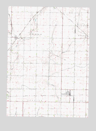
Farnhamville, IA USGS Topographic Map
Click on map above to begin viewing in our Map Viewer.

This topographic map contains these locations and features:
Feature Name Type Latitude Longitude GNIS ID View Map
Cedar CemeteryCemeteryN42.3457°W94.4648°455224View Map
Cedar Wildlife AreaParkN42.3666°W94.4544°1995732View Map
City of FarnhamvilleCivilN42.2768°W94.4078°2394750View Map
City of RinardCivilN42.3396°W94.4849°2396377View Map
Davis Preservation AreaParkN42.3550°W94.4941°1995731View Map
Ditch Number 12CanalN42.3072°W94.3875°465672View Map
EasleyPopulated PlaceN42.3111°W94.3994°464125View Map
Farmers Cooperative Company ElevatorLocaleN42.2755°W94.4036°1995871View Map
FarnhamvillePopulated PlaceN42.2761°W94.4039°456555View Map
Farnhamville (historical)LocaleN42.2747°W94.4033°1995876View Map
Farnhamville Fire DepartmentBuildingN42.2819°W94.4194°2371661View Map
Farnhamville LibraryBuildingN42.2755°W94.4036°1995869View Map
Farnhamville Police DepartmentBuildingN42.2762°W94.4037°1995872View Map
Farnhamville Post OfficePost OfficeN42.2761°W94.4041°1995873View Map
Farnhamville Town HallBuildingN42.2755°W94.4036°1995870View Map
First United ChurchChurchN42.2772°W94.4044°1995874View Map
Holy Trinity Lutheran ChurchChurchN42.2805°W94.4030°1995875View Map
Lohr Wildlife RefugeParkN42.2791°W94.4961°1995730View Map
Muddy (historical)LocaleN42.3691°W94.4553°1995761View Map
Muddy Post Office (historical)Post OfficeN42.3691°W94.4553°1995762View Map
Prairie Valley Elementary SchoolSchoolN42.3378°W94.4157°1996835View Map
Prairie Valley Middle SchoolSchoolN42.3333°W94.4169°1995868View Map
Reading CemeteryCemeteryN42.2593°W94.4326°460542View Map
RinardPopulated PlaceN42.3397°W94.4886°460638View Map
Rinard (historical)LocaleN42.3389°W94.4864°1995759View Map
Rinard Post Office (historical)Post OfficeN42.3397°W94.4886°1995760View Map
SliferPopulated PlaceN42.3414°W94.3786°464749View Map
Slifer (historical)LocaleN42.3414°W94.3786°1996630View Map
Slifer Post Office (historical)Post OfficeN42.3414°W94.3786°1996629View Map
Township of CedarCivilN42.3401°W94.4556°467550View Map
Township of ReadingCivilN42.2528°W94.4554°468590View Map
Welshs SloughStreamN42.3733°W94.4455°462795View Map

Note: Coordinates in the location and feature list above are referenced to NAD83 datum.


Copyright (C) 2008-2024 Ryan Niemi / Sunset Dynamics ... All Rights Reserved