TopoQuest Logo
Do you find TopoQuest useful?
Help keep TopoQuest running and adding new maps/features by donating!
Bitcoin:  19c7KJd3qBynnjoSw5npx9KScwjBe4ifkT
Litecoin:  LXs6TkuXGGXo1vDsWCkWVdjQX94eUKd6ui
Home View Maps Find Maps Find Places Resources & Links


Churdan, Iowa Topographic Map

USGS Map Title: Churdan, IA
USGS Map MRC: 42094B4
DRG (GeoTIFF) Download: o42094b4.tif


Neighboring USGS Topographic Map Quads:


  Lohrville, IA  
42094C5
 

  Farnhamville, IA  
42094C4
 

  Gowrie, IA  
42094C3
 

  Wightman, IA  
42094B5
 

  Churdan, IA  
42094B4
 

  Paton, IA  
42094B3
 

  Scranton, IA  
42094A5
 

  Jefferson West, IA  
42094A4
 

  Jefferson East, IA  
42094A3


Map MRC Location:

N43°
W95°
N43°
W94°
H8 H7 H6 H5 H4 H3 H2 H1
G8 G7 G6 G5 G4 G3 G2 G1
F8 F7 F6 F5 F4 F3 F2 F1
E8 E7 E6 E5 E4 E3 E2 E1
D8 D7 D6 D5 D4 D3 D2 D1
C8 C7 C6 C5 C4 C3 C2 C1
B8 B7 B6 B5 B4 B3 B2 B1
A8 A7 A6 A5 A4 A3 A2 A1
N42°
W95°
N42°
W94°

Churdan, IA USGS 1:24K Topographic Map Preview:
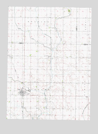
Churdan, IA USGS Topographic Map
Click on map above to begin viewing in our Map Viewer.

This topographic map contains these locations and features:
Feature Name Type Latitude Longitude GNIS ID View Map
AdazaPopulated PlaceN42.1953°W94.4944°454096View Map
Adaza (historical)LocaleN42.1953°W94.4961°1995909View Map
Adaza Post Office (historical)Post OfficeN42.1953°W94.4944°1995908View Map
ChurdanPopulated PlaceN42.1519°W94.4744°455414View Map
Churdan (historical)LocaleN42.1544°W94.4803°1996014View Map
Churdan City HallBuildingN42.1555°W94.4766°1996007View Map
Churdan Fire and RescueBuildingN42.1555°W94.4791°1996006View Map
Churdan LibraryBuildingN42.1555°W94.4741°1996008View Map
Churdan Post OfficePost OfficeN42.1550°W94.4766°1996013View Map
City of ChurdanCivilN42.1539°W94.4786°2393523View Map
Ditch Number 28CanalN42.2305°W94.4552°465707View Map
First Baptist ChurchChurchN42.1539°W94.4786°1996010View Map
Happy RunStreamN42.1533°W94.4441°457240View Map
Highland CemeteryCemeteryN42.1530°W94.4699°457463View Map
Paton - Churdan Elementary SchoolSchoolN42.1597°W94.4763°2719735View Map
Paton - Churdan Middle / High SchoolSchoolN42.1596°W94.4771°1996009View Map
Reading CreekStreamN42.2030°W94.4344°460543View Map
Saint Columbkill's Catholic ChurchChurchN42.1530°W94.4766°1996012View Map
Township of HighlandCivilN42.1661°W94.4552°468035View Map
United Methodist ChurchChurchN42.1530°W94.4769°1996011View Map

Note: Coordinates in the location and feature list above are referenced to NAD83 datum.


Copyright (C) 2008-2024 Ryan Niemi / Sunset Dynamics ... All Rights Reserved