TopoQuest Logo
Do you find TopoQuest useful?
Help keep TopoQuest running and adding new maps/features by donating!
Bitcoin:  19c7KJd3qBynnjoSw5npx9KScwjBe4ifkT
Litecoin:  LXs6TkuXGGXo1vDsWCkWVdjQX94eUKd6ui
Home View Maps Find Maps Find Places Resources & Links


Fields, Louisiana Topographic Map

USGS Map Title: Fields, LA
USGS Map MRC: 30093E5
DRG (GeoTIFF) Download: o30093e5.tif


Neighboring USGS Topographic Map Quads:


  Bon Wier, TX  
30093F6
 

  Merryville South, LA  
30093F5
 

  Singer, LA  
30093F4
 

  Bancroft, LA  
30093E6
 

  Fields, LA  
30093E5
 

  Oretta, LA  
30093E4
 

  Shoats Creek, LA  
30093D6
 

  Clark Hollow, LA  
30093D5
 

  DeQuincy, LA  
30093D4


Map MRC Location:

N31°
W94°
N31°
W93°
H8 H7 H6 H5 H4 H3 H2 H1
G8 G7 G6 G5 G4 G3 G2 G1
F8 F7 F6 F5 F4 F3 F2 F1
E8 E7 E6 E5 E4 E3 E2 E1
D8 D7 D6 D5 D4 D3 D2 D1
C8 C7 C6 C5 C4 C3 C2 C1
B8 B7 B6 B5 B4 B3 B2 B1
A8 A7 A6 A5 A4 A3 A2 A1
N30°
W94°
N30°
W93°

Fields, LA USGS 1:24K Topographic Map Preview:
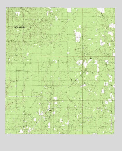
Fields, LA USGS Topographic Map
Click on map above to begin viewing in our Map Viewer.

This topographic map contains these locations and features:
Feature Name Type Latitude Longitude GNIS ID View Map
Bear Head Creek Oil FieldOilfieldN30.5424°W93.5129°553545View Map
Beauregard Parish Library Fields Southwest BranchBuildingN30.5265°W93.5743°2603028View Map
Buckston Marsh Oil FieldOilfieldN30.5694°W93.5196°544759View Map
Buxton MarshStreamN30.5710°W93.5035°533512View Map
East Bancroft Oil FieldOilfieldN30.5571°W93.6104°544753View Map
FieldsPopulated PlaceN30.5263°W93.5749°554398View Map
Fields Baptist ChurchChurchN30.5263°W93.5696°544755View Map
Fields Camp (historical)LocaleN30.5530°W93.5749°544756View Map
Fields Fire TowerTowerN30.5582°W93.5394°2332437View Map
Fields Lookout TowerTowerN30.5577°W93.5396°558769View Map
Fields Oil FieldOilfieldN30.5152°W93.5949°554399View Map
Fields Post OfficePost OfficeN30.5260°W93.5752°1630132View Map
Fields Volunteer Fire Department District 1BuildingN30.5263°W93.5743°2332582View Map
Hyatt High SchoolSchoolN30.5244°W93.5757°542004View Map
Jackson GullyStreamN30.6105°W93.5091°542005View Map
Johns GullyStreamN30.5388°W93.5179°554886View Map
Little CreekStreamN30.5113°W93.5154°536531View Map
Louisiana Noname 73 DamDamN30.5685°W93.5402°556931View Map
MysticPopulated PlaceN30.5744°W93.5291°542007View Map
Mystic Baptist ChurchChurchN30.5727°W93.5338°555455View Map
North Fields Oil FieldOilfieldN30.5552°W93.5677°544757View Map
Parish Governing Authority District 1CivilN30.5631°W93.5240°1929723View Map
Paul Burns GullyStreamN30.5469°W93.5210°542011View Map
South Bear Head Creek Oil FieldOilfieldN30.5191°W93.5279°544758View Map
Spikes LakeReservoirN30.5695°W93.5404°542013View Map
Union Church (historical)ChurchN30.5263°W93.5696°544754View Map
Ward OneCivilN30.5196°W93.5929°544921View Map

Note: Coordinates in the location and feature list above are referenced to NAD83 datum.


Copyright (C) 2008-2024 Ryan Niemi / Sunset Dynamics ... All Rights Reserved