TopoQuest Logo
Do you find TopoQuest useful?
Help keep TopoQuest running and adding new maps/features by donating!
Bitcoin:  19c7KJd3qBynnjoSw5npx9KScwjBe4ifkT
Litecoin:  LXs6TkuXGGXo1vDsWCkWVdjQX94eUKd6ui
Home View Maps Find Maps Find Places Resources & Links


Fort Grant, Arizona Topographic Map

USGS Map Title: Fort Grant, AZ
USGS Map MRC: 32109E8
DRG (GeoTIFF) Download: o32109e8.tif


Neighboring USGS Topographic Map Quads:


  Blue Jay Peak, AZ  
32110F1
 

  Webb Peak, AZ  
32109F8
 

  Mount Graham, AZ  
32109F7
 

  Sierra Bonita Ranch, AZ  
32110E1
 

  Fort Grant, AZ  
32109E8
 

  Stockton Pass, AZ  
32109E7
 

  Reiley Peak, AZ  
32110D1
 

  West of Greasewood Mountain, AZ  
32109D8
 

  Greasewood Mountain, AZ  
32109D7


Map MRC Location:

N33°
W110°
N33°
W109°
H8 H7 H6 H5 H4 H3 H2 H1
G8 G7 G6 G5 G4 G3 G2 G1
F8 F7 F6 F5 F4 F3 F2 F1
E8 E7 E6 E5 E4 E3 E2 E1
D8 D7 D6 D5 D4 D3 D2 D1
C8 C7 C6 C5 C4 C3 C2 C1
B8 B7 B6 B5 B4 B3 B2 B1
A8 A7 A6 A5 A4 A3 A2 A1
N32°
W110°
N32°
W109°

Fort Grant, AZ USGS 1:24K Topographic Map Preview:
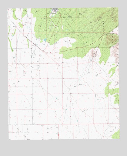
Fort Grant, AZ USGS Topographic Map
Click on map above to begin viewing in our Map Viewer.

This topographic map contains these locations and features:
Feature Name Type Latitude Longitude GNIS ID View Map
Angel Field (historical)AirportN32.6095°W109.9501°22389View Map
Big CreekStreamN32.5787°W109.9629°1305View Map
BonitaPopulated PlaceN32.5898°W109.9692°24330View Map
Bonita Elementary SchoolSchoolN32.5868°W109.9743°22421View Map
Boone WellWellN32.5248°W109.9640°1835View Map
Estes RanchLocaleN32.5106°W109.9556°4501View Map
Fort Grant (historical)LocaleN32.6228°W109.9459°23912View Map
Fort Grant State Industrial SchoolSchoolN32.6228°W109.9459°4750View Map
Fort Grant Unit of the Arizona State Prison Complex SaffordBuildingN32.6228°W109.9453°2072299View Map
Gold GulchValleyN32.5981°W109.9520°5104View Map
Gold Gulch CorralLocaleN32.6162°W109.9326°5107View Map
Goudy Canyon WashStreamN32.5873°W109.9773°5184View Map
Grant CreekStreamN32.5620°W109.9825°5261View Map
Grapevine CanyonValleyN32.6078°W109.9062°5269View Map
Grapevine Canyon WashStreamN32.5965°W109.9415°5273View Map
Grapevine SpringSpringN32.6162°W109.8971°5278View Map
Hog CanyonValleyN32.5687°W109.8784°5856View Map
Hog Canyon WashStreamN32.5148°W109.9892°5859View Map
Jesus Canyon WashStreamN32.6031°W109.9756°6406View Map
Martin WashStreamN32.5059°W109.9462°7737View Map
Martin WellWellN32.5537°W109.8762°7738View Map
Mills RanchLocaleN32.6226°W109.9948°8078View Map
Mothers CanyonValleyN32.5790°W109.8862°8320View Map
Pitchfork CanyonValleyN32.6009°W109.8862°9548View Map
Pitchfork Canyon WashStreamN32.5903°W109.9526°9549View Map
South Taylor WashStreamN32.5560°W109.9992°11646View Map
Tumbleweed TankReservoirN32.5787°W109.9927°12844View Map

Note: Coordinates in the location and feature list above are referenced to NAD83 datum.


Copyright (C) 2008-2024 Ryan Niemi / Sunset Dynamics ... All Rights Reserved