TopoQuest Logo
Do you find TopoQuest useful?
Help keep TopoQuest running and adding new maps/features by donating!
Bitcoin:  19c7KJd3qBynnjoSw5npx9KScwjBe4ifkT
Litecoin:  LXs6TkuXGGXo1vDsWCkWVdjQX94eUKd6ui
Home View Maps Find Maps Find Places Resources & Links


Blue Jay Peak, Arizona Topographic Map

USGS Map Title: Blue Jay Peak, AZ
USGS Map MRC: 32110F1
DRG (GeoTIFF) Download: o32110f1.tif


Neighboring USGS Topographic Map Quads:


  Buford Hill, AZ  
32110G2
 

  Tripp Canyon, AZ  
32110G1
 

  Shingle Mill Mountain, AZ  
32109G8
 

  Eureka Ranch, AZ  
32110F2
 

  Blue Jay Peak, AZ  
32110F1
 

  Webb Peak, AZ  
32109F8
 

  Harrison Canyon, AZ  
32110E2
 

  Sierra Bonita Ranch, AZ  
32110E1
 

  Fort Grant, AZ  
32109E8


Map MRC Location:

N33°
W111°
N33°
W110°
H8 H7 H6 H5 H4 H3 H2 H1
G8 G7 G6 G5 G4 G3 G2 G1
F8 F7 F6 F5 F4 F3 F2 F1
E8 E7 E6 E5 E4 E3 E2 E1
D8 D7 D6 D5 D4 D3 D2 D1
C8 C7 C6 C5 C4 C3 C2 C1
B8 B7 B6 B5 B4 B3 B2 B1
A8 A7 A6 A5 A4 A3 A2 A1
N32°
W111°
N32°
W110°

Blue Jay Peak, AZ USGS 1:24K Topographic Map Preview:
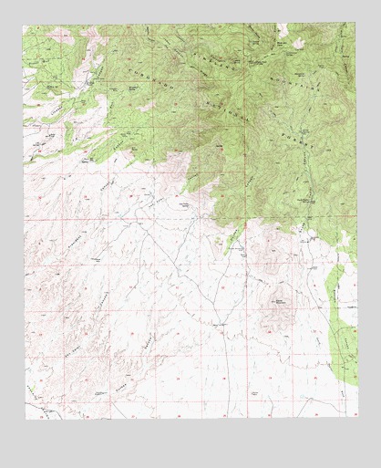
Blue Jay Peak, AZ USGS Topographic Map
Click on map above to begin viewing in our Map Viewer.

This topographic map contains these locations and features:
Feature Name Type Latitude Longitude GNIS ID View Map
Babcock TankReservoirN32.6809°W110.0023°22398View Map
Battle MountainSummitN32.6617°W110.0312°1081View Map
Blue Jay PeakSummitN32.7431°W110.0301°1705View Map
Canyon WindmillLocaleN32.6334°W110.0962°2449View Map
Colter SpringSpringN32.7158°W110.0206°3134View Map
Durkee WindmillLocaleN32.6787°W110.0431°4202View Map
Goldbug TunnelMineN32.7417°W110.0001°22505View Map
Government SpringSpringN32.7409°W110.0266°5194View Map
Johns Canyon RidgeRidgeN32.7376°W110.0656°6466View Map
K H ButteSummitN32.7106°W110.0851°6564View Map
K H RanchLocaleN32.7151°W110.0848°6566View Map
Lindsey GraveCemeteryN32.7328°W110.0992°7038View Map
Lindsey TankReservoirN32.7367°W110.0962°22551View Map
Lindsey TankReservoirN32.7312°W110.1015°7040View Map
Lookout SpringSpringN32.7385°W110.0440°7369View Map
Manzanita SpringSpringN32.7334°W110.0196°7674View Map
Mine WindmillWellN32.7298°W110.1154°22573View Map
Mineshaft SpringSpringN32.7289°W110.0857°8109View Map
President MineMineN32.7292°W110.0895°9759View Map
Seventysix RanchLocaleN32.6817°W110.0181°11131View Map
South Taylor CanyonValleyN32.6573°W110.0201°11644View Map
South Taylor SpringSpringN32.6935°W110.0184°11645View Map
Stansberry Number Three TankReservoirN32.6911°W110.0300°22676View Map
Taylor PassGapN32.7356°W110.0123°12204View Map
Two E SpringSpringN32.7124°W110.1193°12981View Map
Van Valer CanyonValleyN32.6387°W110.1192°13189View Map
Van Valer SpringSpringN32.6926°W110.0635°13190View Map
Van Valer TankReservoirN32.6887°W110.0589°22699View Map
West Babcock CanyonValleyN32.6867°W110.0001°13477View Map
West PeakSummitN32.7373°W110.0384°13518View Map

Note: Coordinates in the location and feature list above are referenced to NAD83 datum.


Copyright (C) 2008-2024 Ryan Niemi / Sunset Dynamics ... All Rights Reserved