TopoQuest Logo
Do you find TopoQuest useful?
Help keep TopoQuest running and adding new maps/features by donating!
Bitcoin:  19c7KJd3qBynnjoSw5npx9KScwjBe4ifkT
Litecoin:  LXs6TkuXGGXo1vDsWCkWVdjQX94eUKd6ui
Home View Maps Find Maps Find Places Resources & Links


Fort Loramie, Ohio Topographic Map

USGS Map Title: Fort Loramie, OH
USGS Map MRC: 40084C3
DRG (GeoTIFF) Download: o40084c3.tif


Neighboring USGS Topographic Map Quads:


  New Bremen, OH  
40084D4
 

  New Knoxville, OH  
40084D3
 

  Botkins, OH  
40084D2
 

  Osgood, OH  
40084C4
 

  Fort Loramie, OH  
40084C3
 

  Sidney, OH  
40084C2
 

  Versailles, OH  
40084B4
 

  Piqua West, OH  
40084B3
 

  Piqua East, OH  
40084B2


Map MRC Location:

N41°
W85°
N41°
W84°
H8 H7 H6 H5 H4 H3 H2 H1
G8 G7 G6 G5 G4 G3 G2 G1
F8 F7 F6 F5 F4 F3 F2 F1
E8 E7 E6 E5 E4 E3 E2 E1
D8 D7 D6 D5 D4 D3 D2 D1
C8 C7 C6 C5 C4 C3 C2 C1
B8 B7 B6 B5 B4 B3 B2 B1
A8 A7 A6 A5 A4 A3 A2 A1
N40°
W85°
N40°
W84°

Fort Loramie, OH USGS 1:24K Topographic Map Preview:
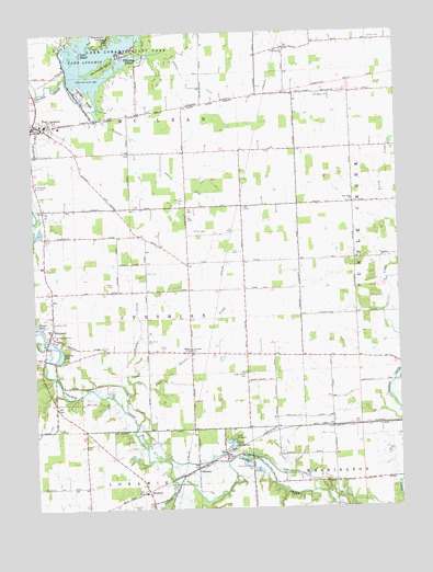
Fort Loramie, OH USGS Topographic Map
Click on map above to begin viewing in our Map Viewer.

This topographic map contains these locations and features:
Feature Name Type Latitude Longitude GNIS ID View Map
Angel Street CemeteryCemeteryN40.2854°W84.3030°1037426View Map
Big Run School (historical)SchoolN40.3156°W84.2658°1053848View Map
Blackberry IslandIslandN40.3659°W84.3505°1038087View Map
Bunker Hill School (historical)SchoolN40.2570°W84.2824°1053854View Map
Camp EvergreenLocaleN40.2684°W84.3080°1038694View Map
Crawford IslandIslandN40.3584°W84.3561°1039460View Map
Cuba CemeteryCemeteryN40.3731°W84.2583°1039522View Map
Cynthian CemeteryCemeteryN40.2989°W84.3694°1039555View Map
DawsonPopulated PlaceN40.2606°W84.3197°1064513View Map
Dawson Post Office (historical)Post OfficeN40.2612°W84.3194°2055283View Map
Earls IslandPopulated PlaceN40.3700°W84.3577°1048675View Map
East Painter CreekStreamN40.2834°W84.3419°1065994View Map
Eilerman DitchCanalN40.3434°W84.3411°1065996View Map
Ernst Swine FarmLocaleN40.3372°W84.3164°2664086View Map
Filburns IslandPopulated PlaceN40.3695°W84.3441°1048733View Map
Forest School (historical)SchoolN40.2859°W84.3030°1053862View Map
Fort LoramiePopulated PlaceN40.3514°W84.3738°1064665View Map
Fort Loramie Fire DepartmentBuildingN40.3528°W84.3741°2550360View Map
Fort Loramie High SchoolSchoolN40.3512°W84.3702°1053863View Map
Fort Loramie Post OfficePost OfficeN40.3514°W84.3736°2055293View Map
Fort Loramie Rescue SquadBuildingN40.3536°W84.3738°2550828View Map
Furrow CemeteryCemeteryN40.3565°W84.3737°1731064View Map
Gaier DitchCanalN40.3353°W84.3236°1040742View Map
Galley CemeteryCemeteryN40.3089°W84.3480°1040745View Map
Hegemanns LandingPopulated PlaceN40.3734°W84.3486°1048830View Map
Hopewell School (historical)SchoolN40.3112°W84.3024°1053871View Map
HoustonPopulated PlaceN40.2545°W84.3369°1064869View Map
Houston Post OfficePost OfficeN40.2542°W84.3374°2055295View Map
Lake EvergreenReservoirN40.2671°W84.3083°1040285View Map
Lake LoramieReservoirN40.3744°W84.3377°1042782View Map
Lake Loramie DamDamN40.3625°W84.3624°1078384View Map
Lake Loramie State ParkParkN40.3723°W84.3377°1037284View Map
Leighty LakeReservoirN40.2908°W84.3664°1042487View Map
Mills CemeteryCemeteryN40.2778°W84.3588°1043387View Map
Mills School (historical)SchoolN40.2739°W84.3636°1053891View Map
New Hope CemeteryCemeteryN40.3300°W84.2658°1731071View Map
New Hope ChurchChurchN40.3300°W84.2652°1043837View Map
New Oran CemeteryCemeteryN40.2942°W84.3370°1043845View Map
NewportPopulated PlaceN40.2959°W84.3697°1063415View Map
Newport Census Designated PlaceCensusN40.2950°W84.3692°2628945View Map
Ninemile CreekStreamN40.2567°W84.3272°1066109View Map
Old Saint Michaels CemeteryCemeteryN40.3517°W84.3711°1731072View Map
OranPopulated PlaceN40.2912°W84.3216°1065208View Map
Oran Christian CemeteryCemeteryN40.2912°W84.3219°1731073View Map
Oran Christian ChurchChurchN40.2920°W84.3213°1066648View Map
Oran Post Office (historical)Post OfficeN40.2917°W84.3222°2055271View Map
Painter CreekStreamN40.2770°W84.3458°1066131View Map
Reams PondReservoirN40.2985°W84.3735°1044887View Map
Saint Michael CemeteryCemeteryN40.3356°W84.3749°1045340View Map
Saint Michaels Catholic ChurchChurchN40.3512°W84.3716°1066438View Map
Saint Michaels New CemeteryCemeteryN40.3345°W84.3741°1045341View Map
Saint PatrickPopulated PlaceN40.3709°W84.2874°1061817View Map
Saint Patrick CemeteryCemeteryN40.3703°W84.2880°1731078View Map
Saint Patricks ChurchChurchN40.3703°W84.2888°1045734View Map
Saint Patricks Post Office (historical)Post OfficeN40.3709°W84.2880°2055267View Map
Saint Peter and Paul ChurchChurchN40.2962°W84.3691°1045785View Map
Saint Peter and Saint Paul CemeteryCemeteryN40.2964°W84.3686°1731079View Map
Shorts School (historical)SchoolN40.3142°W84.3413°1053940View Map
Spirk Mobile Home ParkPopulated PlaceN40.3711°W84.3661°2630982View Map
Township of CynthianCivilN40.2993°W84.3579°1086959View Map
Township of McLeanCivilN40.3622°W84.3541°1086965View Map
Union School (historical)SchoolN40.3442°W84.2658°1053945View Map
UnoPopulated PlaceN40.3445°W84.2655°1053946View Map
Uno Post Office (historical)Post OfficeN40.3445°W84.2652°2055263View Map
Village of Fort LoramieCivilN40.3441°W84.3698°2398903View Map
Webner DitchCanalN40.3628°W84.3219°1066255View Map
Wright CemeteryCemeteryN40.2628°W84.3105°1048155View Map

Note: Coordinates in the location and feature list above are referenced to NAD83 datum.


Copyright (C) 2008-2024 Ryan Niemi / Sunset Dynamics ... All Rights Reserved