TopoQuest Logo
Do you find TopoQuest useful?
Help keep TopoQuest running and adding new maps/features by donating!
Bitcoin:  19c7KJd3qBynnjoSw5npx9KScwjBe4ifkT
Litecoin:  LXs6TkuXGGXo1vDsWCkWVdjQX94eUKd6ui
Home View Maps Find Maps Find Places Resources & Links


Freeburg, Pennsylvania Topographic Map

USGS Map Title: Freeburg, PA
USGS Map MRC: 40076G8
DRG (GeoTIFF) Download: o40076g8.tif


Neighboring USGS Topographic Map Quads:


  Mifflinburg, PA  
40077H1
 

  Lewisburg, PA  
40076H8
 

  Northumberland, PA  
40076H7
 

  Middleburg, PA  
40077G1
 

  Freeburg, PA  
40076G8
 

  Sunbury, PA  
40076G7
 

  Richfield, PA  
40077F1
 

  Dalmatia, PA  
40076F8
 

  Pillow, PA  
40076F7


Map MRC Location:

N41°
W77°
N41°
W76°
H8 H7 H6 H5 H4 H3 H2 H1
G8 G7 G6 G5 G4 G3 G2 G1
F8 F7 F6 F5 F4 F3 F2 F1
E8 E7 E6 E5 E4 E3 E2 E1
D8 D7 D6 D5 D4 D3 D2 D1
C8 C7 C6 C5 C4 C3 C2 C1
B8 B7 B6 B5 B4 B3 B2 B1
A8 A7 A6 A5 A4 A3 A2 A1
N40°
W77°
N40°
W76°

Freeburg, PA USGS 1:24K Topographic Map Preview:
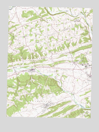
Freeburg, PA USGS Topographic Map
Click on map above to begin viewing in our Map Viewer.

This topographic map contains these locations and features:
Feature Name Type Latitude Longitude GNIS ID View Map
Aikens HallBuildingN40.7964°W76.8756°2114955View Map
Borough of FreeburgCivilN40.7625°W76.9409°1215575View Map
Brouse SchoolSchoolN40.8570°W76.9180°1196951View Map
Clifford StationLocaleN40.8037°W76.9019°1196948View Map
Degenstein Campus CenterBuildingN40.7975°W76.8753°2114960View Map
Dry RunStreamN40.7573°W76.9439°1173532View Map
Evergreen CemeteryCemeteryN40.7662°W76.9358°1174364View Map
Fairoak SchoolSchoolN40.8243°W76.9089°1196949View Map
Fairview CemeteryCemeteryN40.7656°W76.9430°1174492View Map
Flint ValleyValleyN40.7676°W76.8989°1174908View Map
FreeburgPopulated PlaceN40.7631°W76.9394°1175207View Map
Freeburg Post OfficePost OfficeN40.7626°W76.9407°2772707View Map
Freeburg Volunteer Fire CompanyBuildingN40.7624°W76.9401°2653233View Map
Freeburg Washington Elementary SchoolSchoolN40.7634°W76.9408°1207429View Map
Globe MillsPopulated PlaceN40.8062°W76.9916°1175752View Map
Globe Mills CemeteryCemeteryN40.7979°W76.9875°1175753View Map
Hermans SchoolSchoolN40.8387°W76.9111°1176872View Map
Hill End SchoolSchoolN40.8345°W76.8755°1196950View Map
Isaacs HouseBuildingN40.7956°W76.8756°2114964View Map
KantzPopulated PlaceN40.7770°W76.9008°1178225View Map
KratzervillePopulated PlaceN40.8601°W76.8958°1178668View Map
Kratzerville Census Designated PlaceCensusN40.8588°W76.8940°2390007View Map
Kratzerville Volunteer Fire Company Station 130BuildingN40.8585°W76.9011°2653234View Map
KreamerPopulated PlaceN40.8031°W76.9639°1178672View Map
Kreamer Census Designated PlaceCensusN40.8004°W76.9708°2390008View Map
Kreamer Post OfficePost OfficeN40.8029°W76.9669°2773172View Map
Kreamer Volunteer Fire Company Station 120BuildingN40.8007°W76.9781°2652922View Map
Krouses SchoolSchoolN40.8343°W76.9555°1178694View Map
Meiser StationPopulated PlaceN40.8009°W76.9889°1196947View Map
Middle Creek LakeReservoirN40.7634°W76.8872°1181028View Map
Middle Creek MountainSummitN40.7854°W76.9339°1181029View Map
Monongahela CreekStreamN40.8470°W76.8764°1181431View Map
Neitz ValleyValleyN40.7637°W76.8926°1182235View Map
Pawling StationPopulated PlaceN40.8026°W76.9272°1196946View Map
Pennsylvania State Police Troop F Selinsgrove StationBuildingN40.8088°W76.9130°2776924View Map
Phi Mu DeltaBuildingN40.7978°W76.8783°2114969View Map
Pleasant ValleyValleyN40.7730°W76.9045°1184070View Map
Saint Pauls ChurchChurchN40.8415°W76.9758°1186619View Map
SalemPopulated PlaceN40.8123°W76.9011°1186804View Map
Sassafras ComplexLocaleN40.7953°W76.8761°2114972View Map
Scholar's HouseBuildingN40.7975°W76.8769°2114973View Map
Selinsgrove State School and HospitalHospitalN40.8168°W76.8889°1187242View Map
Shobert HallBuildingN40.7953°W76.8750°2114975View Map
Snyder School (historical)SchoolN40.8526°W76.9797°1196952View Map
State Game Lands Number 212ParkN40.7554°W76.8811°1188489View Map
Susquehecka CreekStreamN40.7743°W76.9025°1189115View Map
Theta ChiBuildingN40.7975°W76.8778°2114979View Map
Township of JacksonCivilN40.8630°W76.9522°1217032View Map
Township of MiddlecreekCivilN40.8158°W76.9711°1217033View Map
Township of PennCivilN40.8105°W76.8977°1217035View Map
Township of WashingtonCivilN40.7559°W76.9561°1217039View Map
Weber Chapel AuditoriumBuildingN40.7983°W76.8753°2114981View Map
White TopSummitN40.7765°W76.9614°1193655View Map

Note: Coordinates in the location and feature list above are referenced to NAD83 datum.


Copyright (C) 2008-2024 Ryan Niemi / Sunset Dynamics ... All Rights Reserved