TopoQuest Logo
Do you find TopoQuest useful?
Help keep TopoQuest running and adding new maps/features by donating!
Bitcoin:  19c7KJd3qBynnjoSw5npx9KScwjBe4ifkT
Litecoin:  LXs6TkuXGGXo1vDsWCkWVdjQX94eUKd6ui
Home View Maps Find Maps Find Places Resources & Links


Fremont, North Carolina Topographic Map

USGS Map Title: Fremont, NC
USGS Map MRC: 35077E8
DRG (GeoTIFF) Download: o35077e8.tif


Neighboring USGS Topographic Map Quads:


  Lucama, NC  
35078F1
 

  Wilson, NC  
35077F8
 

  Saratoga, NC  
35077F7
 

  Kenly East, NC  
35078E1
 

  Fremont, NC  
35077E8
 

  Stantonsburg, NC  
35077E7
 

  Northwest Goldsboro, NC  
35078D1
 

  Northeast Goldsboro, NC  
35077D8
 

  Jason, NC  
35077D7


Map MRC Location:

N36°
W78°
N36°
W77°
H8 H7 H6 H5 H4 H3 H2 H1
G8 G7 G6 G5 G4 G3 G2 G1
F8 F7 F6 F5 F4 F3 F2 F1
E8 E7 E6 E5 E4 E3 E2 E1
D8 D7 D6 D5 D4 D3 D2 D1
C8 C7 C6 C5 C4 C3 C2 C1
B8 B7 B6 B5 B4 B3 B2 B1
A8 A7 A6 A5 A4 A3 A2 A1
N35°
W78°
N35°
W77°

Fremont, NC USGS 1:24K Topographic Map Preview:
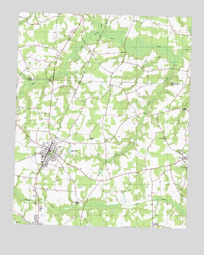
Fremont, NC USGS Topographic Map
Click on map above to begin viewing in our Map Viewer.

This topographic map contains these locations and features:
Feature Name Type Latitude Longitude GNIS ID View Map
Aycock ChurchChurchN35.5840°W77.9322°980389View Map
Aycock High SchoolSchoolN35.5099°W77.9800°980391View Map
Aycock SwampStreamN35.6015°W77.8855°980396View Map
Collingwood EstatesPopulated PlaceN35.5035°W77.9917°1005312View Map
Edmundson CrossroadsPopulated PlaceN35.5027°W77.8986°984644View Map
Elmwood CemeteryCemeteryN35.5465°W77.9694°984753View Map
EurekaPopulated PlaceN35.5427°W77.8764°1020175View Map
Eureka Police DepartmentBuildingN35.5417°W77.8766°2131045View Map
Eureka Post OfficePost OfficeN35.5446°W77.9753°2505362View Map
Eureka Volunteer Fire DepartmentBuildingN35.5417°W77.8783°2639485View Map
Frank Price ChurchChurchN35.6218°W77.9167°985365View Map
FremontPopulated PlaceN35.5454°W77.9747°985403View Map
Fremont Elementary SchoolSchoolN35.5449°W77.9775°1006963View Map
Fremont Emergency ServicesBuildingN35.5480°W77.9721°2720384View Map
Fremont Police DepartmentBuildingN35.5437°W77.9743°2130896View Map
Fremont Post OfficePost OfficeN35.5441°W77.9744°2505366View Map
Fremont Volunteer Fire DepartmentBuildingN35.5477°W77.9723°2638776View Map
Great SwampStreamN35.6132°W77.9378°1024002View Map
Hooks Grove ChurchChurchN35.5015°W77.9969°987029View Map
Mill RunStreamN35.6052°W77.8919°989983View Map
Mount Nelson ChurchChurchN35.5454°W77.8791°990453View Map
New Bethel ChurchChurchN35.5421°W77.9847°990931View Map
New Daniels ChapelChurchN35.5521°W77.9458°990957View Map
Norwayne SchoolSchoolN35.5138°W77.9542°991316View Map
Pikeville Elementary SchoolSchoolN35.5013°W77.9847°1006964View Map
Pikeville Police DepartmentBuildingN35.5014°W77.9846°2130997View Map
Town of EurekaCivilN35.5415°W77.8763°2406469View Map
Town of FremontCivilN35.5436°W77.9755°2406524View Map
Township of NahuntaCivilN35.5414°W77.8927°1027316View Map
Turner Swamp ChurchChurchN35.5527°W77.8916°996365View Map
West LakeReservoirN35.5329°W77.9377°999071View Map
West Lake DamDamN35.5352°W77.9364°999070View Map

Note: Coordinates in the location and feature list above are referenced to NAD83 datum.


Copyright (C) 2008-2024 Ryan Niemi / Sunset Dynamics ... All Rights Reserved