TopoQuest Logo
Do you find TopoQuest useful?
Help keep TopoQuest running and adding new maps/features by donating!
Bitcoin:  19c7KJd3qBynnjoSw5npx9KScwjBe4ifkT
Litecoin:  LXs6TkuXGGXo1vDsWCkWVdjQX94eUKd6ui
Home View Maps Find Maps Find Places Resources & Links


Stantonsburg, North Carolina Topographic Map

USGS Map Title: Stantonsburg, NC
USGS Map MRC: 35077E7
DRG (GeoTIFF) Download: o35077e7.tif


Neighboring USGS Topographic Map Quads:


  Wilson, NC  
35077F8
 

  Saratoga, NC  
35077F7
 

  Fountain, NC  
35077F6
 

  Fremont, NC  
35077E8
 

  Stantonsburg, NC  
35077E7
 

  Walstonburg, NC  
35077E6
 

  Northeast Goldsboro, NC  
35077D8
 

  Jason, NC  
35077D7
 

  Snow Hill, NC  
35077D6


Map MRC Location:

N36°
W78°
N36°
W77°
H8 H7 H6 H5 H4 H3 H2 H1
G8 G7 G6 G5 G4 G3 G2 G1
F8 F7 F6 F5 F4 F3 F2 F1
E8 E7 E6 E5 E4 E3 E2 E1
D8 D7 D6 D5 D4 D3 D2 D1
C8 C7 C6 C5 C4 C3 C2 C1
B8 B7 B6 B5 B4 B3 B2 B1
A8 A7 A6 A5 A4 A3 A2 A1
N35°
W78°
N35°
W77°

Stantonsburg, NC USGS 1:24K Topographic Map Preview:
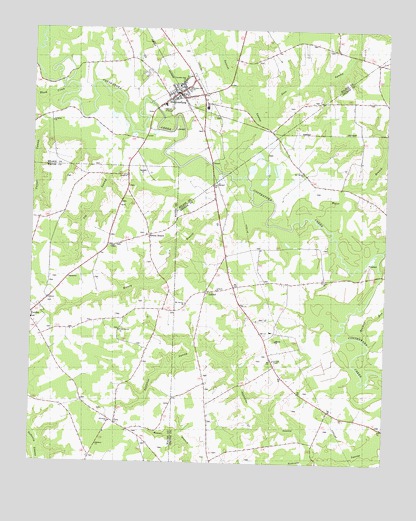
Stantonsburg, NC USGS Topographic Map
Click on map above to begin viewing in our Map Viewer.

This topographic map contains these locations and features:
Feature Name Type Latitude Longitude GNIS ID View Map
Appletree SwampStreamN35.5032°W77.7722°980263View Map
Beaman RunStreamN35.5360°W77.7572°1023805View Map
Black CreekStreamN35.6065°W77.8625°1023835View Map
Bull Head Rural Fire AssociationBuildingN35.5296°W77.7897°2639398View Map
Diggs ChapelChurchN35.5632°W77.8464°984180View Map
Eureka Elementary SchoolSchoolN35.5413°W77.8744°1006961View Map
Faith ChurchChurchN35.5532°W77.7716°984951View Map
FaroPopulated PlaceN35.5115°W77.8439°985011View Map
Faro Volunteer Fire DistrictBuildingN35.5125°W77.8462°2639310View Map
Goss SwampStreamN35.6024°W77.7969°985868View Map
Greater Zion ChurchChurchN35.6082°W77.8200°986040View Map
Ivy SwampStreamN35.5960°W77.8403°987459View Map
Lebanon ChurchChurchN35.5507°W77.8086°988264View Map
Levelton ChapelChurchN35.5304°W77.7883°988371View Map
LindellPopulated PlaceN35.5493°W77.8125°988503View Map
Miracle ChurchChurchN35.5354°W77.7883°990067View Map
Mount Calvary ChurchChurchN35.5463°W77.8197°990332View Map
Mount Calvary ChurchChurchN35.5840°W77.7789°990333View Map
Saint James ChurchChurchN35.5985°W77.8680°993910View Map
Saint Lukes ChurchChurchN35.6115°W77.8208°993995View Map
Salisbury ChurchChurchN35.5054°W77.8505°994187View Map
StantonsburgPopulated PlaceN35.6068°W77.8233°1022777View Map
Stantonsburg Elementary SchoolSchoolN35.6018°W77.8292°1007005View Map
Stantonsburg Emergency Medical ServicesBuildingN35.6064°W77.8238°2720680View Map
Stantonsburg Moyton Volunteer Fire DepartmentBuildingN35.6058°W77.8203°2638523View Map
Stantonsburg Police DepartmentBuildingN35.6063°W77.8229°2130855View Map
Stantonsburg Post OfficePost OfficeN35.6065°W77.8245°2774068View Map
Toisnot SwampStreamN35.5840°W77.7994°996129View Map
Town of StantonsburgCivilN35.6055°W77.8199°2406658View Map
Township of Bull HeadCivilN35.5199°W77.7850°1026721View Map
Travelers Rest ChurchChurchN35.6107°W77.8216°996211View Map
Turner SwampStreamN35.6035°W77.8625°996364View Map
Union Grove ChurchChurchN35.5385°W77.8428°996483View Map
Water BranchStreamN35.5713°W77.7753°1024393View Map
Watery BranchStreamN35.5763°W77.7980°1024394View Map
Watery BranchPopulated PlaceN35.5660°W77.8336°996855View Map
Yelverton ChurchChurchN35.5118°W77.8466°997719View Map

Note: Coordinates in the location and feature list above are referenced to NAD83 datum.


Copyright (C) 2008-2024 Ryan Niemi / Sunset Dynamics ... All Rights Reserved