TopoQuest Logo
Do you find TopoQuest useful?
Help keep TopoQuest running and adding new maps/features by donating!
Bitcoin:  19c7KJd3qBynnjoSw5npx9KScwjBe4ifkT
Litecoin:  LXs6TkuXGGXo1vDsWCkWVdjQX94eUKd6ui
Home View Maps Find Maps Find Places Resources & Links


Gallagher Gulch, Montana Topographic Map

USGS Map Title: Gallagher Gulch, MT
USGS Map MRC: 44112E6
DRG (GeoTIFF) Download: o44112e6.tif


Neighboring USGS Topographic Map Quads:


  Dixon Mountain, MT  
44112F7
 

  Dell, MT  
44112F6
 

  Lima, MT  
44112F5
 

  Caboose Canyon, MT  
44112E7
 

  Gallagher Gulch, MT  
44112E6
 

  Lima Peaks, MT  
44112E5
 

  Deadman Lake, MT  
44112D7
 

  Fritz Peak, ID  
44112D6
 

  Edie Creek, ID  
44112D5


Map MRC Location:

N45°
W113°
N45°
W112°
H8 H7 H6 H5 H4 H3 H2 H1
G8 G7 G6 G5 G4 G3 G2 G1
F8 F7 F6 F5 F4 F3 F2 F1
E8 E7 E6 E5 E4 E3 E2 E1
D8 D7 D6 D5 D4 D3 D2 D1
C8 C7 C6 C5 C4 C3 C2 C1
B8 B7 B6 B5 B4 B3 B2 B1
A8 A7 A6 A5 A4 A3 A2 A1
N44°
W113°
N44°
W112°

Gallagher Gulch, MT USGS 1:24K Topographic Map Preview:
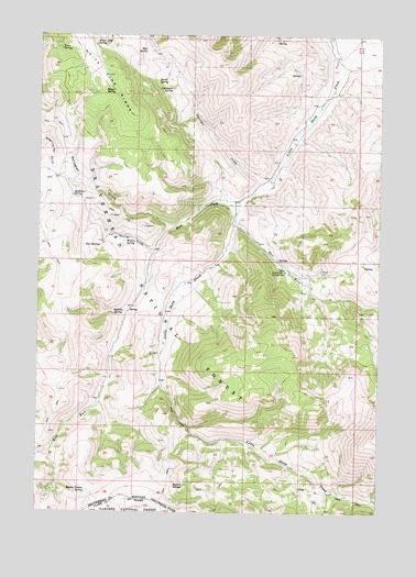
Gallagher Gulch, MT USGS Topographic Map
Click on map above to begin viewing in our Map Viewer.

This topographic map contains these locations and features:
Feature Name Type Latitude Longitude GNIS ID View Map
14S09W13ADC_01 WellWellN44.6180°W112.6370°807131View Map
Beartrap CreekStreamN44.5138°W112.6647°794577View Map
Buffalo CreekStreamN44.5196°W112.6908°794585View Map
Buffalo SpringSpringN44.5069°W112.7002°780554View Map
East Creek CampgroundLocaleN44.5635°W112.6606°782792View Map
East Fork Little Sheep CreekStreamN44.5769°W112.6792°782870View Map
Gallagher GulchValleyN44.5749°W112.7031°783806View Map
Gallagher SpringSpringN44.5827°W112.7387°783807View Map
Giblo SpringSpringN44.6213°W112.7431°783921View Map
Larkspur SpringSpringN44.6106°W112.7026°785967View Map
Magee SpringSpringN44.6104°W112.7235°786771View Map
Mud SpringSpringN44.6208°W112.7120°787808View Map
Peterson MineMineN44.5652°W112.6461°802445View Map
Round Timber SpringSpringN44.5056°W112.7327°793886View Map
Seybold SpringSpringN44.5524°W112.7195°790255View Map
Shovel SpringSpringN44.6127°W112.7043°790461View Map
Straight CreekStreamN44.5874°W112.6650°791580View Map
Two SpringsSpringN44.5699°W112.7278°792561View Map
Two Springs GulchValleyN44.5688°W112.7092°792562View Map
West Fork Little Sheep CreekStreamN44.5805°W112.6781°793039View Map
West Fork Little Sheep Creek MineMineN44.5769°W112.7031°802456View Map
White Pine RidgeRidgeN44.6221°W112.7345°793205View Map
White Pine SpringSpringN44.6227°W112.7303°793207View Map
Willow SpringSpringN44.5707°W112.7186°793376View Map

Note: Coordinates in the location and feature list above are referenced to NAD83 datum.


Copyright (C) 2008-2024 Ryan Niemi / Sunset Dynamics ... All Rights Reserved