TopoQuest Logo
Do you find TopoQuest useful?
Help keep TopoQuest running and adding new maps/features by donating!
Bitcoin:  19c7KJd3qBynnjoSw5npx9KScwjBe4ifkT
Litecoin:  LXs6TkuXGGXo1vDsWCkWVdjQX94eUKd6ui
Home View Maps Find Maps Find Places Resources & Links


Ashland West, Nebraska Topographic Map

USGS Map Title: Ashland West, NE
USGS Map MRC: 41096A4
DRG (GeoTIFF) Download: o41096a4.tif


Neighboring USGS Topographic Map Quads:


  Wahoo East, NE  
41096B5
 

  Mead, NE  
41096B4
 

  Wann, NE  
41096B3
 

  Wahoo SE, NE  
41096A5
 

  Ashland West, NE  
41096A4
 

  Ashland East, NE  
41096A3
 

  Waverly, NE  
40096H5
 

  Greenwood, NE  
40096H4
 

  Murdock, NE  
40096H3


Map MRC Location:

N42°
W97°
N42°
W96°
H8 H7 H6 H5 H4 H3 H2 H1
G8 G7 G6 G5 G4 G3 G2 G1
F8 F7 F6 F5 F4 F3 F2 F1
E8 E7 E6 E5 E4 E3 E2 E1
D8 D7 D6 D5 D4 D3 D2 D1
C8 C7 C6 C5 C4 C3 C2 C1
B8 B7 B6 B5 B4 B3 B2 B1
A8 A7 A6 A5 A4 A3 A2 A1
N41°
W97°
N41°
W96°

Ashland West, NE USGS 1:24K Topographic Map Preview:
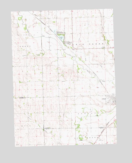
Ashland West, NE USGS Topographic Map
Click on map above to begin viewing in our Map Viewer.

This topographic map contains these locations and features:
Feature Name Type Latitude Longitude GNIS ID View Map
American Lutheran ChurchChurchN41.0389°W96.3756°1897519View Map
Ashland Country ClubLocaleN41.0036°W96.3972°836020View Map
Ashland Emergency ServicesBuildingN41.0395°W96.3811°2553687View Map
Ashland Police DepartmentBuildingN41.0396°W96.3795°1897505View Map
Ashland Volunteer Fire DepartmentBuildingN41.0395°W96.3811°2553419View Map
Callahan CreekStreamN41.0061°W96.4253°827854View Map
Carr CemeteryCemeteryN41.0782°W96.3768°827940View Map
Clear Creek Public SchoolSchoolN41.0594°W96.4403°836534View Map
Luetkenhaus Airport (historical)AirportN41.1043°W96.4102°837635View Map
MemphisPopulated PlaceN41.0950°W96.4314°831213View Map
Memphis (historical)LocaleN41.0944°W96.4364°1897485View Map
Memphis DamDamN41.0967°W96.4386°1767252View Map
Memphis LakeReservoirN41.1007°W96.4428°831214View Map
Memphis Lake State Recreation AreaParkN41.1031°W96.4403°831215View Map
Memphis Post OfficePost OfficeN41.0950°W96.4314°1897486View Map
Mosquito CreekStreamN41.1011°W96.4636°831440View Map
School Number 5SchoolN41.0889°W96.3867°836806View Map
Silver CreekStreamN41.0856°W96.4183°833429View Map
Starns Brothers AirportAirportN41.0827°W96.4035°837477View Map
Township of AshlandCivilN41.0339°W96.3962°837862View Map
Township of Clear CreekCivilN41.0915°W96.3978°837924View Map
Village of MemphisCivilN41.0946°W96.4331°2399311View Map
Wiggenhorn Memorial ParkParkN41.0431°W96.3831°1897522View Map

Note: Coordinates in the location and feature list above are referenced to NAD83 datum.


Copyright (C) 2008-2024 Ryan Niemi / Sunset Dynamics ... All Rights Reserved