TopoQuest Logo
Do you find TopoQuest useful?
Help keep TopoQuest running and adding new maps/features by donating!
Bitcoin:  19c7KJd3qBynnjoSw5npx9KScwjBe4ifkT
Litecoin:  LXs6TkuXGGXo1vDsWCkWVdjQX94eUKd6ui
Home View Maps Find Maps Find Places Resources & Links


Waverly, Nebraska Topographic Map

USGS Map Title: Waverly, NE
USGS Map MRC: 40096H5
DRG (GeoTIFF) Download: o40096h5.tif


Neighboring USGS Topographic Map Quads:


  Ceresco, NE  
41096A6
 

  Wahoo SE, NE  
41096A5
 

  Ashland West, NE  
41096A4
 

  Davey, NE  
40096H6
 

  Waverly, NE  
40096H5
 

  Greenwood, NE  
40096H4
 

  Lincoln, NE  
40096G6
 

  Walton, NE  
40096G5
 

  Eagle, NE  
40096G4


Map MRC Location:

N41°
W97°
N41°
W96°
H8 H7 H6 H5 H4 H3 H2 H1
G8 G7 G6 G5 G4 G3 G2 G1
F8 F7 F6 F5 F4 F3 F2 F1
E8 E7 E6 E5 E4 E3 E2 E1
D8 D7 D6 D5 D4 D3 D2 D1
C8 C7 C6 C5 C4 C3 C2 C1
B8 B7 B6 B5 B4 B3 B2 B1
A8 A7 A6 A5 A4 A3 A2 A1
N40°
W97°
N40°
W96°

Waverly, NE USGS 1:24K Topographic Map Preview:
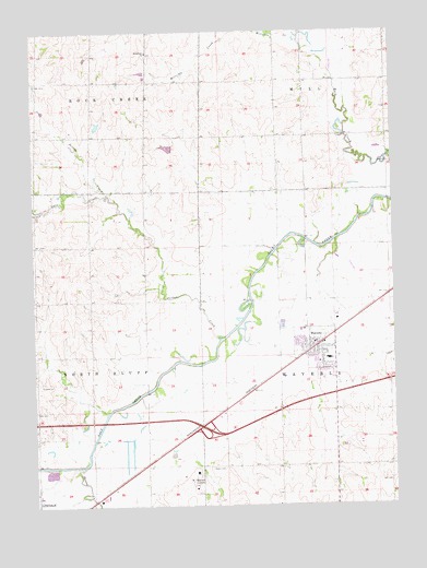
Waverly, NE USGS Topographic Map
Click on map above to begin viewing in our Map Viewer.

This topographic map contains these locations and features:
Feature Name Type Latitude Longitude GNIS ID View Map
Bethlehem ChurchChurchN40.9947°W96.5850°827392View Map
Bevans Turkey FarmLocaleN40.8906°W96.5156°2585737View Map
Branchaud Chiropractic CenterBuildingN40.9139°W96.5317°1899061View Map
City of WaverlyCivilN40.9110°W96.5341°2397229View Map
Cornhusker Raceway ParkParkN40.9175°W96.5283°1899058View Map
Evelyn Hamlow Elementary SchoolSchoolN40.9079°W96.5236°1899070View Map
Farmers Cooperative Company ElevatorLocaleN40.9175°W96.5283°1899057View Map
First United Methodist ChurchChurchN40.9128°W96.5261°1899067View Map
Garr CreekStreamN40.9553°W96.5967°829467View Map
Hall-Feld AirportAirportN40.9914°W96.6216°837540View Map
Interchange 409CrossingN40.8944°W96.5647°1899204View Map
Jaycee ParkParkN40.9206°W96.5281°1899072View Map
Jordan CreekStreamN40.9189°W96.5608°830417View Map
Marian CenterPopulated PlaceN40.8825°W96.5692°835372View Map
Millville CreekStreamN40.9989°W96.5342°831333View Map
North Bluff Election PrecinctCivilN40.9185°W96.6224°1929098View Map
Peace Lutheran ChurchChurchN40.9083°W96.5253°1899066View Map
Pierce CemeteryCemeteryN40.8847°W96.5600°832094View Map
Rose Hill CemeteryCemeteryN40.9150°W96.5224°1785548View Map
Snyder DamDamN40.9750°W96.6036°1767728View Map
Snyder ReservoirReservoirN40.9751°W96.6025°1767729View Map
Sponheinmer DamDamN40.9700°W96.5770°1767818View Map
Sponheinmer ReservoirReservoirN40.9693°W96.5778°1767819View Map
Stevens CreekStreamN40.8850°W96.6083°833817View Map
Township of MillCivilN40.9833°W96.5170°1899257View Map
Township of North BluffCivilN40.9125°W96.6225°1899258View Map
Township of Rock CreekCivilN40.9972°W96.6197°1899279View Map
Township of WaverlyCivilN40.9139°W96.5031°1899256View Map
Villa Marie SchoolSchoolN40.8825°W96.5692°1899068View Map
WaverlyPopulated PlaceN40.9175°W96.5283°834510View Map
WaverlyLocaleN40.9172°W96.5272°1899065View Map
Waverly Dental Associates CenterBuildingN40.9139°W96.5317°1899063View Map
Waverly Election PrecinctCivilN40.9143°W96.5156°1929367View Map
Waverly Family Practice CenterBuildingN40.9139°W96.5317°1899062View Map
Waverly Fire and Rescue DepartmentBuildingN40.9154°W96.5292°1899059View Map
Waverly High SchoolSchoolN40.9053°W96.5376°1899069View Map
Waverly Post OfficePost OfficeN40.9183°W96.5281°1899060View Map
Wayne ParkParkN40.9125°W96.5295°1899071View Map

Note: Coordinates in the location and feature list above are referenced to NAD83 datum.


Copyright (C) 2008-2024 Ryan Niemi / Sunset Dynamics ... All Rights Reserved