TopoQuest Logo
Do you find TopoQuest useful?
Help keep TopoQuest running and adding new maps/features by donating!
Bitcoin:  19c7KJd3qBynnjoSw5npx9KScwjBe4ifkT
Litecoin:  LXs6TkuXGGXo1vDsWCkWVdjQX94eUKd6ui
Home View Maps Find Maps Find Places Resources & Links


Geneva, Nebraska Topographic Map

USGS Map Title: Geneva, NE
USGS Map MRC: 40097E5
DRG (GeoTIFF) Download: o40097e5.tif


Neighboring USGS Topographic Map Quads:


  Grafton, NE  
40097F6
 

  Fairmont, NE  
40097F5
 

  Exeter, NE  
40097F4
 

  Geneva SW, NE  
40097E6
 

  Geneva, NE  
40097E5
 

  Friend SW, NE  
40097E4
 

  Shickley, NE  
40097D6
 

  Strang, NE  
40097D5
 

  Ohiowa, NE  
40097D4


Map MRC Location:

N41°
W98°
N41°
W97°
H8 H7 H6 H5 H4 H3 H2 H1
G8 G7 G6 G5 G4 G3 G2 G1
F8 F7 F6 F5 F4 F3 F2 F1
E8 E7 E6 E5 E4 E3 E2 E1
D8 D7 D6 D5 D4 D3 D2 D1
C8 C7 C6 C5 C4 C3 C2 C1
B8 B7 B6 B5 B4 B3 B2 B1
A8 A7 A6 A5 A4 A3 A2 A1
N40°
W98°
N40°
W97°

Geneva, NE USGS 1:24K Topographic Map Preview:
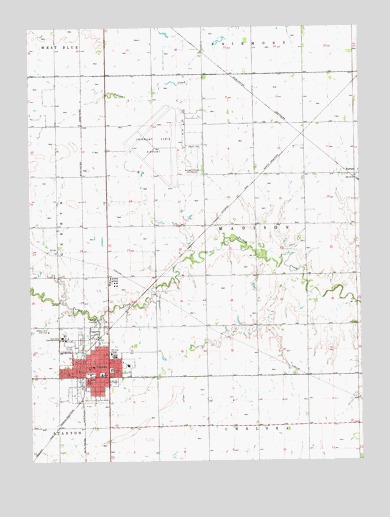
Geneva, NE USGS Topographic Map
Click on map above to begin viewing in our Map Viewer.

This topographic map contains these locations and features:
Feature Name Type Latitude Longitude GNIS ID View Map
Assembly of God ChurchChurchN40.5300°W97.5923°1882200View Map
Aurora Cooperative Elevator Company - Geneva Branch ElevatorLocaleN40.5256°W97.6064°1882189View Map
Blue Valley Mental Health CenterHospitalN40.5242°W97.6034°1882206View Map
BurressPopulated PlaceN40.5814°W97.5017°835264View Map
BurressLocaleN40.5814°W97.5017°1882252View Map
Burress Post Office (historical)Post OfficeN40.5814°W97.5017°1882251View Map
City of GenevaCivilN40.5295°W97.5991°2394878View Map
Doc's Airport (historical)AirportN40.5139°W97.6106°837563View Map
Evangelical Free ChurchChurchN40.5267°W97.5892°1882202View Map
Eye Surgical AssociatesHospitalN40.5264°W97.5948°1882205View Map
Fairmont Army Air Field (historical)MilitaryN40.5903°W97.5725°2091969View Map
Fairmont Army Air Field Historical MarkerParkN40.6028°W97.5953°1882304View Map
Fairmont State AirfieldAirportN40.5951°W97.5686°837553View Map
Family Medical CenterHospitalN40.5245°W97.5939°1882209View Map
Fillmore CountyCivilN40.5247°W97.5965°835851View Map
Fillmore County 1871-1971 Historical MarkerParkN40.5256°W97.6028°1882307View Map
Fillmore County CourthouseBuildingN40.5253°W97.6028°1882292View Map
Fillmore County FairgroundsLocaleN40.5333°W97.6114°1882293View Map
Fillmore County HospitalHospitalN40.5254°W97.5863°1882204View Map
Fillmore County Sheriffs DeptBuildingN40.5256°W97.6025°1882188View Map
GenevaPopulated PlaceN40.5270°W97.5959°829483View Map
GenevaLocaleN40.5261°W97.6064°1882290View Map
Geneva CemeteryCemeteryN40.5347°W97.6064°1882289View Map
Geneva City ParkParkN40.5231°W97.5934°1882291View Map
Geneva Elementary SchoolSchoolN40.5275°W97.5887°1882211View Map
Geneva High SchoolSchoolN40.5331°W97.5939°1882210View Map
Geneva Milling Company - North ElevatorLocaleN40.5247°W97.6075°1882190View Map
Geneva Milling Company ElevatorLocaleN40.5217°W97.6056°1882191View Map
Geneva Police DepartmentBuildingN40.5233°W97.6003°1882192View Map
Geneva Post OfficePost OfficeN40.5273°W97.6031°1882193View Map
Geneva Public LibraryBuildingN40.5256°W97.5995°1882187View Map
Geneva Rescue SquadBuildingN40.5267°W97.6037°2553760View Map
Geneva Volunteer Fire DepartmentBuildingN40.5267°W97.6037°1882186View Map
Grace Lutheran ChurchChurchN40.5286°W97.5903°1882201View Map
Grace Lutheran Elementary SchoolSchoolN40.5250°W97.6109°829607View Map
Heritage of GenevaHospitalN40.5311°W97.5948°1882203View Map
Hidden Hills Country ClubLocaleN40.5375°W97.6184°836049View Map
Kingdom Hall of Jehovahs WitnessesChurchN40.5286°W97.6073°1882198View Map
Light of Christ MonasteryChurchN40.5270°W97.5959°1882194View Map
Mid-America Vision CenterHospitalN40.5258°W97.6009°1882207View Map
Ourada ChiropracticHospitalN40.5258°W97.6025°1882208View Map
Prince of Peace Lutheran ChurchChurchN40.5192°W97.5998°1882199View Map
Saint Joseph Catholic ChurchChurchN40.5228°W97.6028°1882195View Map
Saint Joseph SchoolSchoolN40.5228°W97.6039°832946View Map
Sawyer (historical)Populated PlaceN40.5945°W97.5225°1882232View Map
Sawyer (historical)LocaleN40.5945°W97.5225°1882233View Map
Sawyer Post Office (historical)Post OfficeN40.5945°W97.5225°1882231View Map
State Girls Training SchoolSchoolN40.5358°W97.6134°833797View Map
Township of MadisonCivilN40.5678°W97.5394°838124View Map
United Church of Christ CongregationalChurchN40.5272°W97.6025°1882196View Map
United Methodist ChurchChurchN40.5272°W97.6012°1882197View Map

Note: Coordinates in the location and feature list above are referenced to NAD83 datum.


Copyright (C) 2008-2024 Ryan Niemi / Sunset Dynamics ... All Rights Reserved