TopoQuest Logo
Do you find TopoQuest useful?
Help keep TopoQuest running and adding new maps/features by donating!
Bitcoin:  19c7KJd3qBynnjoSw5npx9KScwjBe4ifkT
Litecoin:  LXs6TkuXGGXo1vDsWCkWVdjQX94eUKd6ui
Home View Maps Find Maps Find Places Resources & Links


Genoa City, Wisconsin Topographic Map

USGS Map Title: Genoa City, WI
USGS Map MRC: 42088E3
DRG (GeoTIFF) Download: o42088e3.tif


Neighboring USGS Topographic Map Quads:


  Springfield, WI  
42088F4
 

  Burlington, WI  
42088F3
 

  Rochester, WI  
42088F2
 

  Lake Geneva, WI  
42088E4
 

  Genoa City, WI  
42088E3
 

  Silver Lake, WI  
42088E2
 

  Hebron, IL  
42088D4
 

  Richmond, IL  
42088D3
 

  Fox Lake, IL  
42088D2


Map MRC Location:

N43°
W89°
N43°
W88°
H8 H7 H6 H5 H4 H3 H2 H1
G8 G7 G6 G5 G4 G3 G2 G1
F8 F7 F6 F5 F4 F3 F2 F1
E8 E7 E6 E5 E4 E3 E2 E1
D8 D7 D6 D5 D4 D3 D2 D1
C8 C7 C6 C5 C4 C3 C2 C1
B8 B7 B6 B5 B4 B3 B2 B1
A8 A7 A6 A5 A4 A3 A2 A1
N42°
W89°
N42°
W88°

Genoa City, WI USGS 1:24K Topographic Map Preview:
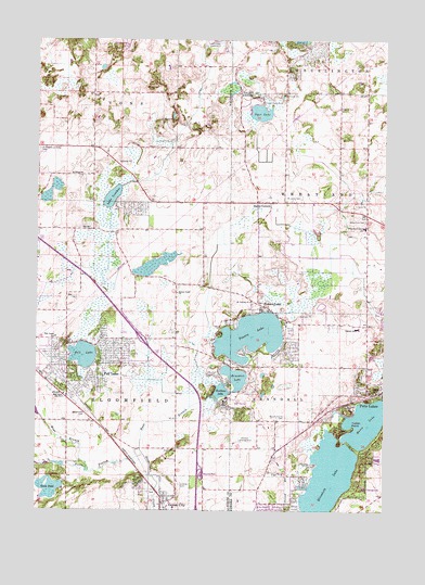
Genoa City, WI USGS Topographic Map
Click on map above to begin viewing in our Map Viewer.

This topographic map contains these locations and features:
Feature Name Type Latitude Longitude GNIS ID View Map
Baptist CemeteryCemeteryN42.5791°W88.2620°1998789View Map
Benedict LakeLakeN42.5354°W88.3036°1561557View Map
Berean Grace ChurchChurchN42.5578°W88.3251°1561581View Map
Bloomfield - Genoa City Fire and RescueBuildingN42.5312°W88.3642°2697977View Map
Bloomfield CemeteryCemeteryN42.5260°W88.3571°1561931View Map
Bloomfield Police DepartmentBuildingN42.5311°W88.3650°2759450View Map
Bohners LakePopulated PlaceN42.6231°W88.2804°1867652View Map
Bohners Lake Census Designated PlaceCensusN42.6242°W88.2879°2393342View Map
Brookwood Middle SchoolSchoolN42.5100°W88.3185°2716374View Map
Camp Oh-da-ko-taLocaleN42.6092°W88.2951°1562645View Map
Cottage School (historical)SchoolN42.5320°W88.2520°1850066View Map
Dyer LakeReservoirN42.6057°W88.2953°1564227View Map
East Branch North Branch Nippersink CreekStreamN42.5147°W88.3359°1564295View Map
Elizabeth LakeLakeN42.5078°W88.2693°1564512View Map
Elizabeth LakeLakeN42.5066°W88.2710°407871View Map
Evergreen FarmLocaleN42.5309°W88.2820°1850069View Map
Goose PondLakeN42.5058°W88.3701°1565666View Map
High Street CemeteryCemeteryN42.6069°W88.2669°1566386View Map
Hillside CemeteryCemeteryN42.5064°W88.3237°1566453View Map
Indian PointCapeN42.5222°W88.2609°1566925View Map
Karcher Springs State Natural AreaParkN42.6122°W88.2518°2059256View Map
Lake Geneva Aire Estates AirportAirportN42.5722°W88.3673°1582047View Map
Lake IvanhoeLakeN42.5831°W88.3483°1567047View Map
Lake Ivanhoe Census Designated PlaceCensusN42.5800°W88.3415°2586517View Map
Lake MaryLakeN42.5237°W88.2562°1569034View Map
Lake View FarmLocaleN42.5225°W88.2787°1850115View Map
Lake View Hill FarmLocaleN42.5003°W88.2573°1850116View Map
Locust Grove Farm (historical)LocaleN42.5375°W88.2987°1850122View Map
Mound Prairie CemeteryCemeteryN42.5246°W88.2853°1569792View Map
Mount MoriahSummitN42.5203°W88.2662°1850128View Map
North BloomfieldPopulated PlaceN42.5745°W88.3551°1851307View Map
Pell LakeLakeN42.5411°W88.3581°1571157View Map
Pell LakePopulated PlaceN42.5381°W88.3509°1571158View Map
Pell Lake Census Designated Place (historical)CensusN42.5420°W88.3589°2393182View Map
Pell Lake Post OfficePost OfficeN42.5365°W88.3666°2768071View Map
Powers LakeLakeN42.5464°W88.2981°1571857View Map
Powers LakePopulated PlaceN42.5536°W88.2945°1571858View Map
Powers Lake Census Designated PlaceCensusN42.5395°W88.2935°2393197View Map
Prairie FarmLocaleN42.5411°W88.2659°1850142View Map
Randall Consolidated SchoolSchoolN42.5484°W88.2603°1572061View Map
Randall Fire Department Station 1BuildingN42.5388°W88.2815°2698189View Map
Saint Johns Lutheran CemeteryCemeteryN42.5825°W88.2837°1573027View Map
Saint Johns Lutheran ChurchChurchN42.5822°W88.2909°1850162View Map
Saint Kilian Catholic CemeteryCemeteryN42.5886°W88.3600°2002809View Map
Saint Kilian ChurchChurchN42.5886°W88.3601°1573202View Map
Saint Theresa ChurchChurchN42.5553°W88.2984°1573584View Map
Silver Springs FarmLocaleN42.5142°W88.2876°1850183View Map
Slades CornersPopulated PlaceN42.5820°W88.2940°1574263View Map
Star Center Elementary SchoolSchoolN42.5459°W88.3678°1574801View Map
Star Center School Number 4SchoolN42.5309°W88.3648°1574802View Map
Tombeau LakeLakeN42.5317°W88.3087°1575502View Map
Twin Lakes Police DepartmentBuildingN42.5280°W88.2686°2759515View Map
Twin Lakes Post OfficePost OfficeN42.5300°W88.2597°2712488View Map
Twin Lakes Volunteer Fire Department and Rescue SquadBuildingN42.5317°W88.2522°2697572View Map
Val Sauer H 820 DamDamN42.5800°W88.3551°1793011View Map
Village of BloomfieldCivilN42.5488°W88.3522°2711667View Map
Village of Genoa CityCivilN42.5066°W88.3192°1583264View Map
Vincent AirportAirportN42.5187°W88.3016°1581989View Map
West Branch North Branch Nippersink CreekStreamN42.5109°W88.3562°1576474View Map
Wheatland CemeteryCemeteryN42.5770°W88.2571°1576600View Map
Wheatland Center SchoolSchoolN42.5753°W88.2574°1576601View Map

Note: Coordinates in the location and feature list above are referenced to NAD83 datum.


Copyright (C) 2008-2024 Ryan Niemi / Sunset Dynamics ... All Rights Reserved