TopoQuest Logo
Do you find TopoQuest useful?
Help keep TopoQuest running and adding new maps/features by donating!
Bitcoin:  19c7KJd3qBynnjoSw5npx9KScwjBe4ifkT
Litecoin:  LXs6TkuXGGXo1vDsWCkWVdjQX94eUKd6ui
Home View Maps Find Maps Find Places Resources & Links


Herman, Nebraska Topographic Map

USGS Map Title: Herman, NE
USGS Map MRC: 41096F2
DRG (GeoTIFF) Download: o41096f2.tif


Neighboring USGS Topographic Map Quads:


  Craig, NE  
41096G3
 

  Tekamah, NE  
41096G2
 

  Little Sioux, IA  
41096G1
 

  Nickerson NE, NE  
41096F3
 

  Herman, NE  
41096F2
 

  Mondamin, IA  
41096F1
 

  Orum, NE  
41096E3
 

  Blair, NE  
41096E2
 

  Modale, IA  
41096E1


Map MRC Location:

N42°
W97°
N42°
W96°
H8 H7 H6 H5 H4 H3 H2 H1
G8 G7 G6 G5 G4 G3 G2 G1
F8 F7 F6 F5 F4 F3 F2 F1
E8 E7 E6 E5 E4 E3 E2 E1
D8 D7 D6 D5 D4 D3 D2 D1
C8 C7 C6 C5 C4 C3 C2 C1
B8 B7 B6 B5 B4 B3 B2 B1
A8 A7 A6 A5 A4 A3 A2 A1
N41°
W97°
N41°
W96°

Herman, NE USGS 1:24K Topographic Map Preview:
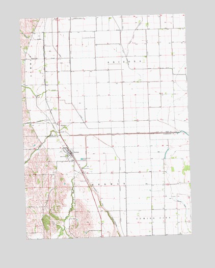
Herman, NE USGS Topographic Map
Click on map above to begin viewing in our Map Viewer.

This topographic map contains these locations and features:
Feature Name Type Latitude Longitude GNIS ID View Map
Baptist ChurchChurchN41.6750°W96.2167°1897752View Map
Burns LakeLakeN41.6438°W96.1344°827792View Map
Cameron DitchCanalN41.6492°W96.1795°827878View Map
Carr CreekStreamN41.7014°W96.2131°827941View Map
County Line DitchCanalN41.6833°W96.1558°828408View Map
Crannell CreekStreamN41.7267°W96.2192°828444View Map
Davis CreekStreamN41.6855°W96.2245°828592View Map
Harney Slough DitchCanalN41.7394°W96.1647°829817View Map
HermanPopulated PlaceN41.6733°W96.2150°829934View Map
Herman (historical)LocaleN41.6733°W96.2142°1897745View Map
Herman CemeteryCemeteryN41.6575°W96.2036°829935View Map
Herman ParkParkN41.6719°W96.2181°1897746View Map
Herman Post OfficePost OfficeN41.6732°W96.2156°1897747View Map
Herman Rescue SquadBuildingN41.6739°W96.2150°2553689View Map
Herman Volunteer Fire and RescueBuildingN41.6736°W96.2157°1897750View Map
Hill CreekStreamN41.6830°W96.2017°830000View Map
Holmquist Grain and Lumber Company ElevatorLocaleN41.6733°W96.2150°1897748View Map
New York CreekStreamN41.6830°W96.2017°831612View Map
Ranch SpurLocaleN41.6883°W96.2206°832444View Map
Tekamah-Herman Grade SchoolSchoolN41.6692°W96.2134°1897751View Map
Thone CemeteryCemeteryN41.6286°W96.2470°834099View Map
Township of Cuming CityCivilN41.6255°W96.1258°1897627View Map
Tysons Incorporated ElevatorLocaleN41.6733°W96.2150°1897749View Map
United Methodist ChurchChurchN41.6758°W96.2170°1897753View Map
Village of HermanCivilN41.6738°W96.2167°2398492View Map
Whittier CreekStreamN41.7267°W96.2136°834696View Map

Note: Coordinates in the location and feature list above are referenced to NAD83 datum.


Copyright (C) 2008-2024 Ryan Niemi / Sunset Dynamics ... All Rights Reserved