TopoQuest Logo
Do you find TopoQuest useful?
Help keep TopoQuest running and adding new maps/features by donating!
Bitcoin:  19c7KJd3qBynnjoSw5npx9KScwjBe4ifkT
Litecoin:  LXs6TkuXGGXo1vDsWCkWVdjQX94eUKd6ui
Home View Maps Find Maps Find Places Resources & Links


Hiawatha, Kansas Topographic Map

USGS Map Title: Hiawatha, KS
USGS Map MRC: 39095G5
DRG (GeoTIFF) Download: o39095g5.tif


Neighboring USGS Topographic Map Quads:


  Morrill, KS  
39095H6
 

  Reserve, KS  
39095H5
 

  Highland NW, KS  
39095H4
 

  Fairview, KS  
39095G6
 

  Hiawatha, KS  
39095G5
 

  Robinson, KS  
39095G4
 

  Horton NW, KS  
39095F6
 

  Horton, KS  
39095F5
 

  Everest, KS  
39095F4


Map MRC Location:

N40°
W96°
N40°
W95°
H8 H7 H6 H5 H4 H3 H2 H1
G8 G7 G6 G5 G4 G3 G2 G1
F8 F7 F6 F5 F4 F3 F2 F1
E8 E7 E6 E5 E4 E3 E2 E1
D8 D7 D6 D5 D4 D3 D2 D1
C8 C7 C6 C5 C4 C3 C2 C1
B8 B7 B6 B5 B4 B3 B2 B1
A8 A7 A6 A5 A4 A3 A2 A1
N39°
W96°
N39°
W95°

Hiawatha, KS USGS 1:24K Topographic Map Preview:
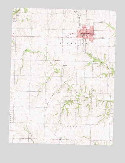
Hiawatha, KS USGS Topographic Map
Click on map above to begin viewing in our Map Viewer.

This topographic map contains these locations and features:
Feature Name Type Latitude Longitude GNIS ID View Map
Agricultural Partners Co - Operative Grain Elevator Number 1LocaleN39.8465°W95.5447°2695131View Map
BakerPopulated PlaceN39.7542°W95.5630°472984View Map
Bethany United Church of ChristChurchN39.8553°W95.5352°2690114View Map
Bethel African Methodist Episcopal ChurchChurchN39.8499°W95.5323°2690824View Map
Bible Church of GodChurchN39.8488°W95.5427°2690825View Map
Brown CountyCivilN39.8265°W95.5642°484976View Map
Brown County Agriculture MuseumBuildingN39.8479°W95.5219°2694928View Map
Brown County CourthouseBuildingN39.8524°W95.5364°2625123View Map
Brown County Historical Society and MuseumBuildingN39.8515°W95.5364°2694927View Map
Brown County JailBuildingN39.8520°W95.5377°2754350View Map
Brown County Sheriff's OfficeBuildingN39.8515°W95.5384°2503936View Map
Calvary Temple Assembly of GodChurchN39.8454°W95.5276°2690828View Map
Christ ChurchChurchN39.8538°W95.5335°2690829View Map
Church of ChristChurchN39.8469°W95.5305°2690831View Map
City of HiawathaCivilN39.8515°W95.5380°485591View Map
Clayton Ville (historical)LocaleN39.7767°W95.5044°481852View Map
Claytonville CemeteryCemeteryN39.7794°W95.5050°472983View Map
Davis MemorialParkN39.8492°W95.5160°2692691View Map
First Baptist ChurchChurchN39.8423°W95.5304°2689275View Map
First Christian ChurchChurchN39.8510°W95.5359°2690842View Map
First Presbyterian ChurchChurchN39.8504°W95.5377°2690113View Map
First United Methodist ChurchChurchN39.8576°W95.5330°2690041View Map
Fisher Community CenterBuildingN39.8475°W95.5244°2692690View Map
HiawathaPopulated PlaceN39.8525°W95.5358°472987View Map
Hiawatha Aquatic ParkLocaleN39.8471°W95.5245°2692689View Map
Hiawatha CemeteryCemeteryN39.8611°W95.5263°2673211View Map
Hiawatha Chamber of CommerceBuildingN39.8532°W95.5368°2692613View Map
Hiawatha City DamDamN39.8267°W95.5272°479923View Map
Hiawatha City HallBuildingN39.8526°W95.5376°2693104View Map
Hiawatha City of NorthLocaleN39.8638°W95.5215°2691931View Map
Hiawatha Community HospitalHospitalN39.8524°W95.5308°2499115View Map
Hiawatha Country ClubLocaleN39.8365°W95.5389°485385View Map
Hiawatha Elementary SchoolSchoolN39.8566°W95.5355°2506510View Map
Hiawatha High SchoolSchoolN39.8522°W95.5231°480226View Map
Hiawatha Middle SchoolSchoolN39.8504°W95.5240°2506359View Map
Hiawatha Police DepartmentBuildingN39.8526°W95.5332°2503970View Map
Hiawatha Post OfficePost OfficeN39.8515°W95.5369°2693769View Map
Hiawatha Unified School District OfficeSchoolN39.8467°W95.5266°2506358View Map
Hiawatha Volunteer Fire DepartmentBuildingN39.8527°W95.5327°2111418View Map
Hiawatha Wastewater Plant Number 3LocaleN39.8364°W95.5327°2693402View Map
James SchoolSchoolN39.8564°W95.5353°472988View Map
Juvenile Services and Adult Community CorrectionsBuildingN39.8516°W95.5359°2504327View Map
Kansas Highway Patrol Troop BBuildingN39.8526°W95.5332°2504162View Map
Kansas National Guard Armory HiawathaMilitaryN39.8536°W95.5277°2625173View Map
KNZA-FM (Hiawatha)TowerN39.7731°W95.5264°481503View Map
Lake HiawathaReservoirN39.8259°W95.5284°472986View Map
Morrill Public LibraryBuildingN39.8526°W95.5335°2694736View Map
Mount Hope CemeteryCemeteryN39.8497°W95.5158°472989View Map
Northeast Kansas Multi - County Health Department Brown CountyBuildingN39.8440°W95.5281°2694986View Map
Pentecostal Church of GodChurchN39.8548°W95.5440°2690858View Map
Saint Ann's Catholic ChurchChurchN39.8577°W95.5395°2689723View Map
The Christian CenterChurchN39.8585°W95.5265°2688780View Map
The Church of Jesus Christ of Latter Day SaintsChurchN39.8491°W95.5228°2690319View Map
Town and Country Ambulance ServiceBuildingN39.8537°W95.5288°2696575View Map
Trinity United Methodist ChurchChurchN39.8527°W95.5300°2689556View Map
Union SchoolSchoolN39.8125°W95.5366°472985View Map
Zion Lutheran ChurchChurchN39.8469°W95.5266°2690873View Map

Note: Coordinates in the location and feature list above are referenced to NAD83 datum.


Copyright (C) 2008-2024 Ryan Niemi / Sunset Dynamics ... All Rights Reserved