TopoQuest Logo
Do you find TopoQuest useful?
Help keep TopoQuest running and adding new maps/features by donating!
Bitcoin:  19c7KJd3qBynnjoSw5npx9KScwjBe4ifkT
Litecoin:  LXs6TkuXGGXo1vDsWCkWVdjQX94eUKd6ui
Home View Maps Find Maps Find Places Resources & Links


Hickory Plains, Arkansas Topographic Map

USGS Map Title: Hickory Plains, AR
USGS Map MRC: 34091H6
DRG (GeoTIFF) Download: o34091h6.tif


Neighboring USGS Topographic Map Quads:


  McRae, AR  
35091A7
 

  Walker, AR  
35091A6
 

  Jasmine, AR  
35091A5
 

  Wattensaw, AR  
34091H7
 

  Hickory Plains, AR  
34091H6
 

  Des Arc West, AR  
34091H5
 

  Pocket Prairie, AR  
34091G7
 

  Carlisle, AR  
34091G6
 

  Hazen, AR  
34091G5


Map MRC Location:

N35°
W92°
N35°
W91°
H8 H7 H6 H5 H4 H3 H2 H1
G8 G7 G6 G5 G4 G3 G2 G1
F8 F7 F6 F5 F4 F3 F2 F1
E8 E7 E6 E5 E4 E3 E2 E1
D8 D7 D6 D5 D4 D3 D2 D1
C8 C7 C6 C5 C4 C3 C2 C1
B8 B7 B6 B5 B4 B3 B2 B1
A8 A7 A6 A5 A4 A3 A2 A1
N34°
W92°
N34°
W91°

Hickory Plains, AR USGS 1:24K Topographic Map Preview:
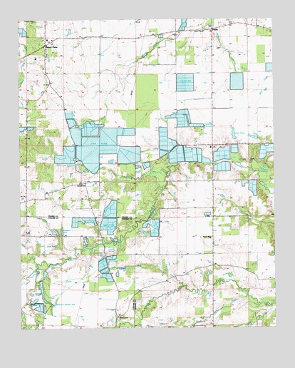
Hickory Plains, AR USGS Topographic Map
Click on map above to begin viewing in our Map Viewer.

This topographic map contains these locations and features:
Feature Name Type Latitude Longitude GNIS ID View Map
Arkansas Noname 12 DamDamN34.8768°W91.7451°79602View Map
Arkansas Noname 13 DamDamN34.8834°W91.7485°79604View Map
Bane CreekStreamN34.9381°W91.6774°46072View Map
Big Pond DamDamN34.9131°W91.7312°81289View Map
Brown Grove School (historical)SchoolN34.9123°W91.6551°59981View Map
Brown Grove Volunteer Fire DepartmentBuildingN34.9085°W91.6553°2116194View Map
Buck CreekStreamN34.8854°W91.6379°47125View Map
Burlesons PondReservoirN34.9148°W91.7331°74721View Map
Collins CreekStreamN34.9015°W91.7421°47933View Map
Cross Roads Church (historical)ChurchN34.9348°W91.7182°59985View Map
Cross Roads School (historical)SchoolN34.9348°W91.7179°59986View Map
CrossroadPopulated PlaceN34.9337°W91.7196°76712View Map
Crossroads Volunteer Fire DepartmentBuildingN34.9385°W91.7209°2116328View Map
Dunn CreekStreamN34.9356°W91.7026°48714View Map
Ford CemeteryCemeteryN34.9979°W91.6551°49152View Map
HayleyPopulated PlaceN34.9959°W91.6549°57052View Map
Hickory PlainsPopulated PlaceN34.9901°W91.7368°57915View Map
Hickory Plains ChurchChurchN34.9873°W91.7365°60005View Map
Hickory Plains Post OfficePost OfficeN34.9898°W91.7375°2781859View Map
Hickory Plains School (historical)SchoolN34.9862°W91.7362°60006View Map
Hodges School (historical)SchoolN34.9420°W91.6924°60010View Map
Johnson ChapelChurchN34.9951°W91.6585°50687View Map
Johnson Chapel CemeteryCemeteryN34.9959°W91.6582°60013View Map
Johnson Chapel School (historical)SchoolN34.9956°W91.6671°60014View Map
Lick CreekStreamN34.9429°W91.6724°51138View Map
Little Faras RunStreamN34.8920°W91.6699°77516View Map
Little PondReservoirN34.9144°W91.7296°81291View Map
Little Pond DamDamN34.9134°W91.7301°81290View Map
McBee CemeteryCemeteryN34.9429°W91.6368°51777View Map
McBy Church (historical)ChurchN34.9493°W91.6585°60024View Map
McCallie - North LakeReservoirN34.8834°W91.7485°79605View Map
McCallie - South ReservoirReservoirN34.8785°W91.7459°79603View Map
Murdocks Mill (historical)LocaleN34.8823°W91.7043°61329View Map
Omni Corporation Pond DamDamN34.9518°W91.6435°80325View Map
Omni PondReservoirN34.9534°W91.6447°80326View Map
Peters School (historical)SchoolN34.8945°W91.6254°60037View Map
Plainview School (historical)SchoolN34.9287°W91.7474°60041View Map
Pleasant Ridge CemeteryCemeteryN34.9998°W91.7415°53587View Map
Pleasant Ridge ChurchChurchN34.9118°W91.6557°53595View Map
Powell CemeteryCemeteryN34.9937°W91.6715°53739View Map
Reservoir Number OneReservoirN34.8904°W91.7395°79594View Map
Short CreekStreamN34.8837°W91.6268°54826View Map
Township of BullardCivilN34.9874°W91.6488°69001View Map
Township of Hickory PlainCivilN34.9862°W91.7457°69006View Map
Township of UnionCivilN34.9091°W91.6530°69010View Map
Tucker CemeteryCemeteryN34.9881°W91.6529°55679View Map
Uzzett (historical)Populated PlaceN34.8904°W91.6918°60058View Map
Walters ChapelChurchN34.8793°W91.7021°56026View Map
Walters Chapel CemeteryCemeteryN34.8787°W91.6857°61330View Map
Winborn School (historical)SchoolN34.9151°W91.7468°61328View Map
Youngs PondLakeN34.8895°W91.7393°75238View Map
Youngs Reservoir Number One DamDamN34.8934°W91.7401°79593View Map

Note: Coordinates in the location and feature list above are referenced to NAD83 datum.


Copyright (C) 2008-2024 Ryan Niemi / Sunset Dynamics ... All Rights Reserved