TopoQuest Logo
Do you find TopoQuest useful?
Help keep TopoQuest running and adding new maps/features by donating!
Bitcoin:  19c7KJd3qBynnjoSw5npx9KScwjBe4ifkT
Litecoin:  LXs6TkuXGGXo1vDsWCkWVdjQX94eUKd6ui
Home View Maps Find Maps Find Places Resources & Links


High Bridge, Wisconsin Topographic Map

USGS Map Title: High Bridge, WI
USGS Map MRC: 46090D6
DRG (GeoTIFF) Download: o46090d6.tif


Neighboring USGS Topographic Map Quads:


  Ashland East, WI  
46090E7
 

  Odanah, WI  
46090E6
 

  Cedar, WI  
46090E5
 

  Marengo, WI  
46090D7
 

  High Bridge, WI  
46090D6
 

  Gurney, WI  
46090D5
 

  Mineral Lake, WI  
46090C7
 

  Mellen, WI  
46090C6
 

  Mount Whittlesey, WI  
46090C5


Map MRC Location:

N47°
W91°
N47°
W90°
H8 H7 H6 H5 H4 H3 H2 H1
G8 G7 G6 G5 G4 G3 G2 G1
F8 F7 F6 F5 F4 F3 F2 F1
E8 E7 E6 E5 E4 E3 E2 E1
D8 D7 D6 D5 D4 D3 D2 D1
C8 C7 C6 C5 C4 C3 C2 C1
B8 B7 B6 B5 B4 B3 B2 B1
A8 A7 A6 A5 A4 A3 A2 A1
N46°
W91°
N46°
W90°

High Bridge, WI USGS 1:24K Topographic Map Preview:
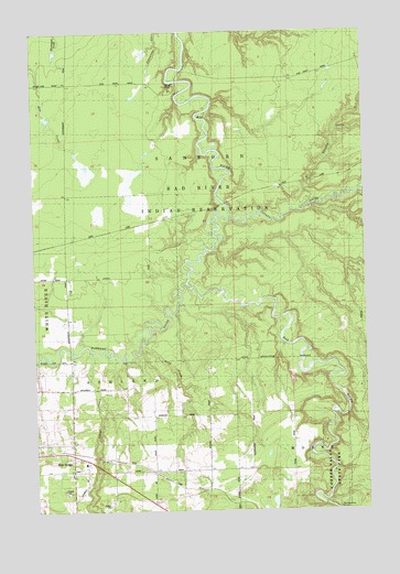
High Bridge, WI USGS Topographic Map
Click on map above to begin viewing in our Map Viewer.

This topographic map contains these locations and features:
Feature Name Type Latitude Longitude GNIS ID View Map
Billy CreekStreamN46.4180°W90.7107°1561797View Map
Brownstone FallsFallsN46.3763°W90.6410°1562276View Map
Copper Falls State Natural AreaParkN46.3844°W90.6400°2508259View Map
Elm Hoist Wildlife G963 9 DamDamN46.4949°W90.7052°1792587View Map
Elm Hoist Wildlife Pond 0.5ReservoirN46.4949°W90.7052°1792588View Map
High BridgePopulated PlaceN46.3888°W90.7363°1566371View Map
High Bridge Post OfficePost OfficeN46.3892°W90.7353°2765634View Map
Marengo RiverStreamN46.4341°W90.6924°1579811View Map
Potato RiverStreamN46.4511°W90.6760°1571834View Map
Silver CreekStreamN46.4169°W90.7288°1580409View Map
Town of AshlandCivilN46.3805°W90.7332°1582724View Map
Tyler ForksStreamN46.3755°W90.6388°1580686View Map
Vaughn CreekStreamN46.4536°W90.6477°1576051View Map

Note: Coordinates in the location and feature list above are referenced to NAD83 datum.


Copyright (C) 2008-2024 Ryan Niemi / Sunset Dynamics ... All Rights Reserved