TopoQuest Logo
Do you find TopoQuest useful?
Help keep TopoQuest running and adding new maps/features by donating!
Bitcoin:  19c7KJd3qBynnjoSw5npx9KScwjBe4ifkT
Litecoin:  LXs6TkuXGGXo1vDsWCkWVdjQX94eUKd6ui
Home View Maps Find Maps Find Places Resources & Links


Mount Whittlesey, Wisconsin Topographic Map

USGS Map Title: Mount Whittlesey, WI
USGS Map MRC: 46090C5
DRG (GeoTIFF) Download: o46090c5.tif


Neighboring USGS Topographic Map Quads:


  High Bridge, WI  
46090D6
 

  Gurney, WI  
46090D5
 

  Saxon, WI  
46090D4
 

  Mellen, WI  
46090C6
 

  Mount Whittlesey, WI  
46090C5
 

  Upson, WI  
46090C4
 

  Morse, WI  
46090B6
 

  Glidden, WI  
46090B5
 

  Augustine Lake, WI  
46090B4


Map MRC Location:

N47°
W91°
N47°
W90°
H8 H7 H6 H5 H4 H3 H2 H1
G8 G7 G6 G5 G4 G3 G2 G1
F8 F7 F6 F5 F4 F3 F2 F1
E8 E7 E6 E5 E4 E3 E2 E1
D8 D7 D6 D5 D4 D3 D2 D1
C8 C7 C6 C5 C4 C3 C2 C1
B8 B7 B6 B5 B4 B3 B2 B1
A8 A7 A6 A5 A4 A3 A2 A1
N46°
W91°
N46°
W90°

Mount Whittlesey, WI USGS 1:24K Topographic Map Preview:
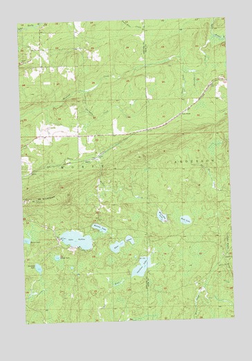
Mount Whittlesey, WI USGS Topographic Map
Click on map above to begin viewing in our Map Viewer.

This topographic map contains these locations and features:
Feature Name Type Latitude Longitude GNIS ID View Map
BallouPopulated PlaceN46.3175°W90.5846°1577501View Map
Ballou CreekStreamN46.3186°W90.5793°1561134View Map
Beaver LakeLakeN46.2843°W90.6240°1578741View Map
Berkshire Mine RuinsLocaleN46.3011°W90.6238°1561599View Map
Caroline LakeLakeN46.2724°W90.5547°1562727View Map
Caroline Lake State Natural AreaParkN46.2758°W90.5400°2076410View Map
Dollar LakeLakeN46.2770°W90.6052°1564044View Map
Dunn CreekStreamN46.3536°W90.5191°1564186View Map
Eureka LakeLakeN46.2889°W90.5792°1564711View Map
Javorsky CreekStreamN46.3674°W90.5068°1567105View Map
Lake GalileeLakeN46.2843°W90.5932°1565382View Map
Maki LakeLakeN46.2913°W90.5277°1568910View Map
McCarthy LakeLakeN46.2929°W90.5418°1569173View Map
Mellen Lookout TowerTowerN46.3008°W90.6174°1581277View Map
Mount WhittleseySummitN46.3008°W90.6174°1576709View Map
O'Dovero FarmsLocaleN46.3291°W90.6080°1838435View Map
Opergard CreekStreamN46.3461°W90.5893°1570845View Map
Snowshoe LakeLakeN46.2729°W90.6167°1574353View Map
Twin LakesLakeN46.2811°W90.5693°1575811View Map
Tyler ForksPopulated PlaceN46.3358°W90.5277°1577863View Map

Note: Coordinates in the location and feature list above are referenced to NAD83 datum.


Copyright (C) 2008-2024 Ryan Niemi / Sunset Dynamics ... All Rights Reserved