TopoQuest Logo
Do you find TopoQuest useful?
Help keep TopoQuest running and adding new maps/features by donating!
Bitcoin:  19c7KJd3qBynnjoSw5npx9KScwjBe4ifkT
Litecoin:  LXs6TkuXGGXo1vDsWCkWVdjQX94eUKd6ui
Home View Maps Find Maps Find Places Resources & Links


Hillsdale, Illinois Topographic Map

USGS Map Title: Hillsdale, IL
USGS Map MRC: 41090E2
DRG (GeoTIFF) Download: o41090e2.tif


Neighboring USGS Topographic Map Quads:


  Cordova, IL  
41090F3
 

  Erie NW, IL  
41090F2
 

  Erie, IL  
41090F1
 

  Port Byron, IL  
41090E3
 

  Hillsdale, IL  
41090E2
 

  Spring Hill, IL  
41090E1
 

  Green Rock, IL  
41090D3
 

  Geneseo, IL  
41090D2
 

  Atkinson, IL  
41090D1


Map MRC Location:

N42°
W91°
N42°
W90°
H8 H7 H6 H5 H4 H3 H2 H1
G8 G7 G6 G5 G4 G3 G2 G1
F8 F7 F6 F5 F4 F3 F2 F1
E8 E7 E6 E5 E4 E3 E2 E1
D8 D7 D6 D5 D4 D3 D2 D1
C8 C7 C6 C5 C4 C3 C2 C1
B8 B7 B6 B5 B4 B3 B2 B1
A8 A7 A6 A5 A4 A3 A2 A1
N41°
W91°
N41°
W90°

Hillsdale, IL USGS 1:24K Topographic Map Preview:
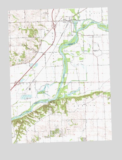
Hillsdale, IL USGS Topographic Map
Click on map above to begin viewing in our Map Viewer.

This topographic map contains these locations and features:
Feature Name Type Latitude Longitude GNIS ID View Map
Bethesda CemeteryCemeteryN41.6048°W90.1990°404329View Map
Big SloughStreamN41.5839°W90.1832°404436View Map
Black AirportAirportN41.6124°W90.1811°427377View Map
Canoe CreekStreamN41.5886°W90.1854°405555View Map
Colbert CemeteryCemeteryN41.5225°W90.2162°406335View Map
Ebenezer CemeteryCemeteryN41.5345°W90.1562°1952046View Map
Ebenezer Community ChurchChurchN41.5345°W90.1565°407745View Map
Ebenezer School (historical)SchoolN41.5384°W90.1468°407750View Map
HillsdalePopulated PlaceN41.6136°W90.1729°410292View Map
Hillsdale Fire Protection DistrictBuildingN41.6140°W90.1751°2640650View Map
Hillsdale Post OfficePost OfficeN41.6146°W90.1737°2788599View Map
Interchange 10CrossingN41.6084°W90.1935°1820931View Map
Interchange 6CrossingN41.5570°W90.2418°1820930View Map
JoslinPopulated PlaceN41.5573°W90.2221°411258View Map
Joslin School (historical)SchoolN41.5531°W90.2179°411259View Map
Joslin SloughStreamN41.5389°W90.2157°411260View Map
Kempster IslandIslandN41.6114°W90.1523°411389View Map
Kempsterville School (historical)SchoolN41.5923°W90.1437°411390View Map
McHenry CemeteryCemeteryN41.5397°W90.1279°413275View Map
Mount Moriah CemeteryCemeteryN41.6214°W90.2007°413995View Map
Oak Grove School (historical)SchoolN41.5164°W90.2257°414810View Map
Oxbow SloughGutN41.5842°W90.1543°415282View Map
Peterson IslandIslandN41.5753°W90.1807°415583View Map
Phenix School (historical)SchoolN41.5200°W90.1426°415601View Map
Poplar Grove School (historical)SchoolN41.6142°W90.1948°416033View Map
Riverdale Junior High SchoolSchoolN41.6142°W90.1773°1718891View Map
Ropp Airpark (historical)AirportN41.5753°W90.1598°1718892View Map
Shadow LakeLakeN41.5451°W90.1755°418252View Map
Shady BeachPopulated PlaceN41.5389°W90.1968°418255View Map
Spade SloughGutN41.5664°W90.1557°418865View Map
Township of Canoe CreekCivilN41.6116°W90.1894°428756View Map
Township of PhenixCivilN41.5394°W90.1396°429555View Map
Village of HillsdaleCivilN41.6106°W90.1748°2398508View Map

Note: Coordinates in the location and feature list above are referenced to NAD83 datum.


Copyright (C) 2008-2024 Ryan Niemi / Sunset Dynamics ... All Rights Reserved