TopoQuest Logo
Do you find TopoQuest useful?
Help keep TopoQuest running and adding new maps/features by donating!
Bitcoin:  19c7KJd3qBynnjoSw5npx9KScwjBe4ifkT
Litecoin:  LXs6TkuXGGXo1vDsWCkWVdjQX94eUKd6ui
Home View Maps Find Maps Find Places Resources & Links


Hortonville, Wisconsin Topographic Map

USGS Map Title: Hortonville, WI
USGS Map MRC: 44088C6
DRG (GeoTIFF) Download: o44088c6.tif


Neighboring USGS Topographic Map Quads:


  Northport, WI  
44088D7
 

  New London, WI  
44088D6
 

  Shiocton, WI  
44088D5
 

  Readfield, WI  
44088C7
 

  Hortonville, WI  
44088C6
 

  Greenville, WI  
44088C5
 

  Lake Poygan, WI  
44088B7
 

  Oshkosh NW, WI  
44088B6
 

  Oshkosh NE, WI  
44088B5


Map MRC Location:

N45°
W89°
N45°
W88°
H8 H7 H6 H5 H4 H3 H2 H1
G8 G7 G6 G5 G4 G3 G2 G1
F8 F7 F6 F5 F4 F3 F2 F1
E8 E7 E6 E5 E4 E3 E2 E1
D8 D7 D6 D5 D4 D3 D2 D1
C8 C7 C6 C5 C4 C3 C2 C1
B8 B7 B6 B5 B4 B3 B2 B1
A8 A7 A6 A5 A4 A3 A2 A1
N44°
W89°
N44°
W88°

Hortonville, WI USGS 1:24K Topographic Map Preview:
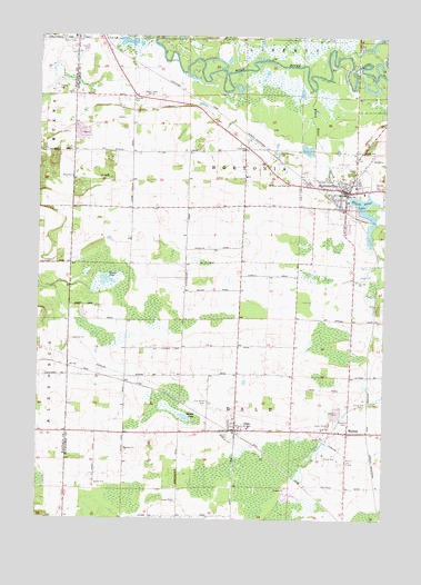
Hortonville, WI USGS Topographic Map
Click on map above to begin viewing in our Map Viewer.

This topographic map contains these locations and features:
Feature Name Type Latitude Longitude GNIS ID View Map
Bethlehem Evangelical Lutheran SchoolSchoolN44.3356°W88.6387°2716450View Map
Black Creek Limestone QuarryMineN44.3483°W88.7308°2633469View Map
Black Otter CreekStreamN44.3614°W88.6509°1561876View Map
Black Otter LakeReservoirN44.3303°W88.6324°1561877View Map
Cloverleaf School (historical)SchoolN44.2878°W88.6776°1851399View Map
DalePopulated PlaceN44.2730°W88.6784°1563669View Map
Dale CemeteryCemeteryN44.2733°W88.6493°1563670View Map
Dale Census Designated PlaceCensusN44.2757°W88.6730°2586470View Map
Dale Fire and RescueBuildingN44.2724°W88.6753°2697642View Map
Dalonia AirportAirportN44.3164°W88.7009°1582017View Map
Daufen ParkParkN44.2722°W88.6801°1563723View Map
Hickory Grove School (historical)SchoolN44.2791°W88.7182°1849898View Map
Horton Ville DamDamN44.3350°W88.6384°1791980View Map
HortonvillePopulated PlaceN44.3347°W88.6382°1566752View Map
Hortonville Elementary SchoolSchoolN44.3404°W88.6288°2716192View Map
Hortonville High SchoolSchoolN44.3372°W88.6341°1849904View Map
Hortonville Hortonia Fire DepartmentBuildingN44.3344°W88.6388°2697712View Map
Hortonville Middle SchoolSchoolN44.3384°W88.6290°2716901View Map
Hortonville Police DepartmentBuildingN44.3344°W88.6389°2759677View Map
Hortonville Union CemeteryCemeteryN44.3392°W88.6373°1849905View Map
Hortonville Wastewater Treatment PlantLocaleN44.3383°W88.6442°2723265View Map
MedinaPopulated PlaceN44.2728°W88.6379°1569310View Map
Medina CemeteryCemeteryN44.2650°W88.6387°1569312View Map
Pine Grove CemeteryCemeteryN44.2803°W88.6887°1571450View Map
Saints Peter and Paul CemeteryCemeteryN44.3372°W88.6593°1573606View Map
Shaky LakeLakeN44.3117°W88.7264°1573948View Map
Shaky Lake State Natural AreaParkN44.3114°W88.7229°2013544View Map
Squaw LakeLakeN44.2764°W88.6967°1574769View Map
Town of DaleCivilN44.2799°W88.6783°1583044View Map
Town of HortoniaCivilN44.3443°W88.6866°1583410View Map
Village of HortonvilleCivilN44.3365°W88.6362°1583411View Map

Note: Coordinates in the location and feature list above are referenced to NAD83 datum.


Copyright (C) 2008-2024 Ryan Niemi / Sunset Dynamics ... All Rights Reserved