TopoQuest Logo
Do you find TopoQuest useful?
Help keep TopoQuest running and adding new maps/features by donating!
Bitcoin:  19c7KJd3qBynnjoSw5npx9KScwjBe4ifkT
Litecoin:  LXs6TkuXGGXo1vDsWCkWVdjQX94eUKd6ui
Home View Maps Find Maps Find Places Resources & Links


Humble City, New Mexico Topographic Map

USGS Map Title: Humble City, NM
USGS Map MRC: 32103G2
DRG (GeoTIFF) Download: o32103g2.tif


Neighboring USGS Topographic Map Quads:


  Lovington, NM  
32103H3
 

  Humble City NW, NM  
32103H2
 

  Humble City NE, TX  
32103H1
 

  Lovington SE, NM  
32103G3
 

  Humble City, NM  
32103G2
 

  Humble City SE, TX  
32103G1
 

  Monument North, NM  
32103F3
 

  Hobbs West, NM  
32103F2
 

  Hobbs East, NM  
32103F1


Map MRC Location:

N33°
W104°
N33°
W103°
H8 H7 H6 H5 H4 H3 H2 H1
G8 G7 G6 G5 G4 G3 G2 G1
F8 F7 F6 F5 F4 F3 F2 F1
E8 E7 E6 E5 E4 E3 E2 E1
D8 D7 D6 D5 D4 D3 D2 D1
C8 C7 C6 C5 C4 C3 C2 C1
B8 B7 B6 B5 B4 B3 B2 B1
A8 A7 A6 A5 A4 A3 A2 A1
N32°
W104°
N32°
W103°

Humble City, NM USGS 1:24K Topographic Map Preview:
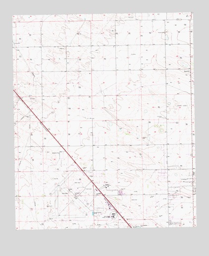
Humble City, NM USGS Topographic Map
Click on map above to begin viewing in our Map Viewer.

This topographic map contains these locations and features:
Feature Name Type Latitude Longitude GNIS ID View Map
10217 Water WellWellN32.8543°W103.1713°930708View Map
10218 Water WellWellN32.8537°W103.2144°930756View Map
10219 Water WellWellN32.8487°W103.2088°930755View Map
10220 Water WellWellN32.7987°W103.2297°930713View Map
10221 Water WellWellN32.7987°W103.2491°930714View Map
10223 Water WellWellN32.7968°W103.2427°930712View Map
10226 Water WellWellN32.8590°W103.1922°930710View Map
10227 Water WellWellN32.8590°W103.1908°930709View Map
10228 Water WellWellN32.8543°W103.1713°930707View Map
10229 Water WellWellN32.8487°W103.2088°930754View Map
10230 Water WellWellN32.8251°W103.1283°930753View Map
10232 Water WellWellN32.7793°W103.1422°930720View Map
10233 Water WellWellN32.8084°W103.1630°930716View Map
10234 Water WellWellN32.8015°W103.1894°930715View Map
10235 Water WellWellN32.7876°W103.1922°930747View Map
10235 Water WellWellN32.7929°W103.2105°930748View Map
10236 Water WellWellN32.7959°W103.1394°930751View Map
10244 Water WellWellN32.7709°W103.1422°930719View Map
10245 Water WellWellN32.7821°W103.1477°930721View Map
Air Base CityPopulated PlaceN32.7698°W103.1952°899494View Map
College Lane Elementary SchoolSchoolN32.7701°W103.1590°933873View Map
Harry McAdams State ParkParkN32.7743°W103.2041°920374View Map
Hobbs Army Air Field (historical)MilitaryN32.7667°W103.2089°2092282View Map
Humble CityPopulated PlaceN32.7951°W103.2191°890257View Map
Humble City Post Office (historical)Post OfficeN32.7951°W103.2191°937968View Map
Industrial AirparkAirportN32.7668°W103.2089°936962View Map
KnowlesPopulated PlaceN32.8404°W103.1277°923614View Map
Knowles CemeteryCemeteryN32.8635°W103.1454°890741View Map
Knowles Fire DepartmentBuildingN32.8416°W103.1314°2657772View Map
Knowles Post Office (historical)Post OfficeN32.8404°W103.1277°938299View Map
KYKK-AM (Hobbs)TowerN32.8165°W103.2327°938600View Map
KYKK-AM (Humble City)TowerN32.8165°W103.2327°938601View Map
KZOR-FM (Hobbs)TowerN32.8165°W103.2327°938665View Map
Lea County Correctional FacilityBuildingN32.7641°W103.2237°2722670View Map
Lea County Cowboy Hall of Fame and Western Heritage CenterBuildingN32.7584°W103.1816°929515View Map
Lea County Road PitMineN32.7723°W103.1777°914576View Map
Lea County Sheriff's Office HobbsBuildingN32.7698°W103.1842°2722608View Map
Lea Regional Medical CenterHospitalN32.7624°W103.1850°901316View Map
New Mexico Junior CollegeSchoolN32.7578°W103.1828°892447View Map
New Mexico State Police District 3 HobbsBuildingN32.7749°W103.2020°2722628View Map
University of the SouthwestSchoolN32.7747°W103.1877°887740View Map

Note: Coordinates in the location and feature list above are referenced to NAD83 datum.


Copyright (C) 2008-2024 Ryan Niemi / Sunset Dynamics ... All Rights Reserved