TopoQuest Logo
Do you find TopoQuest useful?
Help keep TopoQuest running and adding new maps/features by donating!
Bitcoin:  19c7KJd3qBynnjoSw5npx9KScwjBe4ifkT
Litecoin:  LXs6TkuXGGXo1vDsWCkWVdjQX94eUKd6ui
Home View Maps Find Maps Find Places Resources & Links


Iaeger, West Virginia Topographic Map

USGS Map Title: Iaeger, WV
USGS Map MRC: 37081D7
DRG (GeoTIFF) Download: o37081d7.tif


Neighboring USGS Topographic Map Quads:


  Wharncliffe, WV  
37081E8
 

  Gilbert, WV  
37081E7
 

  Baileysville, WV  
37081E6
 

  Panther, WV  
37081D8
 

  Iaeger, WV  
37081D7
 

  Davy, WV  
37081D6
 

  Patterson, VA  
37081C8
 

  Bradshaw, WV  
37081C7
 

  War, WV  
37081C6


Map MRC Location:

N38°
W82°
N38°
W81°
H8 H7 H6 H5 H4 H3 H2 H1
G8 G7 G6 G5 G4 G3 G2 G1
F8 F7 F6 F5 F4 F3 F2 F1
E8 E7 E6 E5 E4 E3 E2 E1
D8 D7 D6 D5 D4 D3 D2 D1
C8 C7 C6 C5 C4 C3 C2 C1
B8 B7 B6 B5 B4 B3 B2 B1
A8 A7 A6 A5 A4 A3 A2 A1
N37°
W82°
N37°
W81°

Iaeger, WV USGS 1:24K Topographic Map Preview:
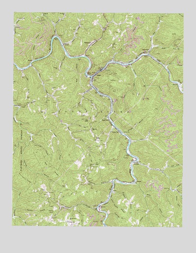
Iaeger, WV USGS Topographic Map
Click on map above to begin viewing in our Map Viewer.

This topographic map contains these locations and features:
Feature Name Type Latitude Longitude GNIS ID View Map
Adkins BranchStreamN37.4712°W81.8604°1534814View Map
Apple GrovePopulated PlaceN37.4376°W81.8048°1549567View Map
AvondalePopulated PlaceN37.4126°W81.7843°1553769View Map
Avondale Post OfficePost OfficeN37.4170°W81.7890°1689114View Map
BeartownPopulated PlaceN37.3862°W81.8115°1553823View Map
Beartown BranchStreamN37.3862°W81.8129°1535419View Map
Bee RidgeRidgeN37.4087°W81.8448°1535491View Map
Betsy BranchStreamN37.4009°W81.7859°1535734View Map
Blevins CemeteryCemeteryN37.3973°W81.7593°1536102View Map
Bowles CemeteryCemeteryN37.4304°W81.7932°1536262View Map
Brant CemeteryCemeteryN37.3948°W81.8482°1536310View Map
Calvary ChurchChurchN37.4690°W81.7926°1536868View Map
Candy CemeteryCemeteryN37.3957°W81.8509°1536983View Map
CarlosPopulated PlaceN37.3959°W81.8015°1554075View Map
Carlos School (historical)SchoolN37.4009°W81.7946°1537039View Map
Cline CemeteryCemeteryN37.4912°W81.8734°1537412View Map
Collins CemeteryCemeteryN37.3798°W81.8465°1537523View Map
Collins CemeteryCemeteryN37.3815°W81.8607°1537524View Map
Collins CemeteryCemeteryN37.4257°W81.8129°1537525View Map
Collins CemeteryCemeteryN37.4734°W81.8276°1537527View Map
Collins School (historical)SchoolN37.3834°W81.8446°1537534View Map
Coon BranchStreamN37.4568°W81.8159°1537613View Map
Crane CreekStreamN37.4257°W81.8610°1537789View Map
Crane CreekStreamN37.4140°W81.7834°1537791View Map
Cub BranchStreamN37.4446°W81.8698°1537889View Map
Cub CreekStreamN37.4668°W81.8687°1537897View Map
D C Perry Memorial BridgeBridgeN37.4791°W81.8382°2647254View Map
Desolate BranchStreamN37.3854°W81.8729°1538148View Map
Dry BranchStreamN37.4682°W81.7634°1538342View Map
Dry ForkStreamN37.4626°W81.8174°1538362View Map
Fishtrap BranchStreamN37.3821°W81.8048°1539010View Map
GarlandPopulated PlaceN37.4007°W81.7846°1554532View Map
George BranchStreamN37.4290°W81.8615°1539369View Map
Grapevine BranchStreamN37.4009°W81.8012°1539596View Map
Grapevine School (historical)SchoolN37.4104°W81.8173°1539604View Map
Harman BranchStreamN37.4704°W81.7890°1539965View Map
High KnobSummitN37.4362°W81.8179°1540245View Map
High Knob ChurchChurchN37.4318°W81.8171°1540247View Map
High Knob School (historical)SchoolN37.4334°W81.8184°1689145View Map
Horn CemeteryCemeteryN37.3934°W81.8484°1540462View Map
Horse CreekStreamN37.4690°W81.8623°1540476View Map
HullPopulated PlaceN37.4868°W81.8437°1689147View Map
Hurricane BranchStreamN37.4221°W81.8643°1540612View Map
IaegerPopulated PlaceN37.4646°W81.8137°1540647View Map
Iaeger Elementary SchoolSchoolN37.4625°W81.8192°2631555View Map
Iaeger High SchoolSchoolN37.4623°W81.8186°1689149View Map
Iaeger Police DepartmentBuildingN37.4664°W81.8096°2728036View Map
Iaeger Post OfficePost OfficeN37.4645°W81.8139°1689151View Map
Iaeger Public LibraryBuildingN37.4642°W81.8144°2727341View Map
Iaeger Volunteer Fire DepartmentBuildingN37.4663°W81.8114°2577700View Map
JohnnycakePopulated PlaceN37.4823°W81.8171°1540953View Map
Johnnycake BranchStreamN37.4743°W81.8232°1540954View Map
Kelly CemeteryCemeteryN37.4220°W81.8143°1541134View Map
Kennedy CemeteryCemeteryN37.4557°W81.8465°1541149View Map
KrollitzPopulated PlaceN37.4718°W81.8604°1554897View Map
Laeger Elementary SchoolSchoolN37.4632°W81.8210°1689148View Map
Laurel ForkStreamN37.3968°W81.7576°1541450View Map
Left Fork Crane CreekStreamN37.4073°W81.7648°1541647View Map
Lick BranchStreamN37.4709°W81.8023°1541831View Map
Little Slaunch BranchStreamN37.3921°W81.8034°1542221View Map
LitwarPopulated PlaceN37.4815°W81.8384°1554976View Map
Lockhart CemeteryCemeteryN37.4395°W81.8246°1542281View Map
Lockhart CemeteryCemeteryN37.4959°W81.8712°1542284View Map
LT Sara Blanche Vance BridgeBridgeN37.4650°W81.8137°2647256View Map
Marion Police DepartmentBuildingN37.3836°W81.8744°2085937View Map
Meadows CemeteryCemeteryN37.4676°W81.8423°1543085View Map
Mile BranchStreamN37.4257°W81.7890°1543264View Map
Mountain Home ChurchChurchN37.3787°W81.8326°1543862View Map
NacolsPopulated PlaceN37.4557°W81.8179°1689172View Map
Negro BranchStreamN37.4807°W81.8393°1544081View Map
Oldhouse BranchStreamN37.4204°W81.8732°1544388View Map
Orchard BranchStreamN37.4757°W81.8354°1544429View Map
Pine KnobSummitN37.4265°W81.8143°1544893View Map
Powell CemeteryCemeteryN37.4101°W81.8159°1545212View Map
Reed CemeteryCemeteryN37.4118°W81.8140°1545478View Map
Right Fork Crane CreekStreamN37.3940°W81.7518°1545630View Map
Right Fork Harman BranchStreamN37.4634°W81.7854°1545649View Map
Right Fork Sandy Huff BranchStreamN37.4804°W81.7729°1545699View Map
Robert CemeteryCemeteryN37.4495°W81.8648°1545838View Map
Robert CemeteryCemeteryN37.4607°W81.8034°1545839View Map
Roberts CemeteryCemeteryN37.3976°W81.8368°1545841View Map
Roberts School (historical)SchoolN37.3957°W81.8282°1689180View Map
Rock BranchStreamN37.4734°W81.8284°1545887View Map
RockridgePopulated PlaceN37.3768°W81.8268°1545998View Map
Rowe CemeteryCemeteryN37.3840°W81.8443°1546121View Map
Sal Gibson HollowValleyN37.4987°W81.7668°1546277View Map
Sandy HuffPopulated PlaceN37.4782°W81.7751°1555567View Map
Sandy Huff BranchStreamN37.4754°W81.7762°1546409View Map
Sandy River Middle SchoolSchoolN37.4185°W81.7896°2088344View Map
Slaunch BranchStreamN37.3954°W81.8023°1546928View Map
Snipe BranchStreamN37.4582°W81.7537°1547035View Map
Sourwood RidgeRidgeN37.4026°W81.8657°1547061View Map
Steele CemeteryCemeteryN37.4420°W81.8529°1547364View Map
Straight BranchStreamN37.4287°W81.7929°1547547View Map
Town of IaegerCivilN37.4720°W81.8030°2391238View Map
Union CityPopulated PlaceN37.4307°W81.7965°1555851View Map
War BranchStreamN37.4854°W81.8437°1548781View Map
War Branch School (historical)SchoolN37.4987°W81.8371°1548782View Map
WilmorePopulated PlaceN37.4587°W81.7523°1549206View Map

Note: Coordinates in the location and feature list above are referenced to NAD83 datum.


Copyright (C) 2008-2024 Ryan Niemi / Sunset Dynamics ... All Rights Reserved