TopoQuest Logo
Do you find TopoQuest useful?
Help keep TopoQuest running and adding new maps/features by donating!
Bitcoin:  19c7KJd3qBynnjoSw5npx9KScwjBe4ifkT
Litecoin:  LXs6TkuXGGXo1vDsWCkWVdjQX94eUKd6ui
Home View Maps Find Maps Find Places Resources & Links


Wharncliffe, West Virginia Topographic Map

USGS Map Title: Wharncliffe, WV
USGS Map MRC: 37081E8
DRG (GeoTIFF) Download: o37081e8.tif


Neighboring USGS Topographic Map Quads:


  Barnabus, WV  
37082F1
 

  Man, WV  
37081F8
 

  Mallory, WV  
37081F7
 

  Majestic, KY  
37082E1
 

  Wharncliffe, WV  
37081E8
 

  Gilbert, WV  
37081E7
 

  Hurley, VA  
37082D1
 

  Panther, WV  
37081D8
 

  Iaeger, WV  
37081D7


Map MRC Location:

N38°
W82°
N38°
W81°
H8 H7 H6 H5 H4 H3 H2 H1
G8 G7 G6 G5 G4 G3 G2 G1
F8 F7 F6 F5 F4 F3 F2 F1
E8 E7 E6 E5 E4 E3 E2 E1
D8 D7 D6 D5 D4 D3 D2 D1
C8 C7 C6 C5 C4 C3 C2 C1
B8 B7 B6 B5 B4 B3 B2 B1
A8 A7 A6 A5 A4 A3 A2 A1
N37°
W82°
N37°
W81°

Wharncliffe, WV USGS 1:24K Topographic Map Preview:
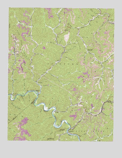
Wharncliffe, WV USGS Topographic Map
Click on map above to begin viewing in our Map Viewer.

This topographic map contains these locations and features:
Feature Name Type Latitude Longitude GNIS ID View Map
Adams ForkStreamN37.6059°W81.9168°1534807View Map
Alum CreekStreamN37.5423°W81.9962°1534902View Map
Axe BranchStreamN37.6165°W81.8985°1535089View Map
BaisdenPopulated PlaceN37.5840°W81.9051°1560591View Map
Baisden ForkStreamN37.5665°W81.8779°1535140View Map
Baisden Post OfficePost OfficeN37.5865°W81.9081°1728726View Map
Baisden Volunteer Fire DepartmentBuildingN37.5770°W81.8973°2577960View Map
Bear BranchStreamN37.5284°W81.9307°1535339View Map
Bear ForkStreamN37.5793°W81.9376°1728727View Map
Bear HollowValleyN37.5787°W81.9365°1535368View Map
Beech ForkStreamN37.6046°W81.9468°1535522View Map
Ben CreekStreamN37.5443°W81.9643°1535620View Map
Ben Creek MountainSummitN37.6223°W81.9329°1553856View Map
Ben Creek School (historical)SchoolN37.5640°W81.9551°1535621View Map
Big BranchStreamN37.5032°W81.8937°1535780View Map
Big BranchStreamN37.5434°W81.9801°1535781View Map
Big BranchStreamN37.5334°W81.9643°1463323View Map
Big ForkStreamN37.6082°W81.9096°1535838View Map
Big HollowValleyN37.5768°W81.8973°1535851View Map
Brushy ForkStreamN37.5262°W81.9043°1536489View Map
Buchanan CemeteryCemeteryN37.5304°W81.9523°1536542View Map
Buck BranchStreamN37.5729°W81.9435°1728737View Map
Bull CreekStreamN37.5079°W81.9296°1536691View Map
Chapman CemeteryCemeteryN37.5971°W81.9132°1537201View Map
Chestnut Log HollowValleyN37.5984°W81.9737°1537286View Map
Cline CemeteryCemeteryN37.5440°W81.9685°489693View Map
Cline School (historical)SchoolN37.5737°W81.8901°1537416View Map
Coal HollowValleyN37.6059°W81.9235°1537447View Map
Elbow HollowValleyN37.5007°W81.8935°1538586View Map
Fourpole CreekStreamN37.5118°W81.9276°1539189View Map
Gilbert CreekPopulated PlaceN37.5759°W81.8948°1867649View Map
Gilbert Creek Census Designated PlaceCensusN37.5697°W81.8906°2389840View Map
Gilbert Elementary SchoolSchoolN37.6176°W81.8820°2088210View Map
Glen AlumPopulated PlaceN37.5848°W81.9929°1549707View Map
Glen Alum JunctionPopulated PlaceN37.5429°W81.9954°1549708View Map
Glen Alum MountainSummitN37.6018°W81.9876°1554563View Map
Greenbrier CreekStreamN37.5229°W81.9460°1467493View Map
Hardy Union School (historical)SchoolN37.5271°W81.9029°1539952View Map
Hickory Gap BranchStreamN37.5762°W81.9726°1540213View Map
Horsepen (historical)Populated PlaceN37.6201°W81.8918°1728790View Map
Horsepen CreekStreamN37.6201°W81.8918°1540505View Map
IsabanPopulated PlaceN37.5301°W81.8882°1554783View Map
Isaban Post OfficePost OfficeN37.5284°W81.8898°1728792View Map
Laurel ForkStreamN37.5884°W81.9346°1541427View Map
Left Fork Alum CreekStreamN37.5587°W81.9951°1541620View Map
Left Fork Ben CreekStreamN37.5551°W81.9662°1541628View Map
Left Fork Gilbert CreekStreamN37.5698°W81.8876°1541661View Map
Left Fork Spring ForkStreamN37.5604°W81.9426°1541726View Map
Lefthand Left Fork Ben CreekStreamN37.6062°W81.9729°1541770View Map
Lick BranchStreamN37.5321°W81.9451°1541833View Map
Lick BranchStreamN37.6068°W81.9515°1541837View Map
Long BranchStreamN37.5146°W81.9457°1469788View Map
Long HollowValleyN37.6193°W81.8948°1542374View Map
Low Gap BranchStreamN37.5915°W81.9426°1542498View Map
Lower Pete BranchStreamN37.6246°W81.8943°1542560View Map
MohawkPopulated PlaceN37.5048°W81.9151°1689167View Map
Mohawk BranchStreamN37.5040°W81.9162°1543482View Map
Monk HollowValleyN37.5418°W81.9823°498484View Map
Mounts CemeteryCemeteryN37.6093°W81.9096°1543885View Map
Mudlick BranchStreamN37.5740°W81.8907°1543941View Map
Mullens BranchStreamN37.5290°W81.9529°1543987View Map
North HollowValleyN37.5740°W81.9404°1728827View Map
Old House BranchStreamN37.5843°W81.9057°1544357View Map
Pickering BranchStreamN37.5612°W81.8762°1544796View Map
Pound Mill BranchStreamN37.5743°W81.9404°1728836View Map
Pounding Mill BranchStreamN37.5509°W81.9604°1545199View Map
Rex Cline CemeteryCemeteryN37.5655°W81.8767°2586349View Map
Right Fork Gilbert CreekStreamN37.5701°W81.8876°1545644View Map
Righthand ForkStreamN37.5604°W81.9423°1728848View Map
Ritchie and Cline CemeteryCemeteryN37.5625°W81.8754°2586374View Map
Rough BranchStreamN37.5012°W81.9390°1546098View Map
Sand LickStreamN37.5818°W81.9685°1546366View Map
Sims ForkStreamN37.5382°W81.8829°1546823View Map
Skillet CreekStreamN37.6134°W81.8821°1546863View Map
Spring ForkStreamN37.5646°W81.9551°1547189View Map
Stafford DistrictCivilN37.6054°W81.8889°1928372View Map
Staggerweed BranchStreamN37.5443°W81.9782°504232View Map
Star ForkStreamN37.5337°W81.9243°1547341View Map
Star Hollow CemeteryCemeteryN37.5341°W81.9257°2586350View Map
Sycamore ForkStreamN37.5659°W81.9721°1547833View Map
Toler CemeteryCemeteryN37.5987°W81.9743°1548109View Map
Trent HollowValleyN37.5301°W81.9532°1728869View Map
Tunnel BranchStreamN37.5404°W81.9907°505565View Map
Turkey CreekStreamN37.5293°W81.9448°1548329View Map
Twisted Gun GapGapN37.6043°W81.9321°1548405View Map
Twisted Gun Golf CourseLocaleN37.5976°W81.9577°2634225View Map
Walnut HollowValleyN37.5909°W81.9398°1548769View Map
War EaglePopulated PlaceN37.5284°W81.9440°1555917View Map
WharncliffePopulated PlaceN37.5554°W81.9657°1548976View Map
Wharncliffe ChurchChurchN37.5837°W81.9337°1548977View Map
Wharncliffe Post OfficePost OfficeN37.5567°W81.9702°1728881View Map
Wharncliffe StationLocaleN37.5462°W81.9651°1548978View Map
Wharncliffe Volunteer Fire DepartmentBuildingN37.5594°W81.9709°2577590View Map
White Oak HollowValleyN37.5851°W81.9329°1549061View Map
Wyoming CityPopulated PlaceN37.5098°W81.9285°1556035View Map

Note: Coordinates in the location and feature list above are referenced to NAD83 datum.


Copyright (C) 2008-2024 Ryan Niemi / Sunset Dynamics ... All Rights Reserved