TopoQuest Logo
Do you find TopoQuest useful?
Help keep TopoQuest running and adding new maps/features by donating!
Bitcoin:  19c7KJd3qBynnjoSw5npx9KScwjBe4ifkT
Litecoin:  LXs6TkuXGGXo1vDsWCkWVdjQX94eUKd6ui
Home View Maps Find Maps Find Places Resources & Links


Ingham Lake, Iowa Topographic Map

USGS Map Title: Ingham Lake, IA
USGS Map MRC: 43094C6
DRG (GeoTIFF) Download: o43094c6.tif


Neighboring USGS Topographic Map Quads:


  Estherville, IA  
43094D7
 

  Gruver, IA  
43094D6
 

  Dolliver, IA  
43094D5
 

  Wallingford, IA  
43094C7
 

  Ingham Lake, IA  
43094C6
 

  Ringsted, IA  
43094C5
 

  Graettinger West, IA  
43094B7
 

  Graettinger East, IA  
43094B6
 

  Depew, IA  
43094B5


Map MRC Location:

N44°
W95°
N44°
W94°
H8 H7 H6 H5 H4 H3 H2 H1
G8 G7 G6 G5 G4 G3 G2 G1
F8 F7 F6 F5 F4 F3 F2 F1
E8 E7 E6 E5 E4 E3 E2 E1
D8 D7 D6 D5 D4 D3 D2 D1
C8 C7 C6 C5 C4 C3 C2 C1
B8 B7 B6 B5 B4 B3 B2 B1
A8 A7 A6 A5 A4 A3 A2 A1
N43°
W95°
N43°
W94°

Ingham Lake, IA USGS 1:24K Topographic Map Preview:
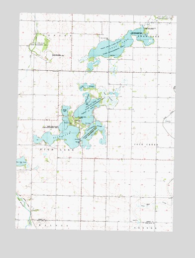
Ingham Lake, IA USGS Topographic Map
Click on map above to begin viewing in our Map Viewer.

This topographic map contains these locations and features:
Feature Name Type Latitude Longitude GNIS ID View Map
Brevick Post Office (historical)Post OfficeN43.3111°W94.7011°1907426View Map
Bubona (historical)Populated PlaceN43.3272°W94.6597°464039View Map
Bubona Post Office (historical)Post OfficeN43.3272°W94.6597°1907425View Map
Bur Oak LakeLakeN43.2887°W94.7476°454985View Map
Crane Lake (historical)LakeN43.3016°W94.6658°464040View Map
Cunningham SloughLakeN43.3058°W94.6916°1822875View Map
Cunningham Slough State Game Management AreaParkN43.3077°W94.6922°1822874View Map
East SloughSwampN43.3255°W94.6778°1822871View Map
Emmet County Waterfowl Production AreaParkN43.3393°W94.6758°2765284View Map
Forest Ridge CampLocaleN43.3119°W94.7005°1822877View Map
High LakeLakeN43.3049°W94.7126°457449View Map
High Lake CemeteryCemeteryN43.3006°W94.6993°1822869View Map
High Lake State Game Management AreaParkN43.3144°W94.7122°1822876View Map
Immanuel ChurchChurchN43.3413°W94.7191°1822866View Map
Ingham LakeLakeN43.3186°W94.6950°457813View Map
Ingham Lake CampLocaleN43.3147°W94.7011°1822873View Map
Ingham Lake State Game Management AreaParkN43.3194°W94.6944°1823128View Map
Island Grove Post Office (historical)Post OfficeN43.3216°W94.7169°1907414View Map
Larson FarmsLocaleN43.3638°W94.7384°2729837View Map
North SloughLakeN43.3324°W94.6952°1822872View Map
Peterson Point Historic FarmsteadLocaleN43.3027°W94.6886°1907391View Map
Ryan Lake (historical)LakeN43.3558°W94.7336°464038View Map
Ryan Lake State Game Management AreaParkN43.3583°W94.7344°460873View Map
Swan LakeLakeN43.3547°W94.6689°462131View Map
Swan LakeLocaleN43.3638°W94.6864°463980View Map
Swan Lake Village CemeteryCemeteryN43.3606°W94.6791°1822867View Map
Swanlake Post Office (historical)Post OfficeN43.3638°W94.6864°1907405View Map
Township of High LakeCivilN43.2986°W94.7378°468033View Map
Voss Post Office (historical)Post OfficeN43.3416°W94.6586°1907406View Map
West SloughLakeN43.3268°W94.6953°1822870View Map
West Swan Lake State Game Management AreaParkN43.3544°W94.6769°1822868View Map
Wolden County ParkParkN43.3111°W94.7058°463897View Map

Note: Coordinates in the location and feature list above are referenced to NAD83 datum.


Copyright (C) 2008-2024 Ryan Niemi / Sunset Dynamics ... All Rights Reserved