TopoQuest Logo
Do you find TopoQuest useful?
Help keep TopoQuest running and adding new maps/features by donating!
Bitcoin:  19c7KJd3qBynnjoSw5npx9KScwjBe4ifkT
Litecoin:  LXs6TkuXGGXo1vDsWCkWVdjQX94eUKd6ui
Home View Maps Find Maps Find Places Resources & Links


Gruver, Iowa Topographic Map

USGS Map Title: Gruver, IA
USGS Map MRC: 43094D6
DRG (GeoTIFF) Download: o43094d6.tif


Neighboring USGS Topographic Map Quads:


  Dunnell, MN  
43094E7
 

  Ceylon, MN  
43094E6
 

  Wilbert, MN  
43094E5
 

  Estherville, IA  
43094D7
 

  Gruver, IA  
43094D6
 

  Dolliver, IA  
43094D5
 

  Wallingford, IA  
43094C7
 

  Ingham Lake, IA  
43094C6
 

  Ringsted, IA  
43094C5


Map MRC Location:

N44°
W95°
N44°
W94°
H8 H7 H6 H5 H4 H3 H2 H1
G8 G7 G6 G5 G4 G3 G2 G1
F8 F7 F6 F5 F4 F3 F2 F1
E8 E7 E6 E5 E4 E3 E2 E1
D8 D7 D6 D5 D4 D3 D2 D1
C8 C7 C6 C5 C4 C3 C2 C1
B8 B7 B6 B5 B4 B3 B2 B1
A8 A7 A6 A5 A4 A3 A2 A1
N43°
W95°
N43°
W94°

Gruver, IA USGS 1:24K Topographic Map Preview:
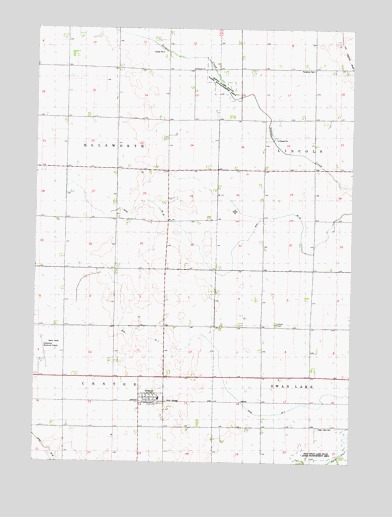
Gruver, IA USGS Topographic Map
Click on map above to begin viewing in our Map Viewer.

This topographic map contains these locations and features:
Feature Name Type Latitude Longitude GNIS ID View Map
Birge Lake (historical)LakeN43.4836°W94.6800°454644View Map
Birge Lake State Game Management AreaParkN43.4833°W94.6780°1907401View Map
City of GruverCivilN43.3931°W94.7036°2394257View Map
County Ditch Number 53CanalN43.4938°W94.6989°465661View Map
Ditch Number 40CanalN43.4377°W94.6711°1823534View Map
Ditch Number 7CanalN43.4047°W94.6775°1823533View Map
DolliverPopulated PlaceN43.4644°W94.6253°455948View Map
East Swan Lake State Games Management AreaParkN43.3777°W94.6253°456204View Map
Emmet CountyCivilN43.3780°W94.6785°465220View Map
Estherville Municipal AirportAirportN43.4041°W94.7476°466792View Map
Fisher FarmLocaleN43.4543°W94.6775°2729834View Map
Forest Ridge SchoolSchoolN43.3936°W94.7008°2720074View Map
GruverLocaleN43.3922°W94.7050°1907484View Map
GruverPopulated PlaceN43.3933°W94.7053°457174View Map
Gruver Fire Department Station 1BuildingN43.3938°W94.7051°2577339View Map
Gruver Post Office (historical)Post OfficeN43.3933°W94.7030°1907482View Map
Maple HillPopulated PlaceN43.3922°W94.6253°464641View Map
Okamanpeedam State ParkParkN43.4897°W94.6253°459813View Map
Palestine CemeteryCemeteryN43.4880°W94.6408°1823536View Map
Palestine ChurchChurchN43.4877°W94.6886°1823535View Map
Roslea Post Office (historical)Post OfficeN43.4722°W94.6586°1907408View Map
Soldier CreekStreamN43.4322°W94.6253°461741View Map
Superior Co-op Elevator - GruverLocaleN43.3933°W94.7053°1907483View Map
Swan lake CemeteryCemeteryN43.3850°W94.6380°1823532View Map
Township of CenterCivilN43.3862°W94.7380°467575View Map
Township of EllsworthCivilN43.4658°W94.7381°467787View Map
United Presbyterian ChurchChurchN43.3933°W94.7053°1907481View Map

Note: Coordinates in the location and feature list above are referenced to NAD83 datum.


Copyright (C) 2008-2024 Ryan Niemi / Sunset Dynamics ... All Rights Reserved