TopoQuest Logo
Do you find TopoQuest useful?
Help keep TopoQuest running and adding new maps/features by donating!
Bitcoin:  19c7KJd3qBynnjoSw5npx9KScwjBe4ifkT
Litecoin:  LXs6TkuXGGXo1vDsWCkWVdjQX94eUKd6ui
Home View Maps Find Maps Find Places Resources & Links


Jewell, Iowa Topographic Map

USGS Map Title: Jewell, IA
USGS Map MRC: 42093C6
DRG (GeoTIFF) Download: o42093c6.tif


Neighboring USGS Topographic Map Quads:


  Webster City, IA  
42093D7
 

  Blairsburg, IA  
42093D6
 

  Williams, IA  
42093D5
 

  Stanhope, IA  
42093C7
 

  Jewell, IA  
42093C6
 

  Ellsworth, IA  
42093C5
 

  Mackey, IA  
42093B7
 

  Ames NW, IA  
42093B6
 

  Story City, IA  
42093B5


Map MRC Location:

N43°
W94°
N43°
W93°
H8 H7 H6 H5 H4 H3 H2 H1
G8 G7 G6 G5 G4 G3 G2 G1
F8 F7 F6 F5 F4 F3 F2 F1
E8 E7 E6 E5 E4 E3 E2 E1
D8 D7 D6 D5 D4 D3 D2 D1
C8 C7 C6 C5 C4 C3 C2 C1
B8 B7 B6 B5 B4 B3 B2 B1
A8 A7 A6 A5 A4 A3 A2 A1
N42°
W94°
N42°
W93°

Jewell, IA USGS 1:24K Topographic Map Preview:
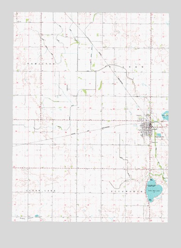
Jewell, IA USGS Topographic Map
Click on map above to begin viewing in our Map Viewer.

This topographic map contains these locations and features:
Feature Name Type Latitude Longitude GNIS ID View Map
Bethesda Lutheran ChurchChurchN42.3050°W93.6405°1996974View Map
Cairo Lake (historical)LakeN42.3447°W93.7205°465555View Map
Central Iowa Cooperative ElevatorLocaleN42.3119°W93.6424°1996964View Map
City of Jewell JunctionCivilN42.3105°W93.6400°2395471View Map
Ditch Number 114CanalN42.2841°W93.6580°465671View Map
Ditch Number 71CanalN42.3314°W93.6530°465743View Map
Evergreen CemeteryCemeteryN42.2980°W93.6397°456431View Map
Federated United Church of ChristChurchN42.3066°W93.6405°1996975View Map
Good Shepherd Catholic ChurchChurchN42.3075°W93.6430°1996972View Map
Goose LakeLakeN42.3124°W93.6259°456970View Map
Grove Branch DitchCanalN42.3519°W93.7216°457158View Map
Jewel Fire DepartmentBuildingN42.3096°W93.6396°1996965View Map
JewellPopulated PlaceN42.3069°W93.6402°457951View Map
JewellLocaleN42.3116°W93.6419°1996963View Map
Jewell City HallBuildingN42.3083°W93.6402°1996967View Map
Jewell Golf and Country ClubLocaleN42.3139°W93.6419°1996970View Map
Jewell Police DepartmentBuildingN42.3082°W93.6402°1996966View Map
Jewell Post OfficePost OfficeN42.3067°W93.6402°1996969View Map
Little Wall LakeLakeN42.2694°W93.6373°458522View Map
Little Wall Lake County ParkParkN42.2728°W93.6388°458523View Map
Lund AirportAirportN42.2605°W93.6446°2677125View Map
McFarland ClinicHospitalN42.3091°W93.6402°1996971View Map
Montgomery Memorial LibraryBuildingN42.3086°W93.6402°1996968View Map
Rahto Branch DitchCanalN42.3141°W93.7044°460503View Map
South Hamilton Elementary SchoolSchoolN42.3041°W93.6471°1996977View Map
South Hamilton Middle / High SchoolSchoolN42.3014°W93.6461°1996976View Map
Township of EllsworthCivilN42.2527°W93.6399°467788View Map
Township of LyonCivilN42.3398°W93.6400°468313View Map
Victory Christian FellowshipChurchN42.3036°W93.6430°1996973View Map

Note: Coordinates in the location and feature list above are referenced to NAD83 datum.


Copyright (C) 2008-2024 Ryan Niemi / Sunset Dynamics ... All Rights Reserved