TopoQuest Logo
Do you find TopoQuest useful?
Help keep TopoQuest running and adding new maps/features by donating!
Bitcoin:  19c7KJd3qBynnjoSw5npx9KScwjBe4ifkT
Litecoin:  LXs6TkuXGGXo1vDsWCkWVdjQX94eUKd6ui
Home View Maps Find Maps Find Places Resources & Links


Story City, Iowa Topographic Map

USGS Map Title: Story City, IA
USGS Map MRC: 42093B5
DRG (GeoTIFF) Download: o42093b5.tif


Neighboring USGS Topographic Map Quads:


  Jewell, IA  
42093C6
 

  Ellsworth, IA  
42093C5
 

  Radcliffe, IA  
42093C4
 

  Ames NW, IA  
42093B6
 

  Story City, IA  
42093B5
 

  McCallsburg, IA  
42093B4
 

  Ames West, IA  
42093A6
 

  Ames East, IA  
42093A5
 

  Nevada, IA  
42093A4


Map MRC Location:

N43°
W94°
N43°
W93°
H8 H7 H6 H5 H4 H3 H2 H1
G8 G7 G6 G5 G4 G3 G2 G1
F8 F7 F6 F5 F4 F3 F2 F1
E8 E7 E6 E5 E4 E3 E2 E1
D8 D7 D6 D5 D4 D3 D2 D1
C8 C7 C6 C5 C4 C3 C2 C1
B8 B7 B6 B5 B4 B3 B2 B1
A8 A7 A6 A5 A4 A3 A2 A1
N42°
W94°
N42°
W93°

Story City, IA USGS 1:24K Topographic Map Preview:
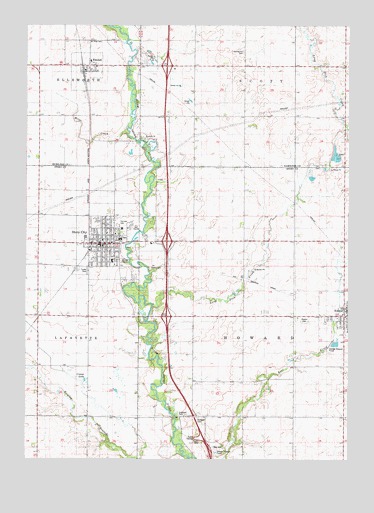
Story City, IA USGS Topographic Map
Click on map above to begin viewing in our Map Viewer.

This topographic map contains these locations and features:
Feature Name Type Latitude Longitude GNIS ID View Map
Anderson ParkParkN42.1375°W93.5666°454181View Map
Baldus CemeteryCemeteryN42.1305°W93.6085°1999489View Map
Bergen Lutheran ChurchChurchN42.1669°W93.5024°1999385View Map
Bethany ManorHospitalN42.1822°W93.5919°1999369View Map
Bethel Lutheran ChurchChurchN42.1886°W93.5938°1999367View Map
Bible Faith ChurchChurchN42.1833°W93.5980°1999366View Map
Boe CemeteryCemeteryN42.2201°W93.5868°1997008View Map
City of RandallCivilN42.2371°W93.6026°2396314View Map
City of RolandCivilN42.1660°W93.5028°2396417View Map
City of Story CityCivilN42.1866°W93.5865°2395976View Map
Comar LakeLakeN42.1478°W93.6022°455551View Map
Danish CemeteryCemeteryN42.2458°W93.6013°1997009View Map
Doolittle Prairie State PreserveParkN42.1486°W93.5891°1890343View Map
Elm Lutheran ChurchChurchN42.2383°W93.6008°1997017View Map
Fairview CemeteryCemeteryN42.1928°W93.5899°456491View Map
Fosen CemeteryCemeteryN42.2090°W93.5115°1999493View Map
Grace United Methodist ChurchChurchN42.1880°W93.5935°1999364View Map
Heise Wildlife AreaParkN42.2472°W93.5908°1996866View Map
Immanuel Lutheran ChurchChurchN42.1875°W93.5919°1999363View Map
Interchange 123CrossingN42.1664°W93.5702°1999519View Map
Interchange 124CrossingN42.1878°W93.5702°1999518View Map
Interchange 128CrossingN42.2386°W93.5710°1996996View Map
Keigley Branch BridgeBridgeN42.1372°W93.6008°1999521View Map
Long Dick CreekStreamN42.1694°W93.5760°458593View Map
Mamirelund CemeteryCemeteryN42.2428°W93.5410°458749View Map
McFarland Eye CenterHospitalN42.1900°W93.5938°1999368View Map
Miller CreekStreamN42.2189°W93.5860°459105View Map
Mount Olive CemeteryCemeteryN42.2453°W93.6019°459315View Map
Peerson CemeteryCemeteryN42.2058°W93.5722°1999492View Map
RandallLocaleN42.2372°W93.6030°1997018View Map
RandallPopulated PlaceN42.2383°W93.6008°460520View Map
Randall Post OfficePost OfficeN42.2365°W93.6024°1997016View Map
Riverbend Golf CourseLocaleN42.1911°W93.5835°1999360View Map
RolandPopulated PlaceN42.1664°W93.5019°460769View Map
Roland - Story Elementary SchoolSchoolN42.1915°W93.5877°1999526View Map
Roland - Story High SchoolSchoolN42.1886°W93.5887°1999527View Map
Roland CemeteryCemeteryN42.1655°W93.5175°1999494View Map
Roland Post OfficePost OfficeN42.1686°W93.5008°1999380View Map
Roland Post Office (historical)Post OfficeN42.1661°W93.5319°466657View Map
Roland Public LibraryBuildingN42.1680°W93.5005°1999382View Map
Roland Response TeamBuildingN42.1685°W93.5012°2599923View Map
Roland Volunteer Fire DepartmentBuildingN42.1685°W93.5002°2577193View Map
Saint Petri Lutheran ChurchChurchN42.1900°W93.5905°1999365View Map
SheffieldLocaleN42.1375°W93.5549°466198View Map
Sheffield CemeteryCemeteryN42.1369°W93.5586°461553View Map
Sheffield Post Office (historical)Post OfficeN42.1375°W93.5549°1999111View Map
Sowers CemeteryCemeteryN42.1803°W93.5774°461834View Map
Story CityPopulated PlaceN42.1872°W93.5958°462019View Map
Story CityLocaleN42.1889°W93.6002°1999362View Map
Story City Ambulance ServiceBuildingN42.1899°W93.5940°2599877View Map
Story City City HallBuildingN42.1869°W93.5966°1999355View Map
Story City Evangelical Free ChurchChurchN42.1664°W93.5019°1999381View Map
Story City Fire DepartmentBuildingN42.1863°W93.5971°1999357View Map
Story City LibraryBuildingN42.1875°W93.5969°1999358View Map
Story City North Bound Rest AreaLocaleN42.1283°W93.5530°1999520View Map
Story City Police DepartmentBuildingN42.1868°W93.5973°1999356View Map
Story City Post OfficePost OfficeN42.1875°W93.5947°1999359View Map
Township of HowardCivilN42.1661°W93.5223°468055View Map
Whispering Oaks CampgroundLocaleN42.1930°W93.5752°1999361View Map
Willow Grove Post Office (historical)Post OfficeN42.1389°W93.6013°466658View Map

Note: Coordinates in the location and feature list above are referenced to NAD83 datum.


Copyright (C) 2008-2024 Ryan Niemi / Sunset Dynamics ... All Rights Reserved