TopoQuest Logo
Do you find TopoQuest useful?
Help keep TopoQuest running and adding new maps/features by donating!
Bitcoin:  19c7KJd3qBynnjoSw5npx9KScwjBe4ifkT
Litecoin:  LXs6TkuXGGXo1vDsWCkWVdjQX94eUKd6ui
Home View Maps Find Maps Find Places Resources & Links


Joplin, Virginia Topographic Map

USGS Map Title: Joplin, VA
USGS Map MRC: 38077E4
DRG (GeoTIFF) Download: o38077e4.tif


Neighboring USGS Topographic Map Quads:


  Nokesville, VA  
38077F5
 

  Independent Hill, VA  
38077F4
 

  Occoquan, VA  
38077F3
 

  Somerville, VA  
38077E5
 

  Joplin, VA  
38077E4
 

  Quantico, VA  
38077E3
 

  Storck, VA  
38077D5
 

  Stafford, VA  
38077D4
 

  Widewater, VA  
38077D3


Map MRC Location:

N39°
W78°
N39°
W77°
H8 H7 H6 H5 H4 H3 H2 H1
G8 G7 G6 G5 G4 G3 G2 G1
F8 F7 F6 F5 F4 F3 F2 F1
E8 E7 E6 E5 E4 E3 E2 E1
D8 D7 D6 D5 D4 D3 D2 D1
C8 C7 C6 C5 C4 C3 C2 C1
B8 B7 B6 B5 B4 B3 B2 B1
A8 A7 A6 A5 A4 A3 A2 A1
N38°
W78°
N38°
W77°

Joplin, VA USGS 1:24K Topographic Map Preview:
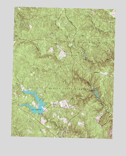
Joplin, VA USGS Topographic Map
Click on map above to begin viewing in our Map Viewer.

This topographic map contains these locations and features:
Feature Name Type Latitude Longitude GNIS ID View Map
Ashland Elementary SchoolSchoolN38.6227°W77.3944°1989930View Map
Belfair CrossroadsPopulated PlaceN38.5793°W77.4278°1495252View Map
Belle Fair Mill (historical)LocaleN38.5579°W77.4242°1749076View Map
Breckenridge ReservoirReservoirN38.5430°W77.3959°1463777View Map
Breckinridge DamDamN38.5362°W77.3916°1490896View Map
Camp Five DamDamN38.5785°W77.4114°1490742View Map
Chopawamsic (historical)Populated PlaceN38.5307°W77.4233°1749089View Map
Chopawamsic Backcounty AreaParkN38.5543°W77.4014°1940319View Map
Chopawamsic School (historical)SchoolN38.5315°W77.4233°1749090View Map
Chopawamsic TrailTrailN38.5543°W77.4014°1940320View Map
Combat VillagePopulated PlaceN38.5996°W77.4533°1495417View Map
Dumfries DistrictCivilN38.5824°W77.3961°1927306View Map
Farms to Forest TrailTrailN38.6029°W77.4100°1940313View Map
Federal Bureau of Investigation AcademySchoolN38.5290°W77.4364°1749106View Map
Flat RunStreamN38.5307°W77.4894°1466662View Map
Forest Hill School (historical)SchoolN38.5598°W77.3755°1761177View Map
Garrisons Corners (historical)Populated PlaceN38.5418°W77.4617°1749110View Map
Happyland Camp Five LakeReservoirN38.5800°W77.4116°1490743View Map
Happyland Camp Number 5LocaleN38.5760°W77.4130°1491163View Map
Hayfield School (historical)SchoolN38.6146°W77.4450°1761189View Map
Hickory Ridge TrailTrailN38.5971°W77.3792°1467989View Map
High Meadows TrailTrailN38.5829°W77.3869°1468013View Map
Hillside TerracePopulated PlaceN38.5074°W77.3760°2459052View Map
JoplinPopulated PlaceN38.5610°W77.3850°1495769View Map
KoppPopulated PlaceN38.5901°W77.4458°1477466View Map
Krukrak (historical)Populated PlaceN38.5273°W77.4905°1749123View Map
Little Mount Zion School (historical)SchoolN38.5698°W77.4428°1749124View Map
Lunga DamDamN38.5223°W77.4630°1490893View Map
Lunga ReservoirReservoirN38.5261°W77.4732°1502061View Map
Mawavi Camp Number 2LocaleN38.5812°W77.4164°1491194View Map
Mawavi Historic DistrictParkN38.5812°W77.4161°1761221View Map
Middle Branch Chopawamsic CreekStreamN38.5582°W77.4172°1474247View Map
Missouri Mill (historical)LocaleN38.5368°W77.3914°1761223View Map
MountLocaleN38.5129°W77.3894°1470794View Map
North Branch Chopawamsic CreekStreamN38.5485°W77.4005°1471579View Map
Oak Ridge CampgroundLocaleN38.5993°W77.4158°1471762View Map
Oak Ridge TrailTrailN38.5948°W77.3914°1940312View Map
Old Belle Fair (historical)Populated PlaceN38.5529°W77.4547°1749134View Map
Old Chopawamsic Church (historical)ChurchN38.5468°W77.4242°1749135View Map
Prince William Forest ParkParkN38.5858°W77.3874°1472799View Map
Quantico Fire and Emergency Services Station 33BuildingN38.5266°W77.4150°2660616View Map
Rock Hill DistrictCivilN38.5097°W77.4923°1927471View Map
Shacklet (historical)Populated PlaceN38.5321°W77.4464°1749150View Map
South Branch Chopawamsic CreekStreamN38.5421°W77.4022°1474279View Map
South Valley TrailTrailN38.5726°W77.3975°1474901View Map
Staffords Store (historical)LocaleN38.5401°W77.4914°1749160View Map
Walmsley (historical)Populated PlaceN38.5243°W77.4828°1749167View Map

Note: Coordinates in the location and feature list above are referenced to NAD83 datum.


Copyright (C) 2008-2024 Ryan Niemi / Sunset Dynamics ... All Rights Reserved