TopoQuest Logo
Do you find TopoQuest useful?
Help keep TopoQuest running and adding new maps/features by donating!
Bitcoin:  19c7KJd3qBynnjoSw5npx9KScwjBe4ifkT
Litecoin:  LXs6TkuXGGXo1vDsWCkWVdjQX94eUKd6ui
Home View Maps Find Maps Find Places Resources & Links


Kanawha, Iowa Topographic Map

USGS Map Title: Kanawha, IA
USGS Map MRC: 42093H7
DRG (GeoTIFF) Download: o42093h7.tif


Neighboring USGS Topographic Map Quads:


  Wesley, IA  
43093A8
 

  Britt, IA  
43093A7
 

  Duncan, IA  
43093A6
 

  Corwith, IA  
42093H8
 

  Kanawha, IA  
42093H7
 

  Olaf, IA  
42093H6
 

  Renwick, IA  
42093G8
 

  Kanawha SE, IA  
42093G7
 

  Cornelia, IA  
42093G6


Map MRC Location:

N43°
W94°
N43°
W93°
H8 H7 H6 H5 H4 H3 H2 H1
G8 G7 G6 G5 G4 G3 G2 G1
F8 F7 F6 F5 F4 F3 F2 F1
E8 E7 E6 E5 E4 E3 E2 E1
D8 D7 D6 D5 D4 D3 D2 D1
C8 C7 C6 C5 C4 C3 C2 C1
B8 B7 B6 B5 B4 B3 B2 B1
A8 A7 A6 A5 A4 A3 A2 A1
N42°
W94°
N42°
W93°

Kanawha, IA USGS 1:24K Topographic Map Preview:
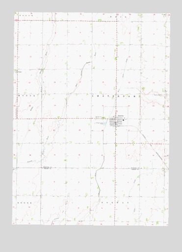
Kanawha, IA USGS Topographic Map
Click on map above to begin viewing in our Map Viewer.

This topographic map contains these locations and features:
Feature Name Type Latitude Longitude GNIS ID View Map
Christian Reformed ChurchChurchN42.9361°W93.7919°1926048View Map
City of KanawhaCivilN42.9342°W93.7932°2395487View Map
Cuba Post Office (historical)Post OfficeN42.9944°W93.7919°1925984View Map
DenhartPopulated PlaceN42.9661°W93.8722°464516View Map
Drainage Ditch Number 107CanalN42.8780°W93.8422°465759View Map
KanawhaLocaleN42.9333°W93.7924°1926045View Map
KanawhaPopulated PlaceN42.9377°W93.7933°458021View Map
Kanawha Christian SchoolSchoolN42.9382°W93.7864°1926052View Map
Kanawha Community Nursing HomeHospitalN42.9391°W93.7949°1926047View Map
Kanawha Fire DepartmentBuildingN42.9340°W93.7936°1926040View Map
Kanawha First Responder UnitBuildingN42.9340°W93.7936°2599946View Map
Kanawha Lutheran ChurchChurchN42.9372°W93.7947°1926049View Map
Kanawha Medical ClinicHospitalN42.9347°W93.7933°1926046View Map
Kanawha Post OfficePost OfficeN42.9361°W93.7930°1926042View Map
Kanawha Public LibraryBuildingN42.9350°W93.7930°1926043View Map
Liberty School MuseumBuildingN42.9391°W93.7961°1926044View Map
Middle Branch Boone RiverStreamN42.9114°W93.8716°459027View Map
Mikesville Post Office (historical)Post OfficeN42.9227°W93.8336°1925975View Map
New Amsterdam Township CemeteryCemeteryN42.9383°W93.8030°1926054View Map
North Central Cooperative ElevatorLocaleN42.9341°W93.7952°1926041View Map
Old Amsterdam CemeteryCemeteryN42.9521°W93.7570°1926053View Map
Township of AmsterdamCivilN42.9519°W93.7933°467395View Map
United Methodist ChurchChurchN42.9375°W93.7936°1926050View Map
West Hancock Middle SchoolSchoolN42.9372°W93.7867°1926051View Map

Note: Coordinates in the location and feature list above are referenced to NAD83 datum.


Copyright (C) 2008-2024 Ryan Niemi / Sunset Dynamics ... All Rights Reserved