TopoQuest Logo
Do you find TopoQuest useful?
Help keep TopoQuest running and adding new maps/features by donating!
Bitcoin:  19c7KJd3qBynnjoSw5npx9KScwjBe4ifkT
Litecoin:  LXs6TkuXGGXo1vDsWCkWVdjQX94eUKd6ui
Home View Maps Find Maps Find Places Resources & Links


Kenbridge East, Virginia Topographic Map

USGS Map Title: Kenbridge East, VA
USGS Map MRC: 36078H1
DRG (GeoTIFF) Download: o36078h1.tif


Neighboring USGS Topographic Map Quads:


  Rubermont, VA  
37078A2
 

  Blackstone West, VA  
37078A1
 

  Blackstone East, VA  
37077A8
 

  Kenbridge West, VA  
36078H2
 

  Kenbridge East, VA  
36078H1
 

  Danieltown, VA  
36077H8
 

  North View, VA  
36078G2
 

  Forksville, VA  
36078G1
 

  Alberta, VA  
36077G8


Map MRC Location:

N37°
W79°
N37°
W78°
H8 H7 H6 H5 H4 H3 H2 H1
G8 G7 G6 G5 G4 G3 G2 G1
F8 F7 F6 F5 F4 F3 F2 F1
E8 E7 E6 E5 E4 E3 E2 E1
D8 D7 D6 D5 D4 D3 D2 D1
C8 C7 C6 C5 C4 C3 C2 C1
B8 B7 B6 B5 B4 B3 B2 B1
A8 A7 A6 A5 A4 A3 A2 A1
N36°
W79°
N36°
W78°

Kenbridge East, VA USGS 1:24K Topographic Map Preview:
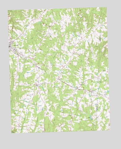
Kenbridge East, VA USGS Topographic Map
Click on map above to begin viewing in our Map Viewer.

This topographic map contains these locations and features:
Feature Name Type Latitude Longitude GNIS ID View Map
Asbury School (historical)SchoolN36.8757°W78.0836°1492127View Map
Bishops CornerPopulated PlaceN36.9235°W78.0894°1477117View Map
Cedar Creek ChurchChurchN36.9538°W78.0439°1464602View Map
Dixon MillpondReservoirN36.8887°W78.0241°1490353View Map
Dixons DamDamN36.8868°W78.0231°1490352View Map
DundasPopulated PlaceN36.9149°W78.0217°1477284View Map
Dundas Post OfficePost OfficeN36.9152°W78.0218°2766193View Map
Fletchers ChapelChurchN36.9813°W78.0719°1466710View Map
Friendship ChurchChurchN36.8760°W78.0836°1492154View Map
Gulifield ChurchChurchN36.9440°W78.0914°1467594View Map
Hounds Creek DistrictCivilN36.9857°W78.0916°1927344View Map
KenbridgePopulated PlaceN36.9621°W78.1250°1495781View Map
Kenbridge Baptist ChurchChurchN36.9596°W78.1186°1493950View Map
Kenbridge Elementary SchoolSchoolN36.9673°W78.1230°2499239View Map
Kenbridge Emergency SquadBuildingN36.9535°W78.1047°2331915View Map
Kenbridge Emergency SquadBuildingN36.9533°W78.1039°2086151View Map
Kenbridge Police DepartmentBuildingN36.9599°W78.1174°2086153View Map
Kenbridge Post OfficePost OfficeN36.9625°W78.1234°1492166View Map
Kenbridge United Methodist ChurchChurchN36.9629°W78.1231°1493951View Map
Lunenburg Country ClubLocaleN36.9518°W78.1036°1491189View Map
Macedonia CemeteryCemeteryN36.9357°W78.0067°1494004View Map
Macedonia ChurchChurchN36.9354°W78.0067°1469969View Map
Manson CemeteryCemeteryN36.8924°W78.0750°1492179View Map
Marshall CemeteryCemeteryN36.8857°W78.0997°1492180View Map
Oak Grove ChurchChurchN36.9979°W78.0811°1471711View Map
Perserverance ChurchChurchN36.9224°W78.0353°1472216View Map
Providence ChurchChurchN36.8990°W78.0797°1472820View Map
Providence Church (historical)ChurchN36.9285°W78.0622°1492203View Map
Rosebud ChurchChurchN36.8907°W78.0483°1473543View Map
Saint Marks ChurchChurchN36.8913°W78.0428°1473821View Map
Seay CreekStreamN36.9940°W78.0253°1474133View Map
Starlight ChurchChurchN36.9835°W78.1022°1475079View Map
Varicks ChapelChurchN36.9924°W78.0339°1476151View Map
Wilkinson CemeteryCemeteryN36.8943°W78.0592°1492234View Map

Note: Coordinates in the location and feature list above are referenced to NAD83 datum.


Copyright (C) 2008-2024 Ryan Niemi / Sunset Dynamics ... All Rights Reserved