TopoQuest Logo
Do you find TopoQuest useful?
Help keep TopoQuest running and adding new maps/features by donating!
Bitcoin:  19c7KJd3qBynnjoSw5npx9KScwjBe4ifkT
Litecoin:  LXs6TkuXGGXo1vDsWCkWVdjQX94eUKd6ui
Home View Maps Find Maps Find Places Resources & Links


Lafayette East, Indiana Topographic Map

USGS Map Title: Lafayette East, IN
USGS Map MRC: 40086D7
DRG (GeoTIFF) Download: o40086d7.tif


Neighboring USGS Topographic Map Quads:


  Brookston SW, IN  
40086E8
 

  Brookston, IN  
40086E7
 

  Delphi, IN  
40086E6
 

  Lafayette West, IN  
40086D8
 

  Lafayette East, IN  
40086D7
 

  Pyrmont, IN  
40086D6
 

  Romney, IN  
40086C8
 

  Stockwell, IN  
40086C7
 

  Mulberry, IN  
40086C6


Map MRC Location:

N41°
W87°
N41°
W86°
H8 H7 H6 H5 H4 H3 H2 H1
G8 G7 G6 G5 G4 G3 G2 G1
F8 F7 F6 F5 F4 F3 F2 F1
E8 E7 E6 E5 E4 E3 E2 E1
D8 D7 D6 D5 D4 D3 D2 D1
C8 C7 C6 C5 C4 C3 C2 C1
B8 B7 B6 B5 B4 B3 B2 B1
A8 A7 A6 A5 A4 A3 A2 A1
N40°
W87°
N40°
W86°

Lafayette East, IN USGS 1:24K Topographic Map Preview:
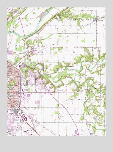
Lafayette East, IN USGS Topographic Map
Click on map above to begin viewing in our Map Viewer.

This topographic map contains these locations and features:
Feature Name Type Latitude Longitude GNIS ID View Map
Altamont SwitchPopulated PlaceN40.3786°W86.8745°430119View Map
Americare Ambulance Service - LafayetteBuildingN40.4232°W86.8522°2719368View Map
Aretz Airport (historical)AirportN40.4603°W86.8347°449239View Map
Ayr-Way Lafayette Shopping CenterLocaleN40.3920°W86.8500°449439View Map
Bennett's GreenhouseBuildingN40.4017°W86.8403°2649881View Map
Bethany ChurchChurchN40.4331°W86.8625°430874View Map
BirminghamPopulated PlaceN40.4686°W86.8528°448389View Map
Buck CreekPopulated PlaceN40.4878°W86.7614°449626View Map
Buck Creek Census Designated PlaceCensusN40.4875°W86.7622°2583446View Map
Burnett CreekStreamN40.4767°W86.8731°431850View Map
Cary CampParkN40.4209°W86.7828°432203View Map
Christ Memorial TempleChurchN40.4242°W86.8383°432495View Map
City of LafayetteCivilN40.3990°W86.8592°2395583View Map
Columbian ParkParkN40.4134°W86.8706°432823View Map
Crouch Elementary SchoolSchoolN40.4242°W86.8533°433200View Map
Dayton Elementary SchoolSchoolN40.3770°W86.7681°447591View Map
DelpPopulated PlaceN40.4895°W86.8092°433460View Map
Dry RunStreamN40.4620°W86.8542°433726View Map
East Tipp Middle SchoolSchoolN40.4602°W86.7613°433937View Map
EastwitchPopulated PlaceN40.4270°W86.8500°433957View Map
Elliott DitchCanalN40.3778°W86.8639°434101View Map
Grace ChurchChurchN40.4234°W86.8711°1964932View Map
Halsmer Airport (historical)AirportN40.3934°W86.8064°449238View Map
Hollywood CemeteryCemeteryN40.4900°W86.7613°436332View Map
Home Hospital (historical)HospitalN40.4180°W86.8692°2660446View Map
Interchange 168CrossingN40.3764°W86.7847°1964930View Map
Interchange 172CrossingN40.4175°W86.8208°1964931View Map
Interchange 175CrossingN40.4561°W86.8478°1964933View Map
Interchange 178CrossingN40.4967°W86.8683°1964934View Map
Kingdom Hall ChurchChurchN40.4028°W86.8697°437327View Map
Knights of Pythias HomeBuildingN40.4014°W86.8745°437393View Map
Lafayette Fire Department Station 5BuildingN40.4246°W86.8397°2625602View Map
Lafayette Fire Department Station 6BuildingN40.4437°W86.8652°2626392View Map
Lafayette Fire Department Station 9BuildingN40.3916°W86.8108°2626393View Map
Lafayette Fire Department Training CenterBuildingN40.3908°W86.8102°2626333View Map
Lafayette Post OfficePost OfficeN40.4187°W86.8540°2768082View Map
Longlois SchoolSchoolN40.4409°W86.8736°438291View Map
Mar-Jean Shopping CenterLocaleN40.4184°W86.8608°438590View Map
Market Square Shopping CenterLocaleN40.4309°W86.8720°438622View Map
MeadowbrookPopulated PlaceN40.4203°W86.8097°1964928View Map
Middle Fork Wildcat CreekStreamN40.4236°W86.7708°439105View Map
MonitorPopulated PlaceN40.4198°W86.7564°439326View Map
Monitor SchoolSchoolN40.4248°W86.7567°439327View Map
Monitor SpringsSpringN40.4198°W86.7717°439328View Map
Murdock ParkParkN40.4228°W86.8747°439886View Map
North Union CemeteryCemeteryN40.4925°W86.8106°440303View Map
Oakland Elementary SchoolSchoolN40.4106°W86.8717°440473View Map
Rest Haven Memorial ParkCemeteryN40.4301°W86.8593°441914View Map
Saint Boniface CemeteryCemeteryN40.4461°W86.8618°442504View Map
Sheffield Township Volunteer Fire DepartmentBuildingN40.3759°W86.7673°2626480View Map
South Fork Wildcat CreekStreamN40.4375°W86.8017°443814View Map
Spring Vale CemeteryCemeteryN40.4497°W86.8608°444018View Map
Sunnyside Junior High SchoolSchoolN40.4214°W86.8689°444419View Map
Swisher - Hurtz CemeteryCemeteryN40.4825°W86.8506°444501View Map
TecumsehPopulated PlaceN40.3928°W86.8683°444613View Map
Tecumseh Junior High SchoolSchoolN40.3967°W86.8742°444614View Map
Tippecanoe Conservation ClubLocaleN40.4553°W86.8533°452403View Map
Town of DaytonCivilN40.3758°W86.7746°2396681View Map
Township of FairfieldCivilN40.4280°W86.8558°453286View Map
Township of PerryCivilN40.4318°W86.7524°453725View Map
Township SchoolSchoolN40.3770°W86.7678°1964929View Map
Union CemeteryCemeteryN40.4470°W86.7668°445064View Map
Vinton Elementary SchoolSchoolN40.4345°W86.8625°445309View Map
Washington Township Buck Creek Fire DepartmentBuildingN40.4876°W86.7629°2625643View Map
WASK-FM (Lafayette)TowerN40.4023°W86.8497°449030View Map
Wildcat Air Landing Area (historical)AirportN40.4348°W86.7653°449240View Map
Wildcat CreekStreamN40.4717°W86.8583°446017View Map
WJEF-FM (Lafayette)TowerN40.3978°W86.8739°449031View Map
WXVW-AM (Lafayette)TowerN40.4023°W86.8497°448431View Map

Note: Coordinates in the location and feature list above are referenced to NAD83 datum.


Copyright (C) 2008-2024 Ryan Niemi / Sunset Dynamics ... All Rights Reserved