TopoQuest Logo
Do you find TopoQuest useful?
Help keep TopoQuest running and adding new maps/features by donating!
Bitcoin:  19c7KJd3qBynnjoSw5npx9KScwjBe4ifkT
Litecoin:  LXs6TkuXGGXo1vDsWCkWVdjQX94eUKd6ui
Home View Maps Find Maps Find Places Resources & Links


Lake Annie, California Topographic Map

USGS Map Title: Lake Annie, CA
USGS Map MRC: 41120H1
DRG (GeoTIFF) Download: o41120h1.tif


Neighboring USGS Topographic Map Quads:


  Crane Mountain, OR  
42120A2
 

  Collins Rim, OR  
42120A1
 

  May Lake, OR  
42119A8
 

  Mount Bidwell, CA  
41120H2
 

  Lake Annie, CA  
41120H1
 

  Barrel Springs, NV  
41119H8
 

  Fort Bidwell, CA  
41120G2
 

  Larkspur Hills, CA  
41120G1
 

  Crooks Meadow, NV  
41119G8


Map MRC Location:

N42°
W121°
N42°
W120°
H8 H7 H6 H5 H4 H3 H2 H1
G8 G7 G6 G5 G4 G3 G2 G1
F8 F7 F6 F5 F4 F3 F2 F1
E8 E7 E6 E5 E4 E3 E2 E1
D8 D7 D6 D5 D4 D3 D2 D1
C8 C7 C6 C5 C4 C3 C2 C1
B8 B7 B6 B5 B4 B3 B2 B1
A8 A7 A6 A5 A4 A3 A2 A1
N41°
W121°
N41°
W120°

Lake Annie, CA USGS 1:24K Topographic Map Preview:
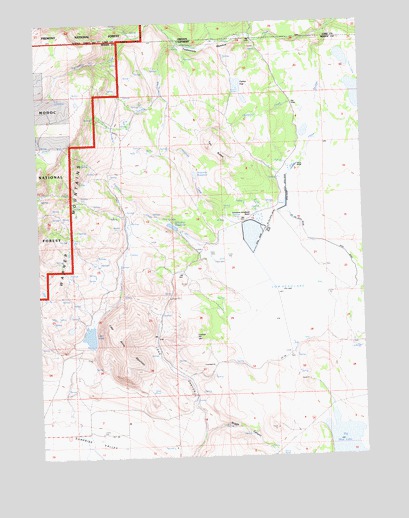
Lake Annie, CA USGS Topographic Map
Click on map above to begin viewing in our Map Viewer.

This topographic map contains these locations and features:
Feature Name Type Latitude Longitude GNIS ID View Map
Briggs CanyonValleyN41.8827°W120.0586°257458View Map
Cow Head LakeLakeN41.9193°W120.0322°258809View Map
Cow Head SloughStreamN41.9973°W120.0134°1140287View Map
Eightmile CreekStreamN41.9396°W120.0538°259802View Map
Elevenmile CreekStreamN41.9757°W120.0174°259838View Map
Fifteenmile CreekStreamN41.9985°W120.0152°1142088View Map
Lake AnnieLakeN41.9097°W120.1067°256265View Map
Lake Annie MountainSummitN41.9082°W120.0958°262279View Map
Long CanyonValleyN41.8835°W120.0633°262824View Map
Ninemile CreekStreamN41.9432°W120.0547°264097View Map
Ninemile ReservoirReservoirN41.9559°W120.0652°252606View Map
North Fork Twelvemile CreekStreamN41.9966°W120.0905°1147014View Map
Peterson DitchCanalN41.9671°W120.0949°264670View Map
Scammons Arrowhead RanchLocaleN41.9443°W120.0436°265897View Map
Schadler 1122 DamDamN41.9407°W120.0716°1664250View Map
Schadler DitchCanalN41.9641°W120.1211°265903View Map
Schadler ReservoirReservoirN41.9407°W120.0716°252607View Map
Tenmile CreekStreamN41.9938°W120.0711°268142View Map
Twelvemile MeadowFlatN41.9924°W120.0613°252608View Map
Twin LakesSwampN41.9787°W120.0023°268536View Map
Two ButtesSummitN41.9629°W120.0569°1660062View Map

Note: Coordinates in the location and feature list above are referenced to NAD83 datum.


Copyright (C) 2008-2024 Ryan Niemi / Sunset Dynamics ... All Rights Reserved