TopoQuest Logo
Do you find TopoQuest useful?
Help keep TopoQuest running and adding new maps/features by donating!
Bitcoin:  19c7KJd3qBynnjoSw5npx9KScwjBe4ifkT
Litecoin:  LXs6TkuXGGXo1vDsWCkWVdjQX94eUKd6ui
Home View Maps Find Maps Find Places Resources & Links


May Lake, Oregon Topographic Map

USGS Map Title: May Lake, OR
USGS Map MRC: 42119A8
DRG (GeoTIFF) Download: o42119a8.tif


Neighboring USGS Topographic Map Quads:


  Sage Hen Butte, OR  
42120B1
 

  Adel, OR  
42119B8
 

  Calderwood Reservoir, OR  
42119B7
 

  Collins Rim, OR  
42120A1
 

  May Lake, OR  
42119A8
 

  Coleman Lake, OR  
42119A7
 

  Lake Annie, CA  
41120H1
 

  Barrel Springs, NV  
41119H8
 

  Little Coleman Canyon, NV  
41119H7


Map MRC Location:

N43°
W120°
N43°
W119°
H8 H7 H6 H5 H4 H3 H2 H1
G8 G7 G6 G5 G4 G3 G2 G1
F8 F7 F6 F5 F4 F3 F2 F1
E8 E7 E6 E5 E4 E3 E2 E1
D8 D7 D6 D5 D4 D3 D2 D1
C8 C7 C6 C5 C4 C3 C2 C1
B8 B7 B6 B5 B4 B3 B2 B1
A8 A7 A6 A5 A4 A3 A2 A1
N42°
W120°
N42°
W119°

May Lake, OR USGS 1:24K Topographic Map Preview:
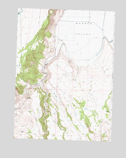
May Lake, OR USGS Topographic Map
Click on map above to begin viewing in our Map Viewer.

This topographic map contains these locations and features:
Feature Name Type Latitude Longitude GNIS ID View Map
Cattle Guard SpringSpringN42.0389°W119.9842°1118702View Map
Cork Reservoir Number SevenReservoirN42.0583°W119.9448°1161729View Map
Expand Reservoir Number ThirtyReservoirN42.0220°W119.8840°1131215View Map
Hahilly Reservoir Number FourReservoirN42.0469°W119.9353°1163882View Map
Horse CreekStreamN42.0317°W119.9600°841087View Map
James Dyke PlaceLocaleN42.0802°W119.9522°1639008View Map
Lucky ReservoirReservoirN42.1201°W119.9982°1145665View Map
May LakeLakeN42.0428°W119.9484°1123866View Map
Six Pack Reservoir Number FourReservoirN42.0298°W119.9387°1131214View Map
South Warner RimRidgeN42.1021°W119.9747°1127357View Map
Spearpoint SpringSpringN42.0289°W119.8784°1127378View Map
Surveyor SpringSpringN42.0067°W119.9870°1127767View Map
Twelvemile CreekLakeN42.0455°W119.9600°1151544View Map
Twentymile CreekLakeN42.0636°W119.9616°1151549View Map
Warner Lake (historical)LocaleN42.0818°W119.9511°1131213View Map
Warner Lake Post Office (historical)Post OfficeN42.0818°W119.9511°1166127View Map
Warner ValleyValleyN42.0777°W119.9249°1128667View Map
Y SpringSpringN42.0281°W119.9973°1129345View Map

Note: Coordinates in the location and feature list above are referenced to NAD83 datum.


Copyright (C) 2008-2024 Ryan Niemi / Sunset Dynamics ... All Rights Reserved