TopoQuest Logo
Do you find TopoQuest useful?
Help keep TopoQuest running and adding new maps/features by donating!
Bitcoin:  19c7KJd3qBynnjoSw5npx9KScwjBe4ifkT
Litecoin:  LXs6TkuXGGXo1vDsWCkWVdjQX94eUKd6ui
Home View Maps Find Maps Find Places Resources & Links


Lake Geneva, Michigan Topographic Map

USGS Map Title: Lake Geneva, MI
USGS Map MRC: 45084B2
DRG (GeoTIFF) Download: o45084b2.tif


Neighboring USGS Topographic Map Quads:


  Tower, MI  
45084C3
 

  Onaway, MI  
45084C2
 

  Millersburg, MI  
45084C1
 

  Silver Lake, MI  
45084B3
 

  Lake Geneva, MI  
45084B2
 

  Cranberry Lake, MI  
45084B1
 

  Hetherton, MI  
45084A3
 

  Atlanta, MI  
45084A2
 

  Atlanta SE, MI  
45084A1


Map MRC Location:

N46°
W85°
N46°
W84°
H8 H7 H6 H5 H4 H3 H2 H1
G8 G7 G6 G5 G4 G3 G2 G1
F8 F7 F6 F5 F4 F3 F2 F1
E8 E7 E6 E5 E4 E3 E2 E1
D8 D7 D6 D5 D4 D3 D2 D1
C8 C7 C6 C5 C4 C3 C2 C1
B8 B7 B6 B5 B4 B3 B2 B1
A8 A7 A6 A5 A4 A3 A2 A1
N45°
W85°
N45°
W84°

Lake Geneva, MI USGS 1:24K Topographic Map Preview:
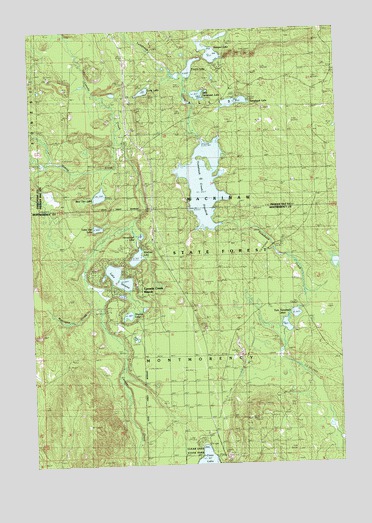
Lake Geneva, MI USGS Topographic Map
Click on map above to begin viewing in our Map Viewer.

This topographic map contains these locations and features:
Feature Name Type Latitude Longitude GNIS ID View Map
Bear Den LakeLakeN45.2026°W84.2221°620843View Map
Canada Creek Post Office (historical)Post OfficeN45.1720°W84.2081°1926646View Map
Canada Creek RanchLocaleN45.1742°W84.2064°622676View Map
Canada Creek RanchPopulated PlaceN45.1720°W84.2081°1852241View Map
Canada Creek Ranch Census Designated PlaceCensusN45.1750°W84.2074°2393363View Map
Clear Lake State ParkParkN45.1278°W84.1833°2100159View Map
Francis LakeLakeN45.2385°W84.1852°626396View Map
Horsehead LakeLakeN45.1909°W84.2060°628600View Map
Lake GenevaLakeN45.1790°W84.2148°626729View Map
Little Joe LakeLakeN45.1932°W84.2231°1618843View Map
Little Tomahawk LakeLakeN45.2312°W84.1809°630796View Map
Long LakeLakeN45.2322°W84.2034°630947View Map
Montague CreekStreamN45.1739°W84.2217°632589View Map
Mud LakeLakeN45.2036°W84.1778°633014View Map
Oxbow CreekStreamN45.2186°W84.2142°634259View Map
Presque Isle North Lookout TowerTowerN45.2245°W84.2042°1623585View Map
Presque Isle South Lookout TowerTowerN45.1381°W84.1620°1623586View Map
Shoepac LakeLakeN45.2445°W84.1745°637830View Map
Shoepac Lake State Forest CampgroundLocaleN45.2392°W84.1725°2374314View Map
Spring LakeLakeN45.2022°W84.1714°638588View Map
Tomahawk Creek FloodingReservoirN45.2058°W84.1792°630704View Map
Tomahawk Creek Flooding State Forest CampgroundLocaleN45.1994°W84.1869°2374313View Map
Tomahawk LakeLakeN45.2290°W84.1665°1614937View Map
Tomahawk Lake State Forest CampgroundLocaleN45.2308°W84.1650°2374315View Map
Twin Tomahawk LakesLakeN45.1635°W84.1447°1615286View Map
Virginia LakeLakeN45.1680°W84.2113°1618854View Map
WCML-FM (Alpena)TowerN45.1381°W84.1622°1625652View Map
WCML-TV (Alpena)TowerN45.1381°W84.1622°1625766View Map
Wildfowl LakeLakeN45.1847°W84.2074°1618860View Map
WPHN-FM (Gaylord)TowerN45.1381°W84.1622°1625697View Map

Note: Coordinates in the location and feature list above are referenced to NAD83 datum.


Copyright (C) 2008-2024 Ryan Niemi / Sunset Dynamics ... All Rights Reserved