TopoQuest Logo
Do you find TopoQuest useful?
Help keep TopoQuest running and adding new maps/features by donating!
Bitcoin:  19c7KJd3qBynnjoSw5npx9KScwjBe4ifkT
Litecoin:  LXs6TkuXGGXo1vDsWCkWVdjQX94eUKd6ui
Home View Maps Find Maps Find Places Resources & Links


Lake View, Iowa Topographic Map

USGS Map Title: Lake View, IA
USGS Map MRC: 42095C1
DRG (GeoTIFF) Download: o42095c1.tif


Neighboring USGS Topographic Map Quads:


  Early, IA  
42095D2
 

  Sac City West, IA  
42095D1
 

  Sac City East, IA  
42094D8
 

  Odebolt East, IA  
42095C2
 

  Lake View, IA  
42095C1
 

  Grant City, IA  
42094C8
 

  Boyer, IA  
42095B2
 

  Vail NE, IA  
42095B1
 

  Breda, IA  
42094B8


Map MRC Location:

N43°
W96°
N43°
W95°
H8 H7 H6 H5 H4 H3 H2 H1
G8 G7 G6 G5 G4 G3 G2 G1
F8 F7 F6 F5 F4 F3 F2 F1
E8 E7 E6 E5 E4 E3 E2 E1
D8 D7 D6 D5 D4 D3 D2 D1
C8 C7 C6 C5 C4 C3 C2 C1
B8 B7 B6 B5 B4 B3 B2 B1
A8 A7 A6 A5 A4 A3 A2 A1
N42°
W96°
N42°
W95°

Lake View, IA USGS 1:24K Topographic Map Preview:
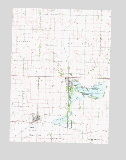
Lake View, IA USGS Topographic Map
Click on map above to begin viewing in our Map Viewer.

This topographic map contains these locations and features:
Feature Name Type Latitude Longitude GNIS ID View Map
Andy Williams BirthplaceLocaleN42.2711°W95.0903°1982937View Map
Arrowhead LakeReservoirN42.2992°W95.0439°454243View Map
Black Hawk LakeReservoirN42.2983°W95.0255°454657View Map
Black Hawk Lake Wildlife Management AreaParkN42.2950°W95.0503°454658View Map
Black Hawk Life Care CenterHospitalN42.3066°W95.0533°1982984View Map
Black Hawk MarshSwampN42.2675°W95.0475°454660View Map
Black Hawk Marsh State Game Management AreaParkN42.2678°W95.0469°1823195View Map
Black Hawk State ParkParkN42.2936°W95.0236°454659View Map
Camp CrescentLocaleN42.3078°W95.0419°1823203View Map
CarnarvonPopulated PlaceN42.2536°W95.0217°455175View Map
CarnarvonLocaleN42.2597°W95.0147°1983026View Map
Carnarvon Post OfficePost OfficeN42.2536°W95.0217°1983027View Map
Chief Black Hawk StatueParkN42.3083°W95.0419°1982994View Map
City of Lake ViewCivilN42.3047°W95.0408°2395604View Map
City of Wall LakeCivilN42.2672°W95.0928°2397177View Map
Cottonwood PointCapeN42.2958°W95.0233°1823196View Map
Drainage Ditch 60CanalN42.3025°W95.0869°455998View Map
Drainage Ditch 71CanalN42.3705°W95.0739°456002View Map
Drillings PointCapeN42.3047°W95.0142°1823197View Map
East Sac County Elementary School - Wall LakeSchoolN42.2714°W95.0952°1982950View Map
East Sac County High SchoolSchoolN42.3105°W95.0562°1983025View Map
Emmanuel Presbyterian ChurchChurchN42.2536°W95.0217°1983028View Map
Farmers Cooperative Company ElevatorLocaleN42.3066°W95.0533°1982980View Map
Ferguson CemeteryCemeteryN42.3141°W95.0136°456574View Map
George Washington Memorial Forest Historical MarkerParkN42.3000°W95.0497°1983029View Map
Gun Shot HillSummitN42.2986°W95.0397°1823200View Map
Home Elevator Company ElevatorLocaleN42.2711°W95.0930°1982935View Map
Hunters PointCapeN42.3005°W95.0408°1823201View Map
Ice House PointCapeN42.3039°W95.0394°1823202View Map
Lake ViewPopulated PlaceN42.3116°W95.0533°463546View Map
Lake View (historical)LocaleN42.3064°W95.0503°1982988View Map
Lake View City LibraryBuildingN42.3050°W95.0519°1982977View Map
Lake View Family Chiropractic CenterHospitalN42.3066°W95.0533°1982983View Map
Lake View Family Dentistry CenterHospitalN42.3066°W95.0533°1982985View Map
Lake View Fire DepartmentBuildingN42.3064°W95.0503°1982979View Map
Lake View MuseumBuildingN42.3066°W95.0533°1982981View Map
Lake View Police DepartmentBuildingN42.3061°W95.0519°1982978View Map
Lake View Post OfficePost OfficeN42.3066°W95.0533°1982982View Map
LakeviewPopulated PlaceN42.3069°W95.0517°458203View Map
Lakewood PointCapeN42.2991°W95.0283°1823198View Map
Lutheran ChurchChurchN42.3066°W95.0533°1982992View Map
McFarland ClinicHospitalN42.3066°W95.0533°1982986View Map
Mercer (historical)LocaleN42.2583°W95.0308°1982888View Map
Mercer Post Office (historical)Post OfficeN42.2583°W95.0308°1982887View Map
Peace Lutheran ChurchChurchN42.2739°W95.0947°1982945View Map
Provost BayReservoirN42.2933°W95.0328°460467View Map
Provost PointCapeN42.2978°W95.0344°1823199View Map
Rock Vision ClinicHospitalN42.3066°W95.0533°1982987View Map
Sac City Junction (historical)Populated PlaceN42.2680°W95.0730°464118View Map
Sac County Ambulance Lake ViewBuildingN42.3045°W95.0513°2599967View Map
Saint Joseph Catholic ChurchChurchN42.2747°W95.0911°1982948View Map
Tomahawk Marsh Wildlife Management AreaParkN42.3639°W95.0475°1982877View Map
Township of ViolaCivilN42.2535°W95.0328°468874View Map
Township of Wall LakeCivilN42.3412°W95.0320°468879View Map
Trimark Physicians Group BuildingHospitalN42.3053°W95.0519°1982990View Map
Trinity Presbyterian ChurchChurchN42.2764°W95.0953°1982946View Map
United Church of ChristChurchN42.3053°W95.0525°1982993View Map
United Methodist ChurchChurchN42.3066°W95.0533°1982989View Map
Victory Baptist ChurchChurchN42.3066°W95.0533°1982991View Map
Wall LakePopulated PlaceN42.2711°W95.0930°462614View Map
Wall LakeLocaleN42.2694°W95.0919°1982949View Map
Wall Lake Baptist ChurchChurchN42.2717°W95.0903°1982947View Map
Wall Lake CemeteryCemeteryN42.2758°W95.0808°462615View Map
Wall Lake Chiropractic CenterHospitalN42.2703°W95.0919°1982944View Map
Wall Lake City Police DepartmentBuildingN42.2708°W95.0930°1982940View Map
Wall Lake Community BuildingBuildingN42.2708°W95.0930°1982939View Map
Wall Lake Fire and RescueBuildingN42.2709°W95.0913°1982938View Map
Wall Lake LibraryBuildingN42.2708°W95.0925°1982941View Map
Wall Lake OutletCanalN42.2966°W95.0025°462617View Map
Wall Lake Post OfficePost OfficeN42.2700°W95.0933°1982942View Map
Wall Lake Saint Anthony Medical ClinicHospitalN42.2703°W95.0919°1982943View Map

Note: Coordinates in the location and feature list above are referenced to NAD83 datum.


Copyright (C) 2008-2024 Ryan Niemi / Sunset Dynamics ... All Rights Reserved