TopoQuest Logo
Do you find TopoQuest useful?
Help keep TopoQuest running and adding new maps/features by donating!
Bitcoin:  19c7KJd3qBynnjoSw5npx9KScwjBe4ifkT
Litecoin:  LXs6TkuXGGXo1vDsWCkWVdjQX94eUKd6ui
Home View Maps Find Maps Find Places Resources & Links


Lakefield NE, Minnesota Topographic Map

USGS Map Title: Lakefield NE, MN
USGS Map MRC: 43095F1
DRG (GeoTIFF) Download: o43095f1.tif


Neighboring USGS Topographic Map Quads:


  Wilder, MN  
43095G2
 

  Windom, MN  
43095G1
 

  Bergen, MN  
43094G8
 

  Lakefield, MN  
43095F2
 

  Lakefield NE, MN  
43095F1
 

  Jackson NW, MN  
43094F8
 

  Lakefield SW, MN  
43095E2
 

  Lakefield SE, MN  
43095E1
 

  Jackson, MN  
43094E8


Map MRC Location:

N44°
W96°
N44°
W95°
H8 H7 H6 H5 H4 H3 H2 H1
G8 G7 G6 G5 G4 G3 G2 G1
F8 F7 F6 F5 F4 F3 F2 F1
E8 E7 E6 E5 E4 E3 E2 E1
D8 D7 D6 D5 D4 D3 D2 D1
C8 C7 C6 C5 C4 C3 C2 C1
B8 B7 B6 B5 B4 B3 B2 B1
A8 A7 A6 A5 A4 A3 A2 A1
N43°
W96°
N43°
W95°

Lakefield NE, MN USGS 1:24K Topographic Map Preview:
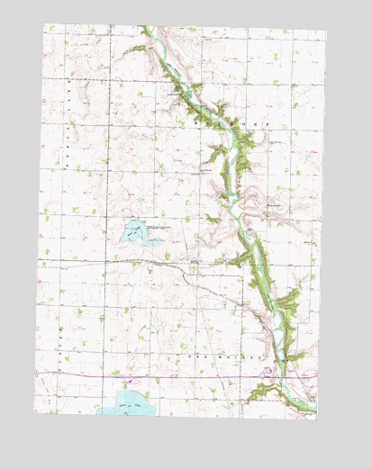
Lakefield NE, MN USGS Topographic Map
Click on map above to begin viewing in our Map Viewer.

This topographic map contains these locations and features:
Feature Name Type Latitude Longitude GNIS ID View Map
Belmont ChurchChurchN43.7027°W95.0547°639900View Map
Boot LakeLakeN43.6838°W95.0830°640374View Map
Bootleg State Wildlife Management AreaParkN43.6844°W95.0778°640381View Map
Clear LakeLakeN43.6267°W95.0839°641299View Map
Clear Lake East Bound Rest AreaLocaleN43.6361°W95.0836°2048820View Map
Des Moines River West Bound Rest AreaLocaleN43.6405°W95.0203°2048819View Map
Doctor Tubola Detention Structure DamDamN43.6900°W95.0236°1777220View Map
East Belmont CemeteryCemeteryN43.7135°W95.0242°643047View Map
First Baptist ChurchChurchN43.6275°W95.0092°2048733View Map
Government Ditches - the Draining of Minnesota Historical MarkerParkN43.6405°W95.0203°2048834View Map
Historic Meatpacking Powerhouse Historical MarkerParkN43.6361°W95.0836°2048791View Map
Judicial Ditch Number EightytwoCanalN43.7050°W95.0564°645996View Map
Judicial Ditch Number ThirtysevenCanalN43.7369°W95.0936°645914View Map
Judicial Ditch Number TwentythreeCanalN43.7463°W95.0986°645857View Map
Killen Woods State ParkParkN43.7266°W95.0630°646141View Map
Stahl ChurchChurchN43.6819°W95.0050°652533View Map
Tillman Gruhlke DamDamN43.6516°W95.0236°1777221View Map
Township of BelmontCivilN43.7176°W95.0348°663561View Map
Township of Des MoinesCivilN43.6310°W95.0407°663970View Map
West Belmont CemeteryCemeteryN43.7038°W95.0542°653929View Map

Note: Coordinates in the location and feature list above are referenced to NAD83 datum.


Copyright (C) 2008-2024 Ryan Niemi / Sunset Dynamics ... All Rights Reserved