TopoQuest Logo
Do you find TopoQuest useful?
Help keep TopoQuest running and adding new maps/features by donating!
Bitcoin:  19c7KJd3qBynnjoSw5npx9KScwjBe4ifkT
Litecoin:  LXs6TkuXGGXo1vDsWCkWVdjQX94eUKd6ui
Home View Maps Find Maps Find Places Resources & Links


Jackson, Minnesota Topographic Map

USGS Map Title: Jackson, MN
USGS Map MRC: 43094E8
DRG (GeoTIFF) Download: o43094e8.tif


Neighboring USGS Topographic Map Quads:


  Lakefield NE, MN  
43095F1
 

  Jackson NW, MN  
43094F8
 

  Alpha, MN  
43094F7
 

  Lakefield SE, MN  
43095E1
 

  Jackson, MN  
43094E8
 

  Dunnell, MN  
43094E7
 

  Spirit Lake, IA  
43095D1
 

  Superior, IA  
43094D8
 

  Estherville, IA  
43094D7


Map MRC Location:

N44°
W95°
N44°
W94°
H8 H7 H6 H5 H4 H3 H2 H1
G8 G7 G6 G5 G4 G3 G2 G1
F8 F7 F6 F5 F4 F3 F2 F1
E8 E7 E6 E5 E4 E3 E2 E1
D8 D7 D6 D5 D4 D3 D2 D1
C8 C7 C6 C5 C4 C3 C2 C1
B8 B7 B6 B5 B4 B3 B2 B1
A8 A7 A6 A5 A4 A3 A2 A1
N43°
W95°
N43°
W94°

Jackson, MN USGS 1:24K Topographic Map Preview:
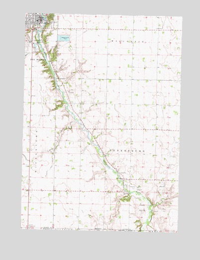
Jackson, MN USGS Topographic Map
Click on map above to begin viewing in our Map Viewer.

This topographic map contains these locations and features:
Feature Name Type Latitude Longitude GNIS ID View Map
Assembly of God ChurchChurchN43.6236°W95.0000°2048734View Map
Central ParkParkN43.6197°W94.9919°2048716View Map
Dann's Island Wayside ParkParkN43.6186°W94.9864°2048713View Map
Des Moines River ReservoirReservoirN43.6200°W94.9836°1776096View Map
Doctors Medical ClinicHospitalN43.6241°W94.9892°2048745View Map
Dumont ParkParkN43.6222°W94.9969°2048717View Map
First Presbyterian ChurchChurchN43.6225°W94.9903°2048740View Map
Fort Belmont City ParkParkN43.6152°W94.9969°2048714View Map
Gettys ParkParkN43.6216°W94.9842°644112View Map
Good Shepherd CemeteryCemeteryN43.6081°W94.9930°644212View Map
Good Shepherd ChurchChurchN43.6202°W94.9967°2048739View Map
Hillside CemeteryCemeteryN43.6055°W94.9742°644997View Map
Hilltop Community ChurchChurchN43.6166°W94.9828°2048738View Map
JacksonPopulated PlaceN43.6208°W94.9886°645559View Map
Jackson City HallBuildingN43.6216°W94.9864°2048722View Map
Jackson County Central High SchoolSchoolN43.6247°W94.9997°2048748View Map
Jackson County CourthouseBuildingN43.6211°W94.9900°2048730View Map
Jackson County JailBuildingN43.6218°W94.9899°2758497View Map
Jackson County Law Enforcement CenterBuildingN43.6213°W94.9900°2048729View Map
Jackson County Sheriff's OfficeBuildingN43.6219°W94.9899°2758505View Map
Jackson DamDamN43.6200°W94.9836°1776095View Map
Jackson Fire DepartmentBuildingN43.6228°W94.9889°2666336View Map
Jackson Post OfficePost OfficeN43.6197°W94.9869°2048719View Map
Jackson Public LibraryBuildingN43.6205°W94.9889°2048723View Map
Judicial Ditch Number ElevenCanalN43.5363°W94.8844°645785View Map
Judicial Ditch Number FiftysixCanalN43.5122°W94.9533°645950View Map
Judicial Ditch Number FiftysixCanalN43.5366°W94.9761°645951View Map
KRAQ-FM (Jackson)TowerN43.6150°W94.9636°663063View Map
Our Redeemers Lutheran ChurchChurchN43.6183°W94.9905°2048736View Map
Our Saviour's Lutheran ChurchChurchN43.6222°W94.9942°2048735View Map
Patterson ParkParkN43.6194°W94.9783°2048715View Map
PetersburgPopulated PlaceN43.5302°W94.9189°649318View Map
Petersburg CemeteryCemeteryN43.5225°W94.9186°649319View Map
Petersburg Post Office (historical)Post OfficeN43.5302°W94.9189°2048763View Map
Riverside CemeteryCemeteryN43.6091°W94.9928°650107View Map
Riverside Elementary SchoolSchoolN43.6247°W94.9917°2048747View Map
Sacred Heart Mercy Health Care CenterHospitalN43.6241°W94.9892°2048744View Map
Saint Johns CemeteryCemeteryN43.5441°W94.8783°650654View Map
Salem Lutheran ChurchChurchN43.6241°W94.9908°2048732View Map
State Line WaysideLocaleN43.5019°W94.9936°2048817View Map
Stony BrookStreamN43.5633°W94.9575°652704View Map
Sunset CemeteryCemeteryN43.6086°W94.9961°652848View Map
Township of PetersburgCivilN43.5444°W94.9144°665289View Map
United Methodist ChurchChurchN43.6244°W94.9947°2048731View Map
West Ridge Village Mobile Home ParkPopulated PlaceN43.6097°W94.9947°2048728View Map

Note: Coordinates in the location and feature list above are referenced to NAD83 datum.


Copyright (C) 2008-2024 Ryan Niemi / Sunset Dynamics ... All Rights Reserved