TopoQuest Logo
Do you find TopoQuest useful?
Help keep TopoQuest running and adding new maps/features by donating!
Bitcoin:  19c7KJd3qBynnjoSw5npx9KScwjBe4ifkT
Litecoin:  LXs6TkuXGGXo1vDsWCkWVdjQX94eUKd6ui
Home View Maps Find Maps Find Places Resources & Links


Lakenan, Missouri Topographic Map

USGS Map Title: Lakenan, MO
USGS Map MRC: 39091F8
DRG (GeoTIFF) Download: o39091f8.tif


Neighboring USGS Topographic Map Quads:


  Shelbyville, MO  
39092G1
 

  Burksville, MO  
39091G8
 

  Emden, MO  
39091G7
 

  Shelbina, MO  
39092F1
 

  Lakenan, MO  
39091F8
 

  Hunnewell, MO  
39091F7
 

  Granville, MO  
39092E1
 

  Goss, MO  
39091E8
 

  Stoutsville, MO  
39091E7


Map MRC Location:

N40°
W92°
N40°
W91°
H8 H7 H6 H5 H4 H3 H2 H1
G8 G7 G6 G5 G4 G3 G2 G1
F8 F7 F6 F5 F4 F3 F2 F1
E8 E7 E6 E5 E4 E3 E2 E1
D8 D7 D6 D5 D4 D3 D2 D1
C8 C7 C6 C5 C4 C3 C2 C1
B8 B7 B6 B5 B4 B3 B2 B1
A8 A7 A6 A5 A4 A3 A2 A1
N39°
W92°
N39°
W91°

Lakenan, MO USGS 1:24K Topographic Map Preview:
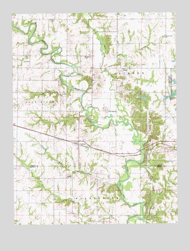
Lakenan, MO USGS Topographic Map
Click on map above to begin viewing in our Map Viewer.

This topographic map contains these locations and features:
Feature Name Type Latitude Longitude GNIS ID View Map
Baker BranchStreamN39.7153°W91.9313°713559View Map
Beatley SchoolSchoolN39.7462°W91.9691°735503View Map
Black CreekStreamN39.6845°W91.9143°735516View Map
Buckman DamDamN39.6700°W91.9752°761291View Map
Buckman LakeReservoirN39.6705°W91.9771°761292View Map
Cox School (historical)SchoolN39.6462°W91.8852°743936View Map
Givan SchoolSchoolN39.7214°W91.9874°718473View Map
Graham School (historical)SchoolN39.6928°W91.9963°733577View Map
Greenwell School (historical)SchoolN39.6525°W91.9599°718832View Map
Hightower SchoolSchoolN39.7242°W91.9460°719589View Map
Horseshoe BranchStreamN39.6287°W91.9010°729323View Map
Hunnewell CemeteryCemeteryN39.6700°W91.8790°719997View Map
Jackson CreekStreamN39.6487°W91.9210°720214View Map
KendallPopulated PlaceN39.7167°W91.9171°740979View Map
Kincheloe BridgeBridgeN39.6942°W91.9466°733578View Map
LakenanPopulated PlaceN39.6723°W91.9510°720759View Map
Paradise LakeReservoirN39.6984°W91.9018°761188View Map
Prairie View ChurchChurchN39.7353°W91.8835°724894View Map
Saint Johns CemeteryCemeteryN39.6617°W91.8779°725776View Map
Saint Roses Catholic ChurchChurchN39.6742°W91.9504°733579View Map
Salt River Railroad BridgeBridgeN39.6662°W91.9004°733580View Map
Simmons Lake DamDamN39.7217°W91.8752°762239View Map
Smith Lake DamDamN39.6984°W91.9018°761187View Map
The MoundSummitN39.6928°W91.9310°727560View Map
Thomas CreekStreamN39.7056°W91.9563°727585View Map
Township of JacksonCivilN39.7266°W91.9141°767409View Map

Note: Coordinates in the location and feature list above are referenced to NAD83 datum.


Copyright (C) 2008-2024 Ryan Niemi / Sunset Dynamics ... All Rights Reserved