TopoQuest Logo
Do you find TopoQuest useful?
Help keep TopoQuest running and adding new maps/features by donating!
Bitcoin:  19c7KJd3qBynnjoSw5npx9KScwjBe4ifkT
Litecoin:  LXs6TkuXGGXo1vDsWCkWVdjQX94eUKd6ui
Home View Maps Find Maps Find Places Resources & Links


Emden, Missouri Topographic Map

USGS Map Title: Emden, MO
USGS Map MRC: 39091G7
DRG (GeoTIFF) Download: o39091g7.tif


Neighboring USGS Topographic Map Quads:


  Newark, MO  
39091H8
 

  Nelsonville, MO  
39091H7
 

  Durham, MO  
39091H6
 

  Burksville, MO  
39091G8
 

  Emden, MO  
39091G7
 

  Philadelphia, MO  
39091G6
 

  Lakenan, MO  
39091F8
 

  Hunnewell, MO  
39091F7
 

  Monroe City, MO  
39091F6


Map MRC Location:

N40°
W92°
N40°
W91°
H8 H7 H6 H5 H4 H3 H2 H1
G8 G7 G6 G5 G4 G3 G2 G1
F8 F7 F6 F5 F4 F3 F2 F1
E8 E7 E6 E5 E4 E3 E2 E1
D8 D7 D6 D5 D4 D3 D2 D1
C8 C7 C6 C5 C4 C3 C2 C1
B8 B7 B6 B5 B4 B3 B2 B1
A8 A7 A6 A5 A4 A3 A2 A1
N39°
W92°
N39°
W91°

Emden, MO USGS 1:24K Topographic Map Preview:
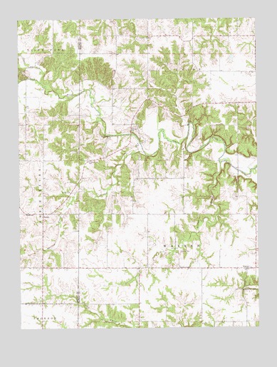
Emden, MO USGS Topographic Map
Click on map above to begin viewing in our Map Viewer.

This topographic map contains these locations and features:
Feature Name Type Latitude Longitude GNIS ID View Map
Andrew ChapelChurchN39.7742°W91.7916°713294View Map
Andrew Chapel CemeteryCemeteryN39.7748°W91.7915°732949View Map
BellvillePopulated PlaceN39.7745°W91.8299°732951View Map
Bevill LakeReservoirN39.8378°W91.7649°760609View Map
Calvert CemeteryCemeteryN39.7806°W91.7904°715222View Map
Davis School (historical)SchoolN39.7967°W91.8141°732945View Map
Day School (historical)SchoolN39.7953°W91.7560°732946View Map
Dickson Lake DamDamN39.8367°W91.7652°760608View Map
Ebenezer CemeteryCemeteryN39.8311°W91.8152°717379View Map
Ebenezer ChurchChurchN39.8275°W91.8277°717384View Map
Ebenezer School (historical)SchoolN39.8462°W91.8082°732942View Map
EmdenPopulated PlaceN39.7964°W91.8629°735600View Map
Emden Garage ParkParkN39.8175°W91.8393°717568View Map
Emden Post OfficePost OfficeN39.7963°W91.8633°2782829View Map
Emden SchoolSchoolN39.7962°W91.8718°717569View Map
Ewing School (historical)SchoolN39.8687°W91.7591°732941View Map
Hawkins BranchStreamN39.8167°W91.7691°719232View Map
HeatherPopulated PlaceN39.8425°W91.8074°732943View Map
Kincaid School (historical)SchoolN39.7525°W91.7685°732948View Map
Merrills BranchStreamN39.8206°W91.8093°722241View Map
Moreland BranchStreamN39.8050°W91.8457°735728View Map
Parsons School (historical)SchoolN39.8400°W91.8710°733559View Map
Pee Dee School (historical)SchoolN39.7523°W91.8138°732950View Map
Spence School (historical)SchoolN39.8395°W91.7807°732944View Map
Tiger ForkStreamN39.8481°W91.8610°727654View Map
Township of North RiverCivilN39.8054°W91.8708°767412View Map
WarrenPopulated PlaceN39.7737°W91.7566°728357View Map
Warren School (historical)SchoolN39.7737°W91.7629°732947View Map

Note: Coordinates in the location and feature list above are referenced to NAD83 datum.


Copyright (C) 2008-2024 Ryan Niemi / Sunset Dynamics ... All Rights Reserved