TopoQuest Logo
Do you find TopoQuest useful?
Help keep TopoQuest running and adding new maps/features by donating!
Bitcoin:  19c7KJd3qBynnjoSw5npx9KScwjBe4ifkT
Litecoin:  LXs6TkuXGGXo1vDsWCkWVdjQX94eUKd6ui
Home View Maps Find Maps Find Places Resources & Links


Lime City, Iowa Topographic Map

USGS Map Title: Lime City, IA
USGS Map MRC: 41091F1
DRG (GeoTIFF) Download: o41091f1.tif


Neighboring USGS Topographic Map Quads:


  Tipton West, IA  
41091G2
 

  Tipton East, IA  
41091G1
 

  Lowden, IA  
41090G8
 

  Rochester, IA  
41091F2
 

  Lime City, IA  
41091F1
 

  Bennett, IA  
41090F8
 

  Atalissa, IA  
41091E2
 

  Wilton, IA  
41091E1
 

  Durant, IA  
41090E8


Map MRC Location:

N42°
W92°
N42°
W91°
H8 H7 H6 H5 H4 H3 H2 H1
G8 G7 G6 G5 G4 G3 G2 G1
F8 F7 F6 F5 F4 F3 F2 F1
E8 E7 E6 E5 E4 E3 E2 E1
D8 D7 D6 D5 D4 D3 D2 D1
C8 C7 C6 C5 C4 C3 C2 C1
B8 B7 B6 B5 B4 B3 B2 B1
A8 A7 A6 A5 A4 A3 A2 A1
N41°
W92°
N41°
W91°

Lime City, IA USGS 1:24K Topographic Map Preview:
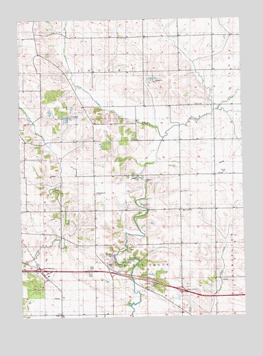
Lime City, IA USGS Topographic Map
Click on map above to begin viewing in our Map Viewer.

This topographic map contains these locations and features:
Feature Name Type Latitude Longitude GNIS ID View Map
Apollo Post Office (historical)Post OfficeN41.7056°W91.0835°2001538View Map
AyresvillePopulated PlaceN41.6847°W91.0140°464233View Map
Bennett CreekStreamN41.7000°W91.0443°454513View Map
Blackhawk Bottoms Public Hunting AreaAreaN41.7345°W91.1218°464348View Map
Bolton CemeteryCemeteryN41.7334°W91.0835°2001695View Map
Bolton SchoolLocaleN41.7284°W91.0840°454741View Map
Bradley CemeteryCemeteryN41.7389°W91.1029°2001696View Map
Cedar LakesLakeN41.7251°W91.0480°464958View Map
Cedar Lakes CampgroundLocaleN41.7242°W91.0477°464956View Map
Center Ross CemeteryCemeteryN41.6881°W91.0368°455295View Map
Centerville CemeteryCemeteryN41.6806°W91.0779°2001693View Map
Eureka CemeteryCemeteryN41.7361°W91.0168°2001694View Map
Fairland CemeteryCemeteryN41.7136°W91.0263°464954View Map
Historic Iowa City STate Historical MarkerParkN41.6420°W91.0549°2001708View Map
Hoover Historical Site State Historical MarkerParkN41.6420°W91.0549°2001710View Map
Interchange 267CrossingN41.6456°W91.1140°2001712View Map
Interchange 271CrossingN41.6361°W91.0357°2001711View Map
Koch LakeLakeN41.7085°W91.0993°464957View Map
Koch Lake CampgroundLocaleN41.7097°W91.0963°464955View Map
Lactin Post Office (historical)Post OfficeN41.6253°W91.0335°2001548View Map
Lime CityPopulated PlaceN41.6478°W91.0774°464620View Map
Lime City CemeteryCemeteryN41.6443°W91.0718°464952View Map
Lime City Post Office (historical)Post OfficeN41.6478°W91.0774°2001549View Map
Lime City School (historical)SchoolN41.6445°W91.0727°465106View Map
Moneka CemeteryCemeteryN41.6853°W91.0104°464953View Map
Ochiltree CemeteryCemeteryN41.6875°W91.0557°2001692View Map
Pleasant Hill Post Office (historical)Post OfficeN41.6511°W91.0846°466502View Map
Pleasant Hill SchoolSchoolN41.6700°W91.0738°460269View Map
Sharon Independent School (historical)SchoolN41.6284°W91.0357°465163View Map
South Bethel CemeteryCemeteryN41.6770°W91.0821°2001691View Map
South Bethel ChurchChurchN41.6767°W91.0824°461764View Map
Spring CreekStreamN41.7431°W91.0913°465368View Map
Sugar Creek ChurchChurchN41.6700°W91.0346°462066View Map
Sugar Creek Church CemeteryCemeteryN41.6695°W91.0349°2001690View Map
Township of CenterCivilN41.7466°W91.1225°467571View Map
Township of Sugar CreekCivilN41.6409°W91.0551°468756View Map
Trinity ChurchChurchN41.6267°W91.1035°462309View Map
Union SchoolLocaleN41.6992°W91.0793°462470View Map
Whitmer CemeteryCemeteryN41.6717°W91.0563°463011View Map
Wilton East Bound Rest AreaLocaleN41.6392°W91.0540°2001707View Map
Wilton West Bound Rest AreaLocaleN41.6420°W91.0549°2001709View Map

Note: Coordinates in the location and feature list above are referenced to NAD83 datum.


Copyright (C) 2008-2024 Ryan Niemi / Sunset Dynamics ... All Rights Reserved